| GPS coordinates of the starting point: | Lat: 34.984287 Lon: 34.068423 |
| GPS coordinates of the ending point: | Lat: 34.984287 Lon: 34.068423 |
| Altitude of the starting point: | 27m |
| Altitude of the highest peak: | 30m |
| Altitude of the end peak: | 27m |
| Starting point: | Konnos beach parking area. |
| Length: | 1.7km |
| Estimated duration: | 45 minutes |
| Difficulty rate: | 1 |
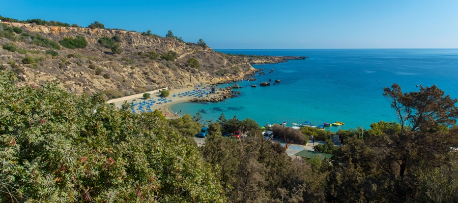
Points of interest: The Konnoi - Cyclops Cave Trail is situated within the Cape Gkreko National Forest Park, which is a Natura 2000 area. The trail follows a route parallel to the rugged shore. Passing through mostly shrubby vegetation, it reaches the natural Cyclops Cave. The return route is on the same trail for about 250 metres. It then follows a downward path toward the beach and finally an uphill climb back to the starting point. All along the trail, there is a seamless view of the turquoise waters and golden sands of Konnos beach, as well as of Agioi Anargyroi church.
Flora: While hiking you can study the plants: coastal boxthorn (Lycium schweinfurthii), prickly burnets (Sarcopoterium spinosum), Phoenician juniper trees (Juniperus phoenicea), acacia trees (Acacia sp.).


