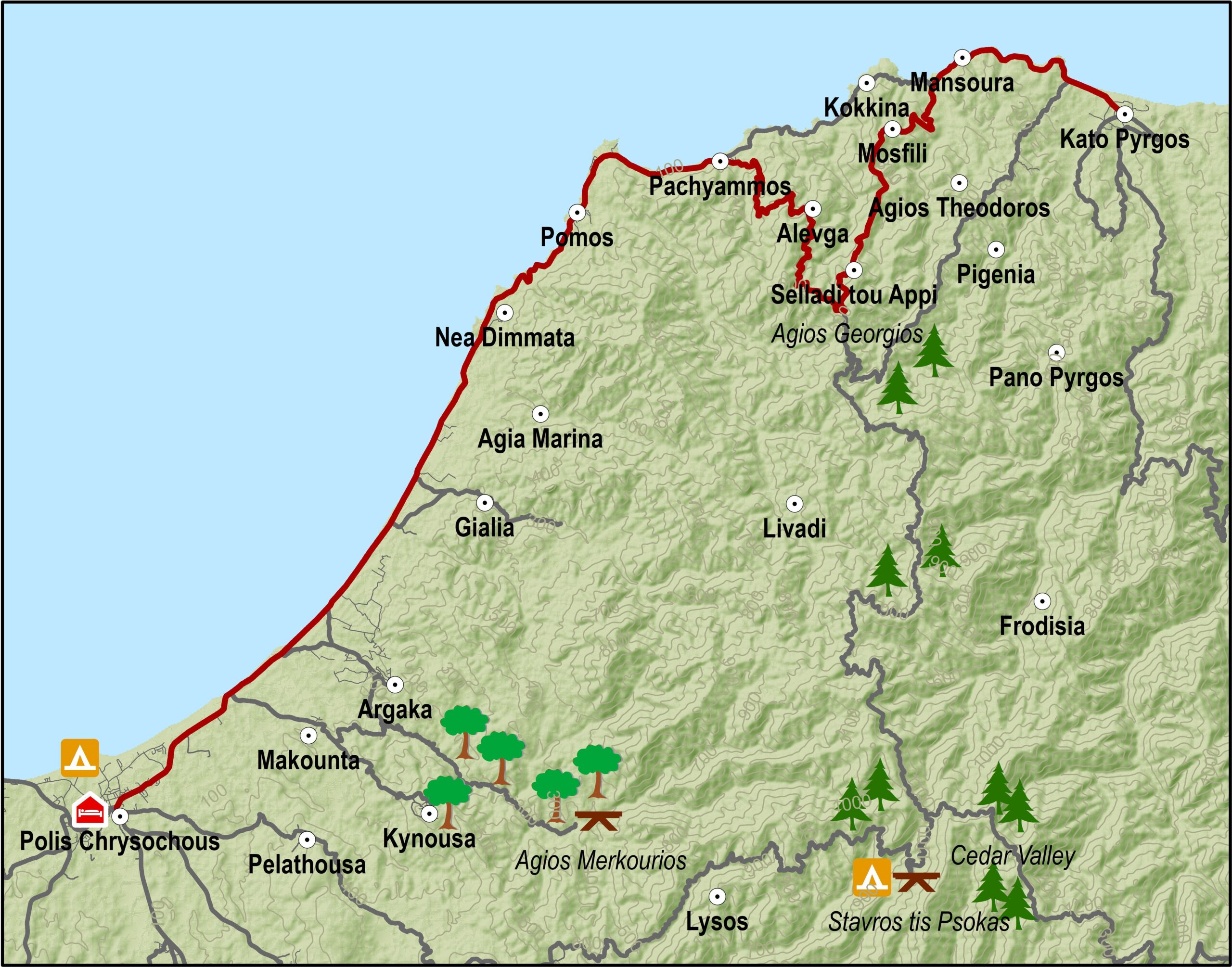
Ξεκινώντας από την Πόλη Χρυσοχούς, η διαδρομή κινείται κατά μήκος της ακτής με μια βόρειο-ανατολική κατεύθυνση προς το χωριό Παχύαμμος. Στην συνέχεια παίρνει μια μικρή παράκαμψη, ανεβαίνει προς τα βουνά με νότια κατεύθυνση, ώστε να παρακαμφθεί ο τουρκικός θύλακας των Κοκκίνων, το οποίο μετά κατηφορίζει για να επανασυνδεθεί με τον παραλιακό δρόμο προς τον Πύργο.
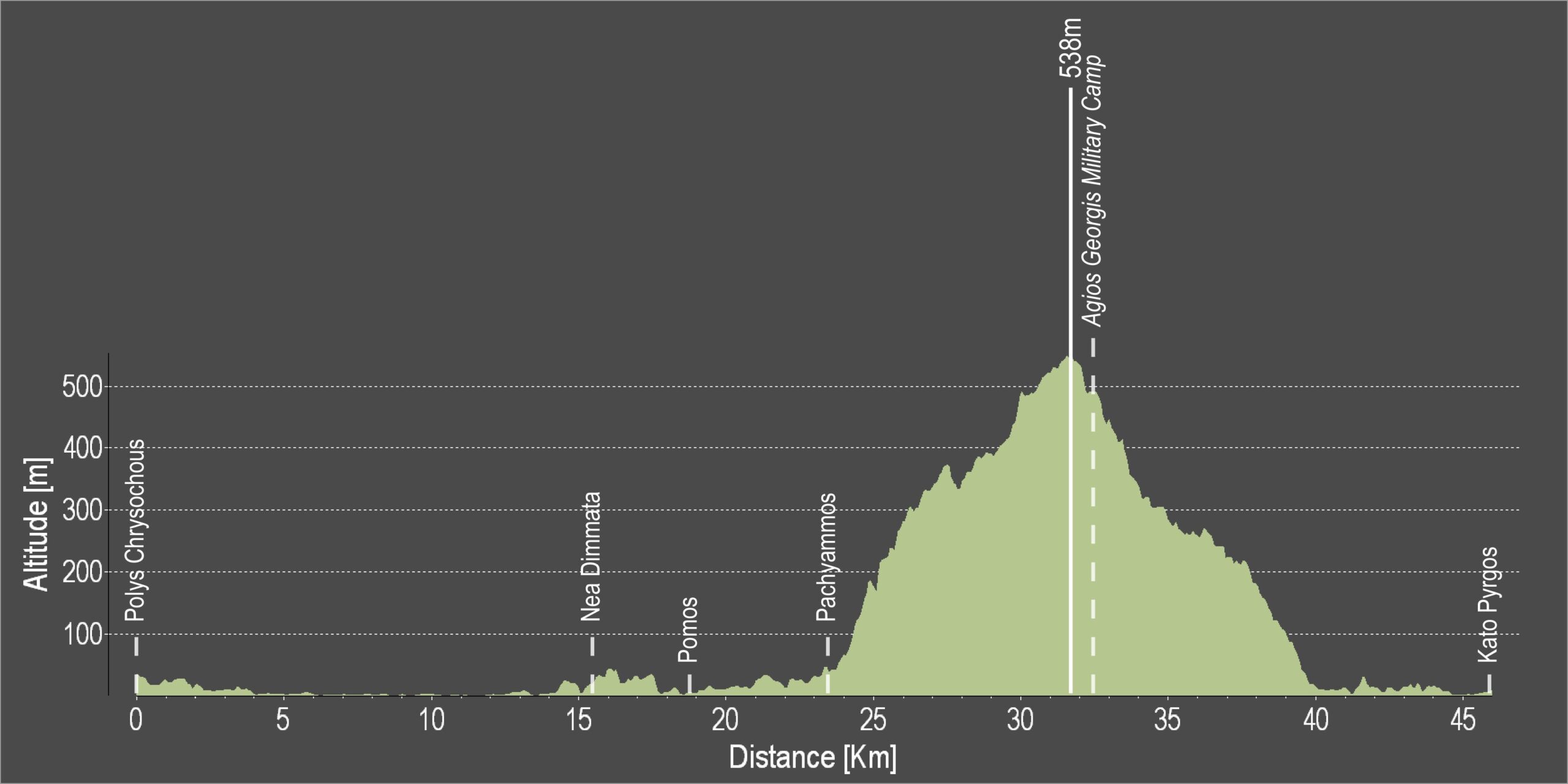
Difficulty rate: Easy and almost flat road with only one uphill past Kokkines. There are often strong onshore winds in the area, particularly in the afternoon. A street bike with at least 20 speeds is required. .
Road condition: Good quality paved roads throughout.
Route Description: This excursion, together with the routes from Pafos, links Pyrgos with Polis and Pafos.
To download the route in gpx format click here
| Distance: | 46.4km |
| Elevation Gain: | 925m |
| Highest point: | 538m |
| Lowest point: | 1m |
| Loop: | NO |
| Terrain: | Mixed |
| Road surface: | Paved |
| Section Distance (km) | Total Distance (km) | |
| Polis Chrysochous | 0,0 | 0,0 |
| Nea Dimmata | 15,4 | 15,4 |
| Pomos | 3,4 | 18,8 |
| Pachyammos | 4,8 | 23,6 |
| Agios Georgios Military Camp | 8,7 | 32,3 |
| Kato Pyrgos | 14,1 | 46,4 |