| GPS coordinates of the starting point: | Lat: 34.931739 Lon: 32.887044 |
| GPS coordinates of the ending point: | Lat: 34.977789 Lon: 32.885425 |
| Altitude of the starting point: | 1,654m |
| Altitude of the highest peak: | 1,654m |
| Altitude of the end peak: | 872m |
| Starting point: | The main road of Karvounas Troodos Square, 1km before Troodos, 9.5km from Karvounas. The trail can either end at the Agios Nikolaos tis Stegis Church or continue until Kakopetria Village. |
| Length: | 9km (12km until Kakopetria) |
| Estimated duration: | 3 hours (4 hours until Kakopetria) |
| Difficulty rate: | 3 (quite a difficult downhill route) |
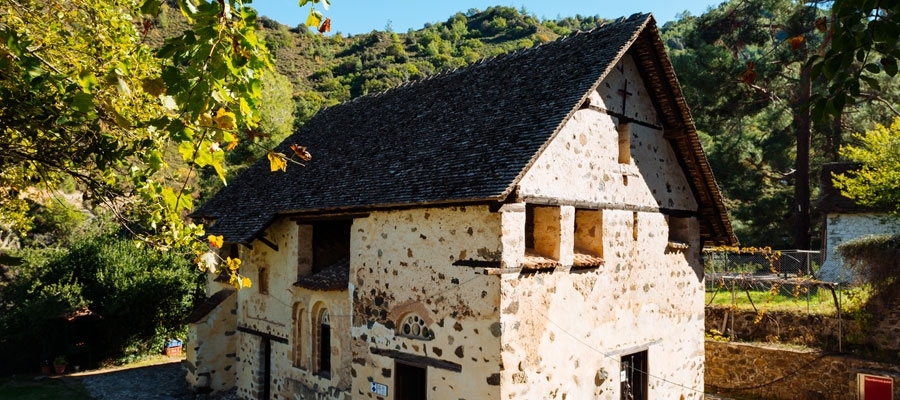
Points of interest: The trail begins at the source of the Karkotis River and crosses through the river’s beautiful valley, passing near the closed chrome mine and ending in Kakopetria. On the way, you can visit the Agios Nikolaos tis Stegis church (12th century) that boasts exquisite frescoes; it is also a UNESCO World Heritage site. From the church, if you follow the Pedoulas - Kakopetria road for about three kilometres, you will end up in Kakopetria. The trail is located within the Troodos National Forest Park.
Flora: While hiking you can study the endemic plants: Shrubby knapweed (Ptilostemon chamaepeuce var. cyprius), Golden oak (Quercus alnifolia), Purple Rock Cress (Arabis purpurea), ‘Manouthkia’ (Pterocephalus multiflorus subsp. multiflorus – an evergreen small shrub with pale pink flowers), Thyme (Thymus integer).
Fauna: The main species of fauna found in the area are:
Mammals: Fox, hare, hedgehog.
Birds: Bonelli’s eagle, Eurasian jay, Wood pigeon, partridge, Cyprus warbler (endemic), Cyprus wheatear (endemic).
Reptiles: Cyprus viper, Cyprus lizard, Black whip snake, Montpellier snake.


