Antiquity Cultural Route (Rural)

Discover the rich, historical wonders of an island that has seen many visitors through the ages, and bears the unique mark of each of them. As you follow a route of ancient ancestors, the insight and revelations they offer will transport you back to the adventures of bygone eras and heroic times. From the oldest settlements to grand architectural feats, a vast choice of archaeological sites can be explored, with so many paths leading back to the glorious past.

Begin your journey on the east coast with the ancient city of Kition in Larnaka (Larnaca). The site provides the first clear evidence that the Mycenaean Greeks arrived in Larnaka in the 13th century BC, and the Phoenicians in the 9th, and features temples dating back to these times.

Thereafter, head for new heights between Larnaka and Lemesos (Limassol), where the Neolithic settlement of Choirokoitia stands proudly on the hillside, distinctly marked out by cylindrical stone and mud dwellings that lay claim to the earliest permanent human housing on the island. The site is remarkably well-preserved and has been a listed UNESCO World Heritage Site since 1998.

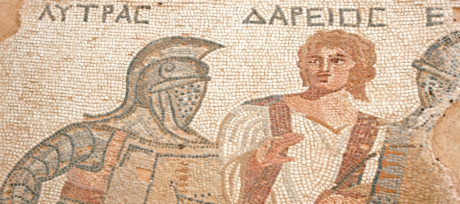
Further down the southeast coast, the ancient Greco-Roman Kourion stands as one of the island’s top ancient highlights and was an important city-kingdom in antiquity. Its magnificent theatre was built in the 2nd century BC and extended in the 2nd century AD. Today, the theatre has been completely restored and is used for open-air musical and theatrical performances during the summer months, commanding breathtaking views of the surrounding patchwork land and sea.

As you follow the coastline towards Pafos (Paphos), history further comes to life, with the whole town listed as a UNESCO World Heritage Site, thanks to its world-famous archaeological sites that stretch out from Palaipafos (Kouklia) to the heart of Kato Pafos. Included are ancient villas of stunning mosaics and numerous sites associated to the cult of the Ancient Greek Goddess of Love and Beauty, Aphrodite, whom legend tells was born of sea foam in the region.

Aphrodite Cultural Route (Rural)

Walk in the Footsteps of a Goddess

Follow in the footsteps of Aphrodite, the Ancient Greek Goddess of Love and Beauty, and protectress of Cyprus, and discover the archaeological sites dedicated to her ancient cult as you wander through layers of history, culture and mythology.

Cyprus has always been considered the ‘Island of Aphrodite’, and no other place in the world can boast of being the birthplace of the Goddess of Love and Beauty. In the 8th century BC, Homer mentions Aphrodite as ‘Kypris’ and ‘Golden Aphrodite’, whilst there are many myths connected to Aphrodite that possibly originated on the island, including those concerning Aphrodite and Hephaistos, Aphrodite and Ares, and Aphrodite and Adonis.

With a historically accurate programme of cultural routes – centred on the search for the traces that Aphrodite has left throughout the island – you will embark upon an enchanted journey through the sites of Palaipafos (Kouklia) in the Pafos (Paphos) region, the ancient city kingdom of Amathus in the Lemesos (Limassol) region, and Kition, in the Larnaka (Larnaca) region. Each is linked to other sites and museums, where artefacts related to the Goddess endure to this day. And upon the way, you will delight in learning all about her birth, mythology and character, as well as the rituals, plants and seashells connected with her cult.

Palaipafos – which is an UNESCO World Heritage Site – has the deepest links with the Goddess, as it is the area that played a central role in the genesis (birth) of Kyprida Aphrodite, and combines the most interesting sites of the route, including the main archaeological site of Palaipafos (Kouklia) and the Chalcolithic site of Lempa. There are also a number of related museums, nature sites and trails in the region.

The ancient city kingdom of Amathus – on the Bay of Lemesos – was probably founded by Greek Mycenaean settlers in the 12th to the 11th centuries BC, and was one of the most important kingdoms where Kyprida Aphrodite was celebrated. The ruins of the temple of Aphrodite can be seen at the main archaeological site of Amathus, whilst the District Museum of Lemesos complements the visit with in-depth information about the celebrated Goddess.

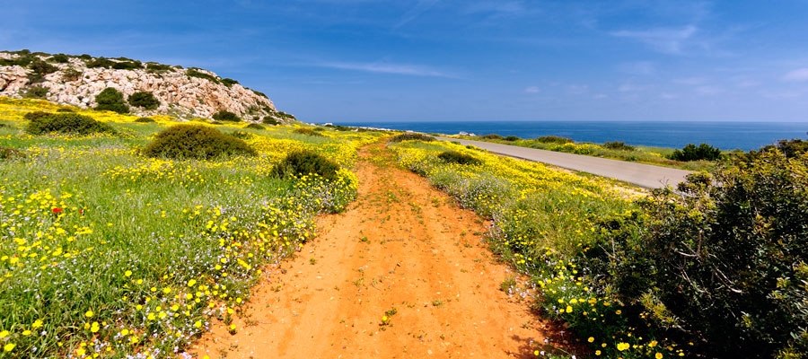
Larnaka and the Agia Napa area offer a combination of sites relating to Aphrodite. The main archaeological site is Kition – Kathari in Larnaka, where visitors can explore the links of the ancient city of Kition with the Goddess Kyprida Aphrodite, along with the area’s ties to the sea, culminating at the Kyprida Aphrodite Nature Trail at Cape Gkreko in Protaras.

Nowhere else will you find legend, history and romance so intricately intertwined, with each new discovery a beautiful reminder of the island’s unique and special bond with Aphrodite.

To access the full brochure detailing the island’s connection with Aphrodite; her historical footsteps, and all the information for the various sites and elements associated to the Goddess, click here


Kavos (Circular) – Ammochostos (Famagusta) District, Cape Gkreko National Forest Park Nature Trail

GPS coordinates of the starting point: Lat: 34.963785 Lon: 34.067116
GPS coordinates of the ending point: Lat: 34.963785 Lon: 34.067116
Altitude of the starting point: 64m
Altitude of the highest peak: 70m
Altitude of the end peak: 64m
Starting point: Old quarry.
Length: 1.2km
Estimated duration: 45 minutes
Difficulty rate: 1


Points of interest: The trail is located at Cape Gkreko within the boundaries of the National Forest Park, which is a Natura 2000 area. The trail first passes through a pine tree landscape and then through low, shrubby vegetation. All along the trail, there are many points of exceptional view, the most impressive of which is at the hilltop, from where you can enjoy an unobstructed nature view on all the points of the horizon: to the east you can see the tip of the cape (Pidalion) where the lighthouse and the facilities of a French radio station (SOMERA) are located: to the west there is the tourist resort of Agia Napa; to the north the main part of the National Forest Park, and to the south the pristine waters and rugged coastline. The impressive cliffs on the south side of the hill are ideal for rock climbing enthusiasts. The Kavos Trail connects to the Sea Caves – Agioi Anargyroi Trail.

Flora: While hiking you can study the indigenous plants: Phoenician juniper (Juniperus phoenicea), lentisk (Pistacia lentiscus), wild thyme (Thymus capitatus), prickly burnet (Sarcopoterium spinosum), and the endemic Cyprus bosea (Bosea cypria).


Sea Caves – Agioi Anargyroi (Linear) – Ammochostos (Famagusta) District, Cape Gkreko National Forest Park Nature Trail

GPS coordinates of the starting point: Lat: 34.975349 Lon: 34.075822
Altitude of the starting point: 13m
Altitude of the highest peak: 30m
Altitude of the end peak: 13m
Starting point: (a) the Sea Caves / (b) Agioi Anargyroi Church.
Length: 4km
Estimated duration: 1.5 hour
Difficulty rate: 1


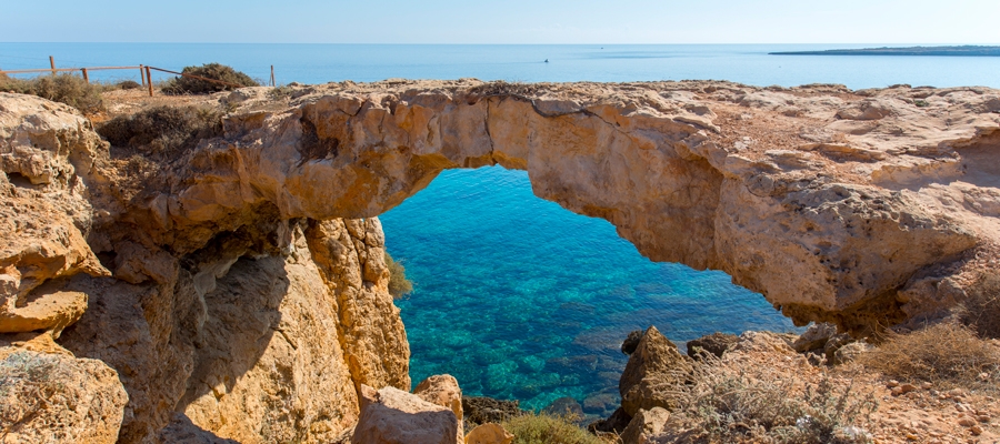
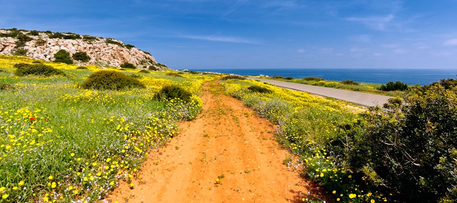
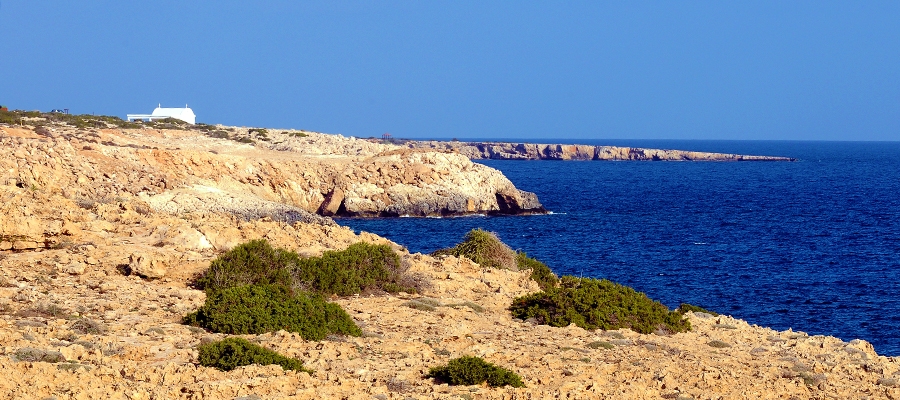
Points of interest: The Sea Caves – Agioi Anargyroi Trail is located on the cape of Cape Gkreko, within the National Forest Park, which is a Natura 2000 area. A big part of the route runs parallel to the shoreline. From the Sea Caves to Kavos hill the trail passes through a rocky area with sparse halophytic vegetation. It then follows a course due north, through low shrubby vegetation. Passing through an area of fields planted with cereals ­ and through an area of low bushes ­ the trail reaches a natural bridge called ‘Kamara tou Koraka’ and ends up at Agioi Anargyroi Church. The church is built over a sea cave, where it is believed that saints (known as Agioi Anargyroi) lived as ascetics. The trail connects to the Konnoi – Agioi Anargyroi Trail, and to the Aphrodite Trail. About 200 metres to the west of the end of trail, there is a picnic site with drinking water.

Flora: While hiking you can study the plants: prickly burnet (Sarcopoterium spinosum), wild thyme (Thymus capitatus), rock samphires (Crithmum maritimum), lentisk (Pistacia lentiscus), wild olive (Olea europaea).

Aphrodite (Circular), Ammochostos (Famagusta) District, Cape Gkreko National Forest Park Nature Trail

GPS coordinates of the starting point: Lat: 34.982762 Lon: 34.069630
GPS coordinates of the ending point: Lat: 34.982762 Lon: 34.069630
Altitude of the starting point: 10m
Altitude of the highest peak: 60m
Altitude of the end peak: 10m
Starting point: Visitor Centre parking site.
Length: 2km
Estimated duration: 1 hour
Difficulty rate: 1


Points of interest: The Aphrodite Trail is located within the Cape Gkreko National Forest Park and follows a downhill incline until it reaches the beach. Here, it connects to the Sea Caves – Agioi Anargyroi Trail and before it reaches a natural bridge called ‘Kamara tou Koraka’ it takes an uphill turn toward the Visitor Centre. This part of the trail is common with the Konnoi – Agioi Anargyroi. The first part of the trail passes by the ruins of the ancient temple, dedicated to the Goddess of Love and Beauty, Aphrodite. On the way to the beach, the trail passes by natural caves with dry stone walls built around their perimeter – constructions that were used by shepherds to keep animals. There are many viewpoints along the route. There is also a sign with the Cypria Aphrodite (Κύπριδα Αφροδίτη) logo indicating where an ancient temple dedicated to the Goddess Aphrodite is believed to have been.

Flora: While hiking you can study the indigenous plants: Phoenician juniper (Juniperus phoenicea), wild thyme (Thymus capitatus), prickly burnet (Sarcopoterium spinosum), rock samphires (Crithmum maritimum).

Konnoi – Cyclops Cave (Circular) – Ammochostos (Famagusta) District, Cape Gkreko National Forest Park Nature Trail

GPS coordinates of the starting point: Lat: 34.984287 Lon: 34.068423
GPS coordinates of the ending point: Lat: 34.984287 Lon: 34.068423
Altitude of the starting point: 27m
Altitude of the highest peak: 30m
Altitude of the end peak: 27m
Starting point: Konnos beach parking area.
Length: 1.7km
Estimated duration: 45 minutes
Difficulty rate: 1


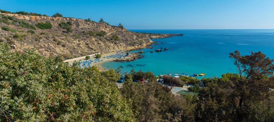
Points of interest: The Konnoi – Cyclops Cave Trail is situated within the Cape Gkreko National Forest Park, which is a Natura 2000 area. The trail follows a route parallel to the rugged shore. Passing through mostly shrubby vegetation, it reaches the natural Cyclops Cave. The return route is on the same trail for about 250 metres. It then follows a downward path toward the beach and finally an uphill climb back to the starting point. All along the trail, there is a seamless view of the turquoise waters and golden sands of Konnos beach, as well as of Agioi Anargyroi church.

Flora: While hiking you can study the plants: coastal boxthorn (Lycium schweinfurthii), prickly burnets (Sarcopoterium spinosum), Phoenician juniper trees (Juniperus phoenicea), acacia trees (Acacia sp.).


Konnoi ­- Agioi Anargyroi (Circular) – Ammochostos (Famagusta) District, Cape Gkreko National Forest Park Nature Trail

GPS coordinates of the starting point: Lat: 34.982763 Lon: 34.069620
GPS coordinates of the ending point: Lat: 34.975341 Lon: 34.075811
Altitude of the starting point: 3m
Altitude of the highest peak: 28m
Altitude of the end peak: 10m
Starting point: (a) Konnos Beach, between Protaras and Cape Gkreko
(b) Agioi Anargyroi church, accessible from the Protaras Cape Gkreko main road close to the Cape.
Length: 4.8km
Estimated duration: 2 hours
Difficulty rate: 1


Points of interest: The trail affords excellent views throughout, with the views of the stunning Konnos Bay being particularly impressive. For the first two kilometres of the trail ­ beginning at Konnos Bay ­ the path continues parallel to the beach and arrives at the Agioi Anargyroi Church, which is built above a sea cave where it is said that the Saint Anargyroi lived an ascetic life. Following the trail to the south, through low shrub vegetation, it leads to the natural Kamara (arch) tou Koraka bridge ­ an impressive geological formation. After the bridge, the trail ascends slightly, passing through the ruins of the temple of Aphrodite, running parallel to the coastline through high shrub vegetation, and towards its end through a small pine forest.

Flora: While hiking you can study the endemic plants: Cyprus bosea (Bosea cypria), Wild garlic (Allium willeanum), Three colour chamomile (Anthemis tricolor), Cyprus Golden – Drop (Onosma fruticosa), Cyprus Germander (Teucrium micropodioides), ‘Valandia’ (Valantia eburnea).

Fauna: The main species of fauna found in the area are:

Mammals: Fox, hare, hedgehog.

Birds:  Kestler, partridge, Cyprus warbler  (endemic), Cyprus wheatear (endemic). The National Cape Gkreko Forest Park serves as a resting point for many migratory birds. Reptiles: Cyprus viper, Cyprus lizard, Cyprus chameleon, Black whip snake. 

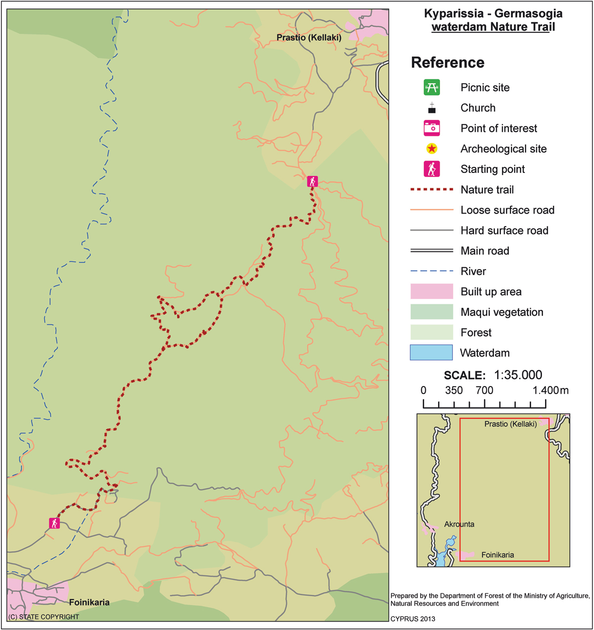
Kyparissia ­- Ydatofraktis (dam) Germasogeias (Linear) – Lemesos (Limassol) District, Lemesos Forest Nature Trail

GPS coordinates of the starting point: Lat: 34.794998 Lon: 33.136578
GPS coordinates of the ending point: Lat: 34.759798 Lon: 33.104231
Altitude of the starting point: 562m
Altitude of the highest peak: 692m
Altitude of the end peak: 140m
Starting point: Around 3km from the main Parekklisia – Kellaki road.
Length: (a) 3.7km (circular), (b) 11km (ends at Germasogeia Dam)
Estimated duration: (a) 1.5 hour, (b) 3 – ­ 3.5 hours
Difficulty rate: (a) 2 (there is a steep downhill at the start), (b) 3 (there is a steep downhill at the start)


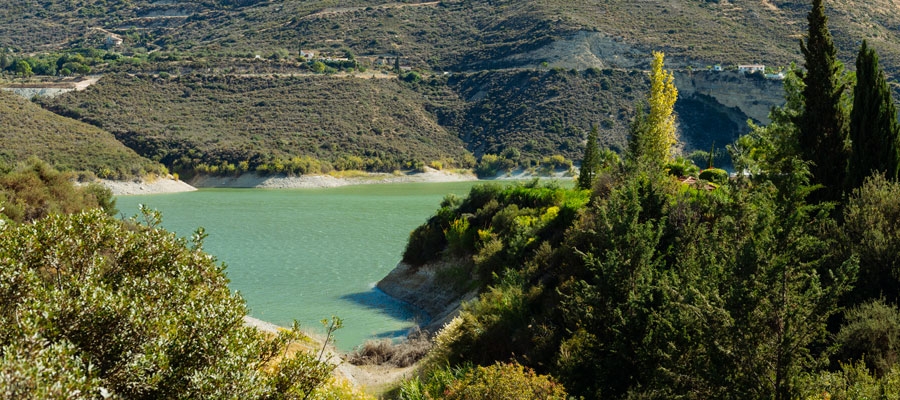
Points of interest: The trail initially passes through areas of forest and then continues for a short distance along the Kyparissia River, offering panoramic views of the Germasogeia dam and Lemesos (Limassol). The trail runs through a forest, with clusters of Cypress trees (Cupressus sempervirens var. horizontalis), and connects to the circular trail of Germasogeia dam. The Kyparissia Forest is a Natura 2000 site.

Flora: While hiking you can study the endemic plants: Entire – Leaved Horehound (Acanthoprasium integrifolium), Kakomallis Alison (Alyssum chondrogynum), Thyme (Thymus integer), Shrubby knapweed (Ptilostemon chamaepeuce subsp. cyprius), Cyprus Yellow Sun Rose (Helianthemum obtusifolium).

Fauna: The main species of fauna found in the area are:

Mammals: Fox, hare, hedgehog.

Birds:  Bonelli’s eagle, Wood pigeon, partridge, Cyprus warbler (endemic), Cyprus wheatear (endemic).

Reptiles: Cyprus viper, Cyprus lizard, Black whip snake.

Chrysovrysi (Linear) – Lemesos (Limassol) District,

GPS coordinates of the starting point: Lat: 34.929738 Lon: 32.924810
GPS coordinates of the ending point: Lat: 34.927571 Lon: 32.934557
Altitude of the starting point: 1,308m
Altitude of the highest peak: 1,315m
Altitude of the end peak: 1,068m
Starting point: Karvounas – Troodos road, 300 metres from Chrysovrysi Spring.
Length: 1.5km
Estimated duration: 1 hour
Difficulty rate: 2


Points of interest: Almost the entire trail is located within the Troodos National Forest Park, which is a Natura 2000 area. The last 300 metres of the trail are on a dirt road that is used by the residents of Amiantos for their agricultural operations. Gabbro rock formations, i.e. ultrabasic plutonic rocks belonging to the Troodos ophiolite complex, prevail along the trail. The route ends up on the Karvounas – Amiantos road, approximately 1.4 kilometres from the village of Amiantos. The A.G. Leventis Botanical Garden of Troodos and the Troodos Geopark Visitor Centre are located within the limits of the asbestos mine.

Flora: While hiking you can study the indigenous plants: plane (Platanus orientalis), Calabrian pine (Pinus brutia), strawberry tree (Arbutus adrachnae), terebinth (Pistacia terebinthus) and the endemic golden oak (Quercus alnifolia).


Loumata ton Aeton (Linear) – Lemesos (Limassol) District, Troodos Forest Nature Trail

GPS coordinates of the starting point: Lat: 34.915396 Lon: 32.931950
GPS coordinates of the ending point: Lat: 34.920130 Lon: 32.931465
Altitude of the starting point: 1,106m
Altitude of the highest peak: 1,106m
Altitude of the end peak: 1,012m
Starting point: The main road between Kato Amiantos village and SEK.
Length: 2.5km
Estimated duration: 1 hour
Difficulty rate: 2


Points of interest: The trail runs through a beautiful hillside and along the riverbank with lush vegetation, ending at Amiantos Park. It also passes the restored hide­out of the EOKA fighters and the stream Loumata ton Aeton. From linear, the trail becomes circular by following the roads through the village towards the summer camping site of S.E.K Trade Union Confederation. The trail is located within the Troodos National Forest Park.

Flora: While hiking you can study the indigenous plants: terebinth (Pistacia terebinthus), storax (Styrax officinalis), strawberry tree (Arbutus adrachnae), laurel (Laurus nobilis), myrtle (Myrtus communis), barberry  (Berberis cretica), oleander (Nerium oleander), honeysuckle (Lonicera etrusca), the common smilax (Smilax aspera), sage (Salvia fruticosa) and the endemic golden oak (Quercus alnifolia).

Fauna: The main species of fauna found in the area are:

Mammals: Fox, hare, hedgehog.

Birds: Bonelli’s eagle, Eurasian jay, Wood pigeon, partridge, Cyprus warbler  (endemic), Cyprus wheatear (endemic).

Reptiles: Cyprus viper, Cyprus lizard, Black whip snake, Montpellier snake.