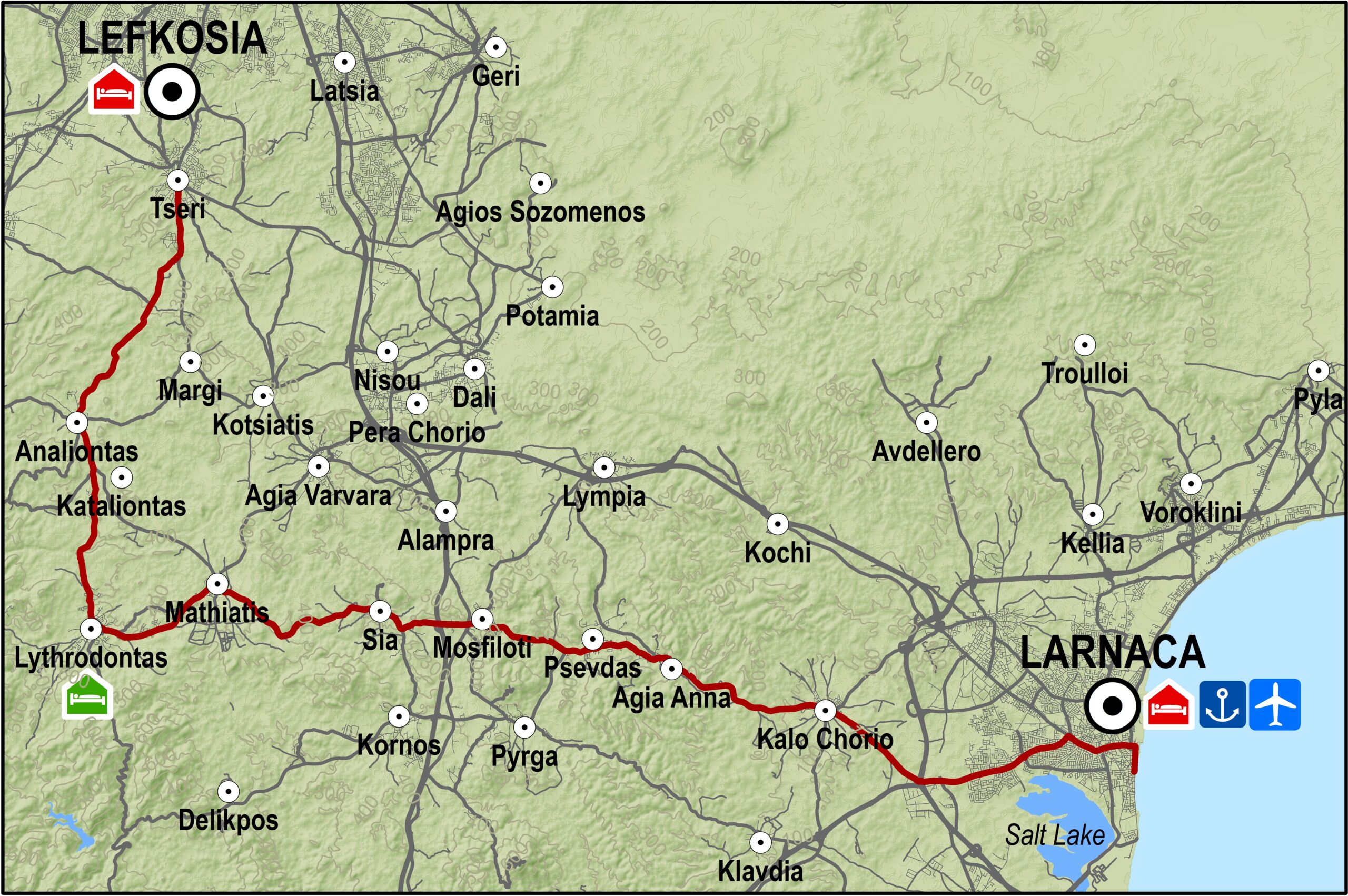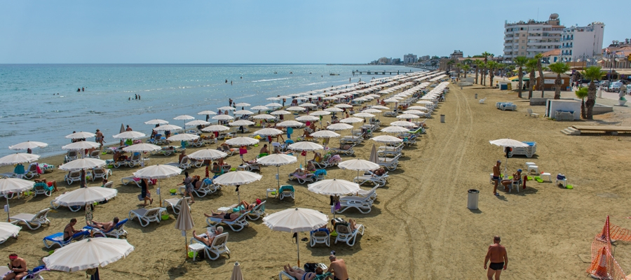
The route begins at the Tseri village and goes through the villages of Tseri, Analiondas and Lythrodontas. It then takes an easterly course through the villages of Mathiatis, Sia, Mosfiloti, Psevdas and Agia Anna until it reaches the Kalo Chorio grade separated junction near the old Larnaka-Kofinou road. There it turns left and to the northwest to reach the Larnaka Fire Department traffic lights and from there the main beachfront of Larnaka city, the Palm tree beach (Foinikoudes).
Route Description: This route is an alternative for going from Larnaka to Lefkosia or vice versa. The monotony of travelling only on paved roads is broken by going through several villages allowing for a little sightseeing and rest.
To download the route in gpx format click here
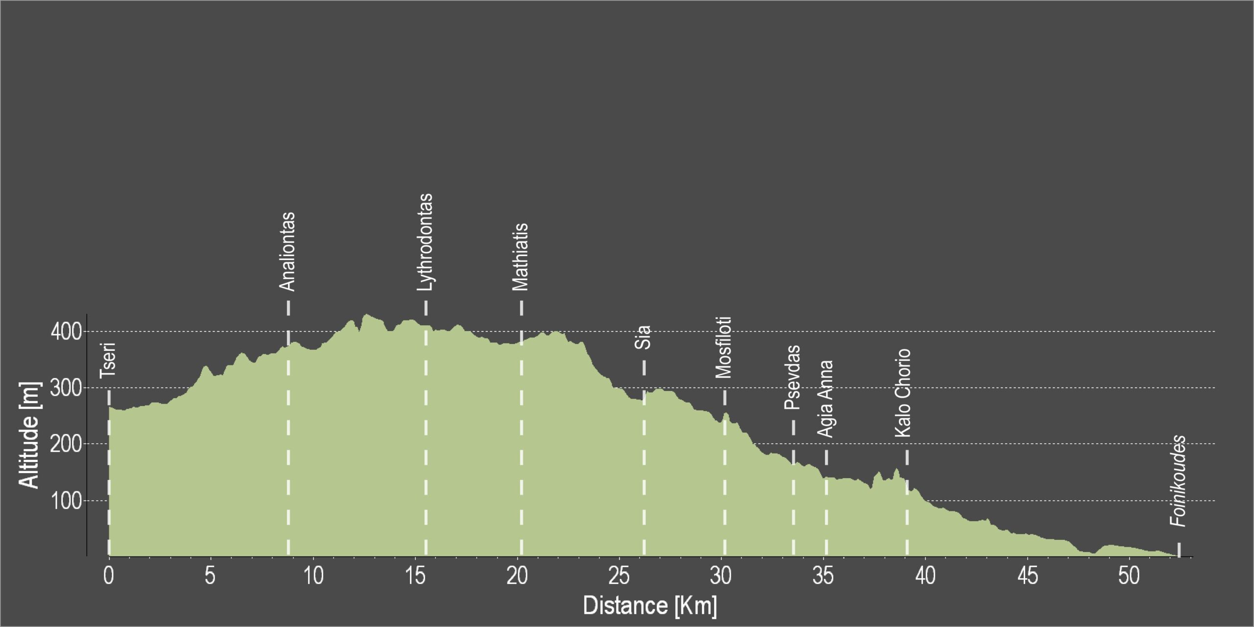
| Distance: | 52.1km |
| Elevation Gain: | 368m |
| Highest point: | 430m |
| Lowest point: | 4m |
| Loop: | NO |
| Terrain: | Mixed |
| Road surface: | Paved |
| Section Distance (km) | Total Distance (km) | |
| Tseri | 0,0 | 0,0 |
| Analiontas | 8,7 | 8,7 |
| Lythrodontas | 6,7 | 15,4 |
| Mathiatis | 4,8 | 20,2 |
| Sia | 6,0 | 26,2 |
| Mosfiloti | 3,9 | 30,1 |
| Psevdas | 3,4 | 33,5 |
| Agia Anna | 1,8 | 35,3 |
| Kalo Chorio | 3,8 | 39,1 |
| Kalo Chorio grade separated junction | 3,6 | 42,7 |
| Larnaka Fire Department traffic lights | 4,9 | 47,6 |
| Foinikoudes | 4,5 | 52,1 |