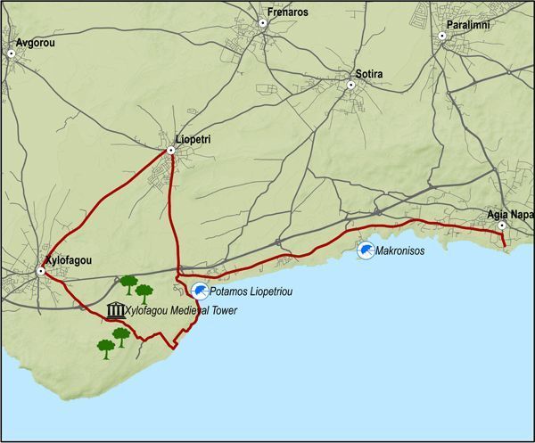
This excursion does the round from Agia Napa to Xylofagou and comes back along the Xylofagou – Agia Napa road.
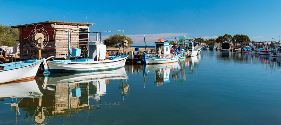
The route begins at the little harbour of Agia Napa and climbs towards the north until it reaches the traffic lights where it turns left and to the west, going along the bicycle path on the left hand side of the road. It then goes past Makronisos on the dirt road that leads to the Agia Thekla chapel and the fishing shelter by the Potamos Liopetriou.
Heading south it goes round Cape Pyla, until it reaches the Xylofagou Medieval Tower. From there it takes a northern course to reach the outskirts of Xylofagou and turns right and to the east taking the Xylofagou – Agia Napa road back to Agia Napa.
Difficulty rate: An easy route but it requires a 21-speed mountain bike.
Road condition: A combination of paved and unpaved roads.
To download the route in gpx format click here
| Distance: | 38.1Km |
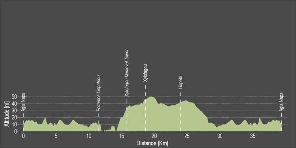
| Elevation Gain: | 78m |
| Highest point: | 51m |
| Lowest point: | 1m |
| Loop: | YES |
| Terrain: | Flat |
| Road surface: | Mixed |
| Section Distance (km) | Total Distance (km) | |
| Agia Napa | 0,0 | 0,0 |
| Potamos Liopetriou | 11,4 | 11,4 |
| Xylofagou Medieval Tower | 4,4 | 15,8 |
| Xylofagou | 2,8 | 18,6 |
| Liopetri | 5,4 | 24,0 |
| Agia Napa | 14,1 | 38,1 |


