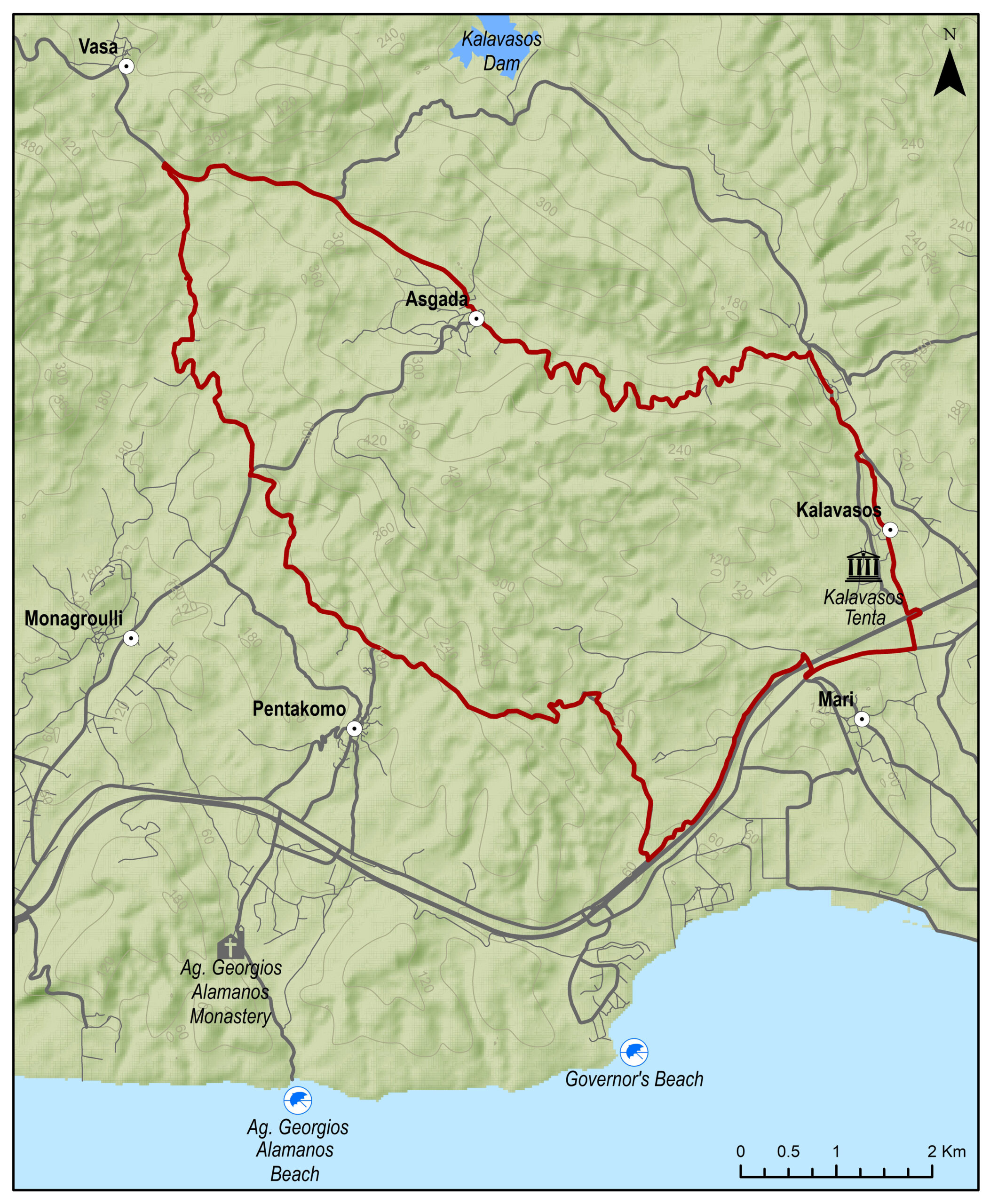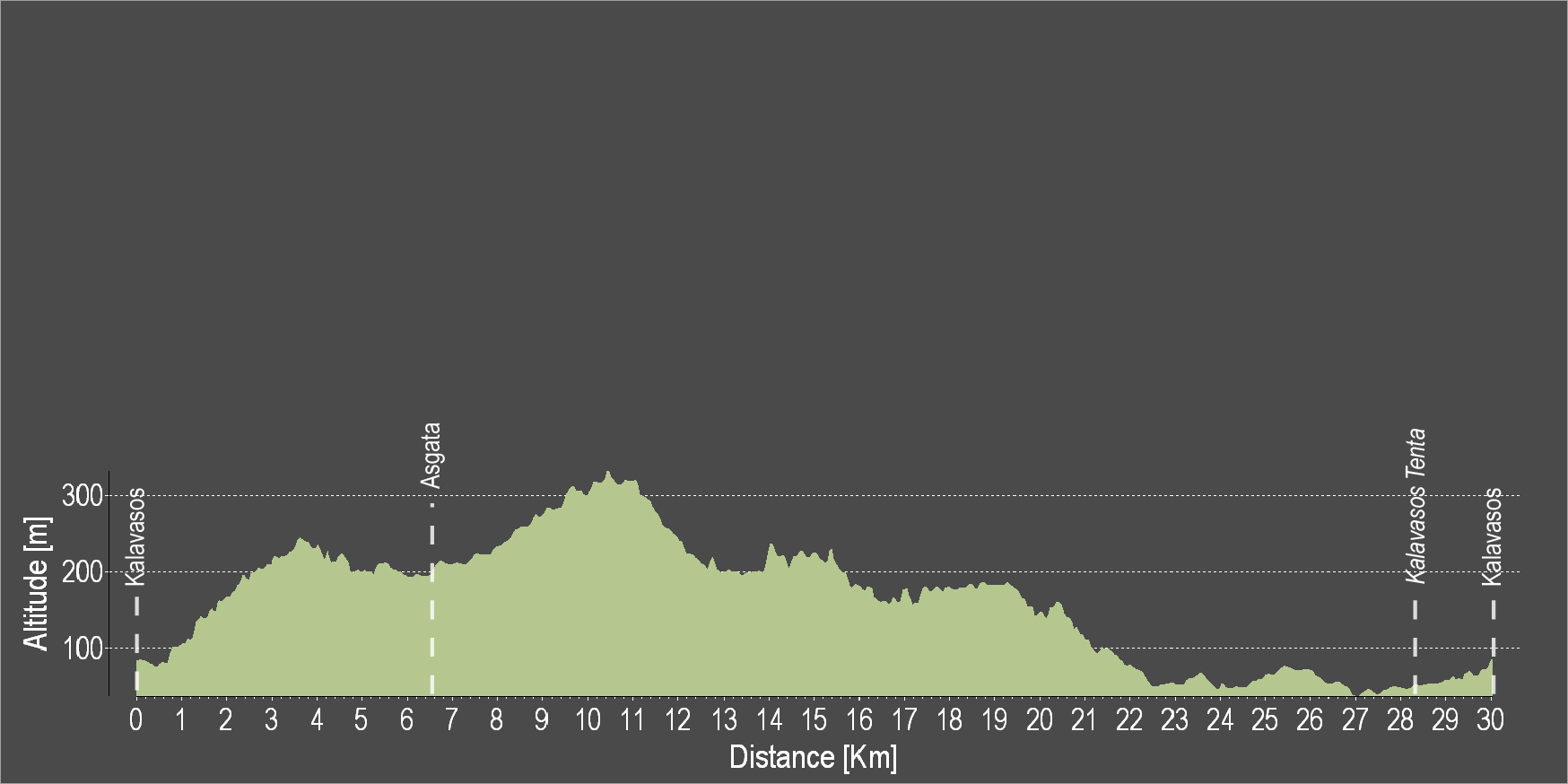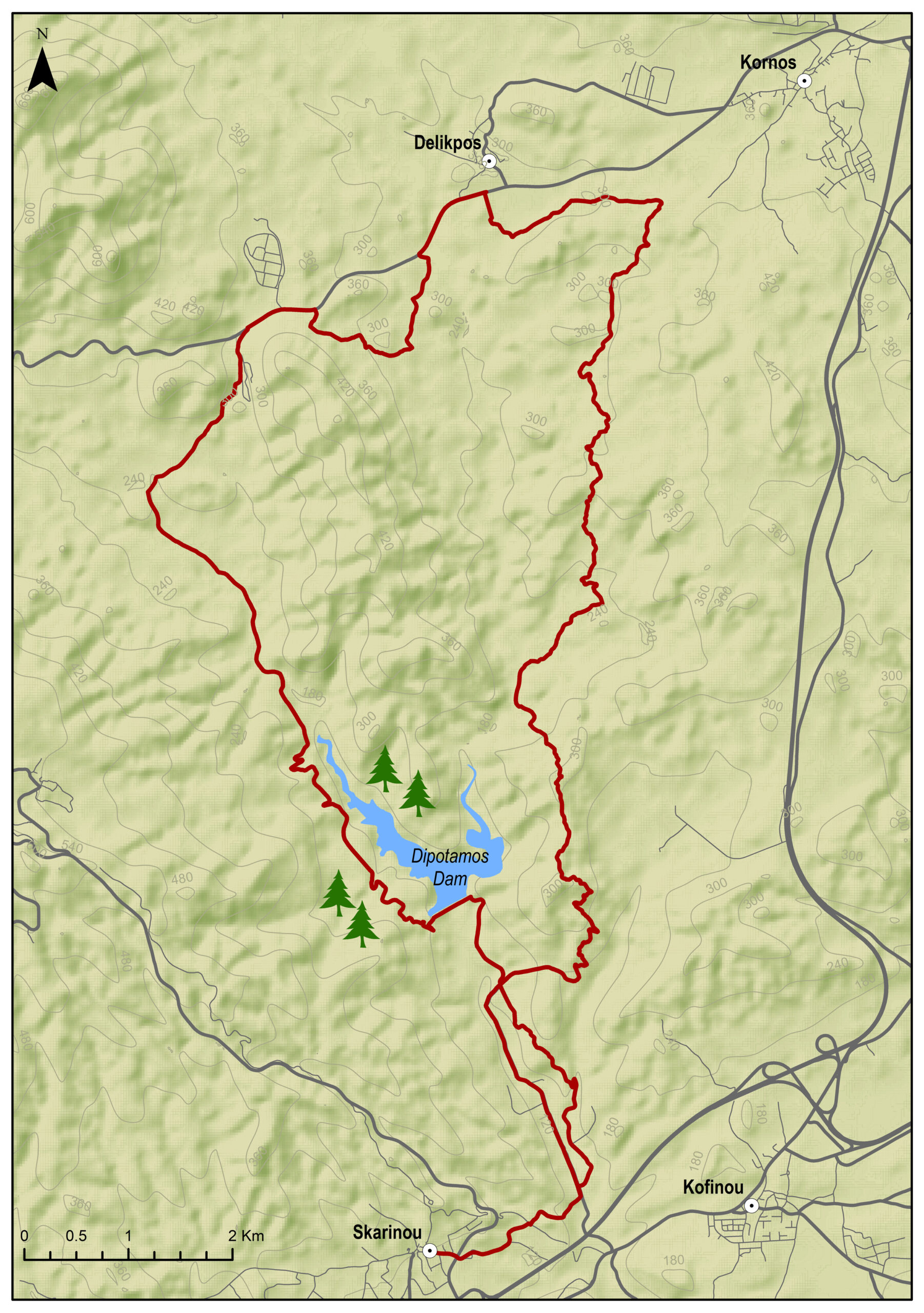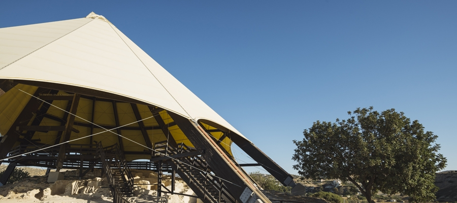
The route starts from the village of Kalavasos and heads north to the village of Asgata. It continues towards the north and enters a downhill dirt road. The dirt road leads almost down to the beach. Continue straight ahead from the main road. Turn left towards Tenta and the Archaeological Monument, the Settlement of the Neolithic Age. Then continue straight again and end the route at Kalavasos.
To download the route in gpx format click here
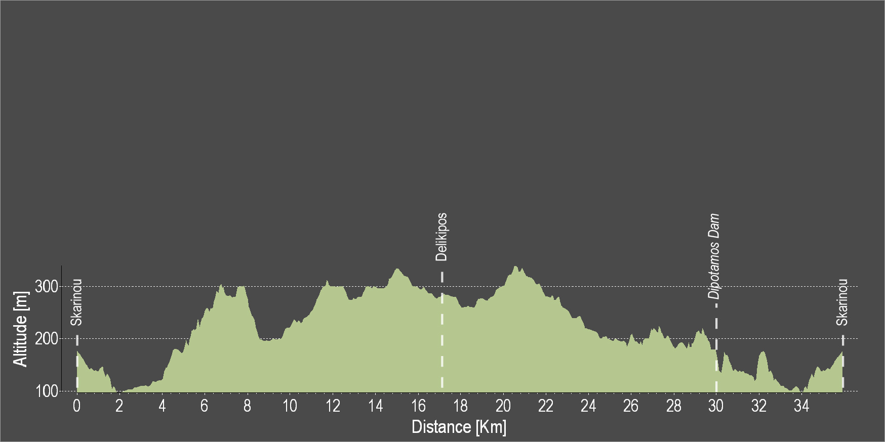
| Distance: | 30.2km |
| Elevation Gain: | 453m |
| Highest point: | 325m |
| Lowest point: | 39m |
| Loop: | YES |
| Terrain: | Mixed |
| Section Distance (km) | Total Distance (km) | |
| Kalavasos | 0.0 | 0.0 |
| Asgada | 6.3 | 6.3 |
| Kalavasos Tenta | 21.3 | 27.6 |
| Kalavasos | 2.6 | 30.2 |