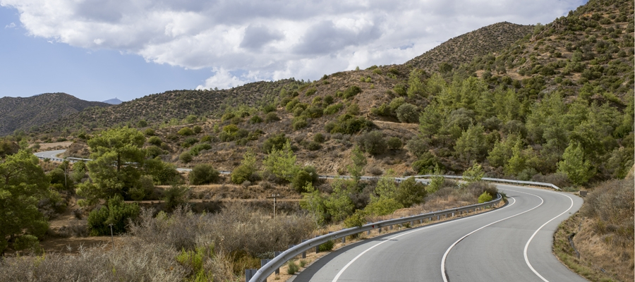
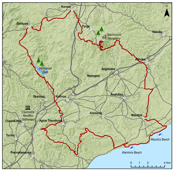
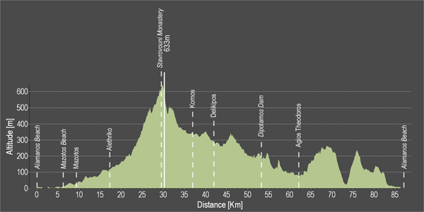
The route starts from the beach of Alaminos and continues along the coast to the villages of Mazotos and Alethriko, before going along the stunning uphill path that ends at the top of Stavrovouni, where the Holy Monastery of Stavrovouni is located, built on a rocky peak. The route then circles back downhill towards the village of Kornos, renowned for its traditional handmade clay vessels, as well as for its tradition in beekeeping, as it produces superior quality honey. Next, discover the village of Delikipos, the Dipotamos Reservoir and the beautiful and picturesque Agios Theodoros to finally reach the beach of Alaminos.
To download the route in gpx format click here
| Distance: | 87.0km |
| Elevation Gain: | 1638m |
| Highest point: | 633m |
| Lowest point: | 0m |
| Loop: | YES |
| Terrain: | Mountain |
| Section Distance (km) | Total Distance (km) | |
| Alaminos Beach | 0.0 | 0.0 |
| Mazotos Beach | 5.7 | 5.7 |
| Mazotos | 3.5 | 9.2 |
| Alethriko | 7.9 | 17.1 |
| Stvrovouni Monastery | 12.6 | 29.7 |
| Kornos | 8.1 | 37.8 |
| Delikipos | 5.0 | 42.8 |
| Dipotamos Dam | 12.3 | 55.1 |
| Agios Theodoros | 8.4 | 63.5 |
| Alaminos Beach | 23.5 | 87.0 |


