Smigies (Circular) – Pafos (Paphos) District, Akamas Forest Nature Trail

GPS coordinates of the starting point: Lat: 35.024020 Lon: 32.333115
GPS coordinates of the ending point: Lat: 35.024020 Lon: 32.333115
Altitude of the starting point: 273m
Altitude of the highest peak: 388m
Altitude of the end peak: 273m
Starting point: Smigies picnic site, 2.5km from Neo Chorio, within the Akamas region.
Length: a) Short route: 2.5km, (b) Long route: 6km
Estimated duration: (a) Short route: 1 hour, (b) Long route: 2 hours
Difficulty rate: 2


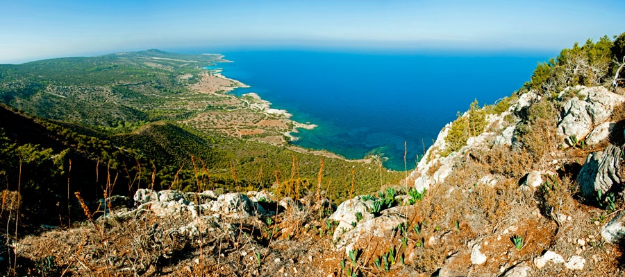
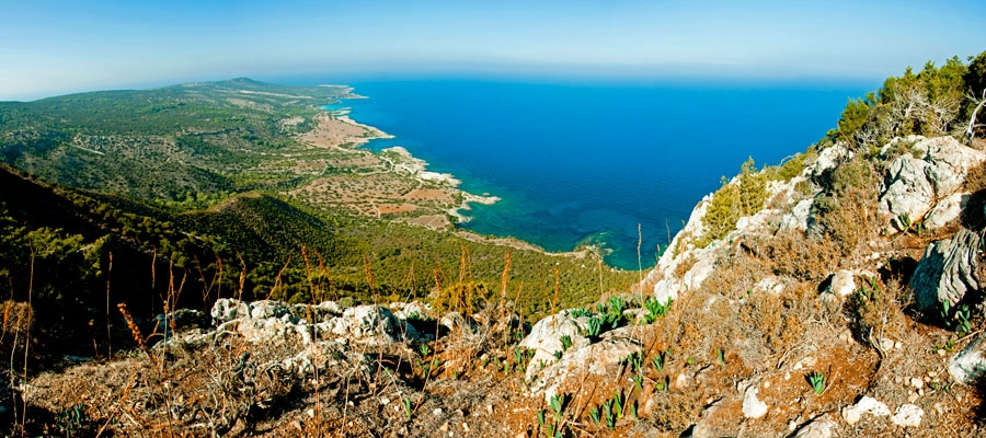
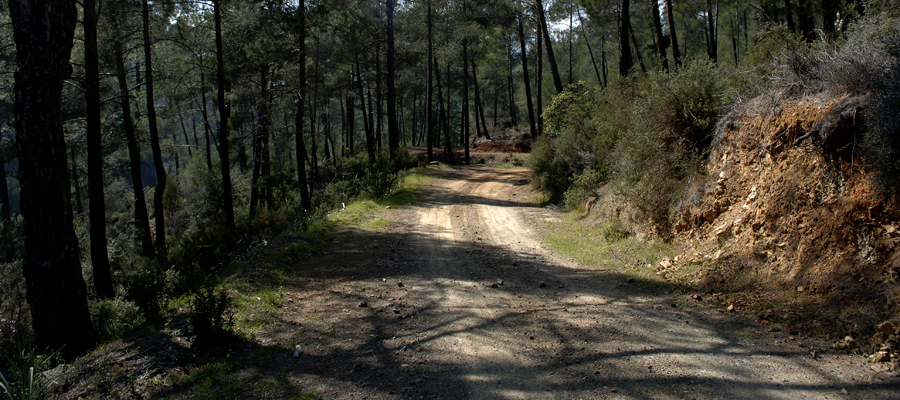
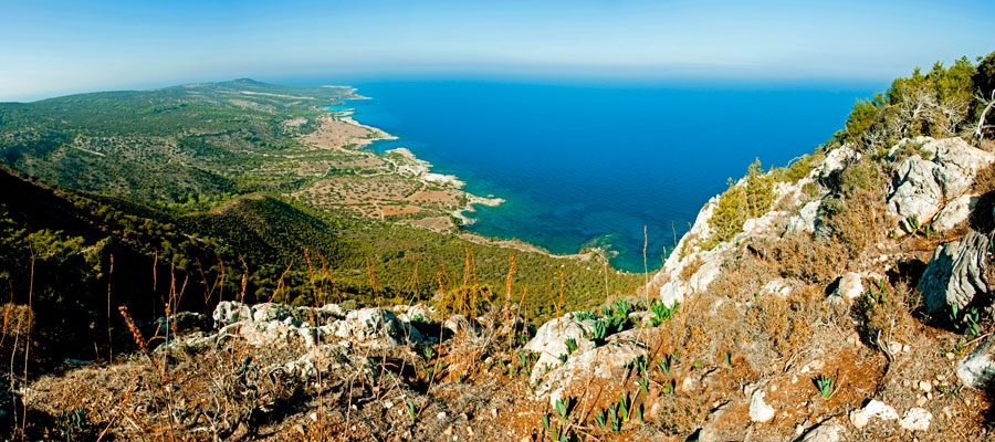
Points of interest: Initially, the trail offers beautiful views of the coastline of the Akamas peninsula to the west ­ including Lara Bay ­ and later on, to the east, with views of Chrysochous bay in the direction of Latsi, Polis, Pachyammos and Pafos (Paphos) forest. The longer route runs past the old mines, magnesium facilities, and abandoned kilns, and through a dense section of the Akamas forest. The trail also connects with the Adonis trail at Kefalovrisia, where you will find a non­ potable water fountain. At the starting point, the two routes are adjacent to the walking trail of Pissouromoutti. Both routes pass by the Piana fire lookout station of the Forestry Department.

Flora: While hiking you can study the endemic plants: Thyme (Thymus integer), Cyprus germander (Teucrium micropodiodes), Cyprus Golden – Drop (Onosma fruticosa), Entire – Leaved Horehound (Acanthoprasium integrifolium), Sweet Marjoram (Origanum majorana var. tenuifolium).

Fauna: The main species of fauna found in the area are:

Mammals: Fox, hare, hedgehog.

Birds: Wood pigeon, partridge, Cyprus warbler (endemic), Cyprus wheatear (endemic).

The Forest of Akamas serves as a resting point for many migratory birds.

Reptiles: Cyprus viper, Cyprus lizard, Black whip snake.
 

Aphrodite (Circular) – Pafos (Paphos) District, Akamas Forest Nature Trail (Rural)

GPS coordinates of the starting point: Lat: 35.056063 Lon: 32.345565
GPS coordinates of the ending point: Lat: 35.056063 Lon: 32.345565
Altitude of the starting point: 35m
Altitude of the highest peak: 333m
Altitude of the end peak: 35m
Starting point: The Loutra tis Afroditis (Baths of Aphrodite).
Length: 7.5km
Estimated duration: 3 – 4 hours
Difficulty rate: 3


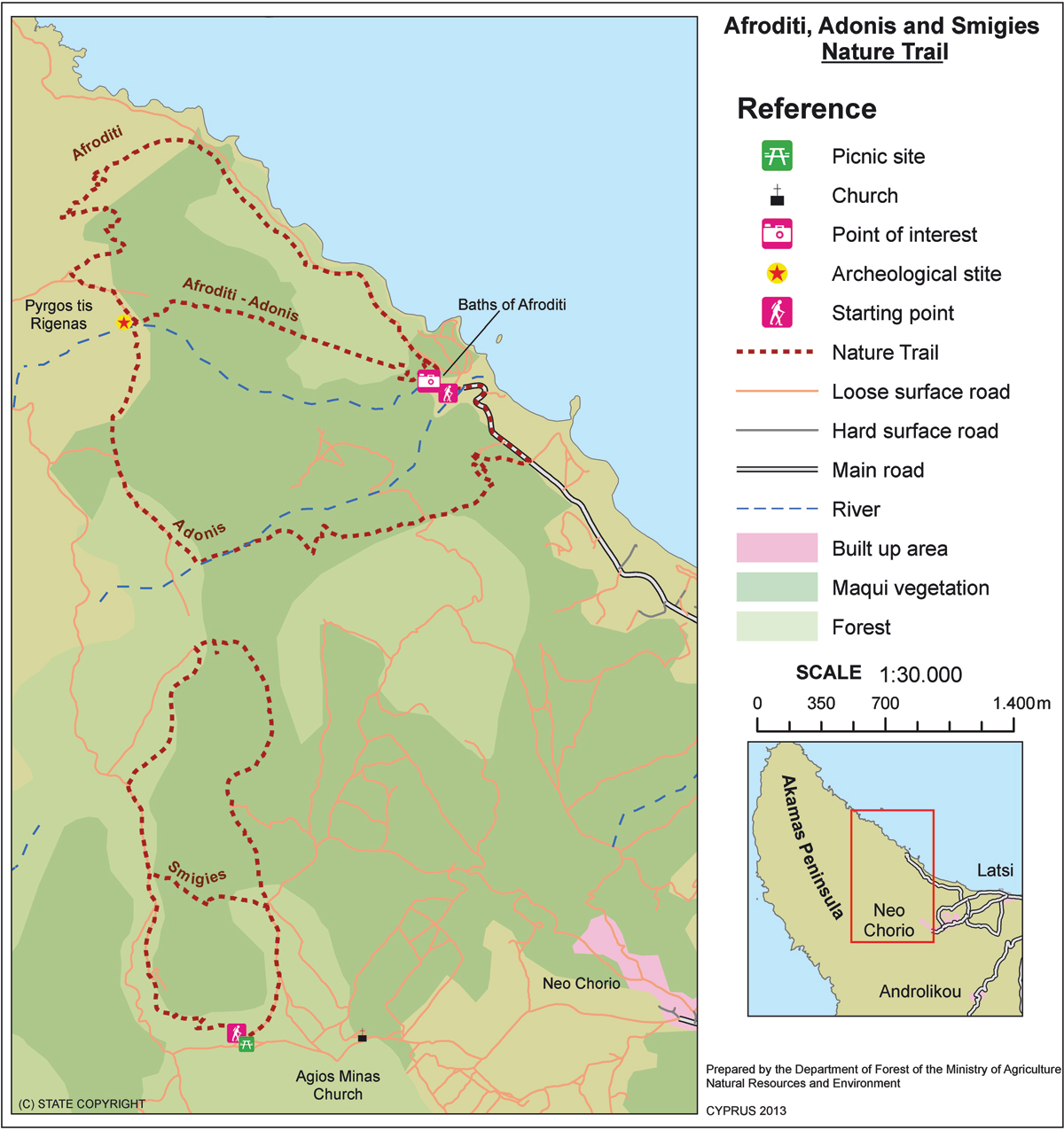
Points of interest: Of special interest on this trail are the Loutra tis Afroditis (Baths of Aphrodite), where, according to legend, the Goddess of Love and Beauty used to take her baths. You will also pass by the ruins of Pyrgos tis Rigainas (Queen’s Tower), which are believed to belong to a Medieval monastery. Also noteworthy is a 500­ year­ old oak tree, which is located near the ruins of the tower. Along the trail you can enjoy excellent views of Cape Arnaoutis, Polis Chrysochous and Pafos (Paphos) Forest. There are two non­ potable water fountains along the trail; one near the ruins of Pyrgos tis Rigainas, and another between the Loutra tis Afroditis (Baths of Aphrodite) and Kakoskali. The trail connects with the Adonis trail, whilst at its starting point you can visit the Botanical Gardens of Akamas. 

Flora: While hiking you can study the endemic plants: Cyprus Golden – Drop (Onosma fruticosa), Cyprus sage (Phlomis cypria var. occidentalis).

Fauna: The main species of fauna found in the area are:

Mammals: Fox, hare, hedgehog.

Birds: Wood pigeon, partridge, Cyprus warbler  (endemic), Cyprus wheatear (endemic).

The forest serves as a resting point for many migratory birds.

Reptiles: Cyprus viper, Cyprus lizard, Black whip Snake.


Adonis (Circular) – Pafos (Paphos) District – Akamas

GPS coordinates of the starting point: Lat: 35.056063 Lon: 32.345565
GPS coordinates of the ending point: Lat: 35.056063 Lon: 32.345565
Altitude of the starting point: 35m
Altitude of the highest peak: 319m
Altitude of the end peak: 35m
Starting point: 400m before the Loutra tis Afroditis (Baths of Aphrodite).
Length: 7.5km
Estimated duration: 3 – 4 hours
Difficulty rate: 3


Points of interest: This trail offers beautiful views of Polis Chrysochous, the Pafos (Paphos) Forest and the Akamas peninsula. The path runs past Pyrgos tis Rigainas (Queen’s Tower) and connects with the Smigies trail at Kefalovrysia (where there is a fountain of non­ potable water), and with the Afroditi trail at Pyrgos tis Rigainas. Also noteworthy is the 500 ­year­ old oak tree, which is located near the ruins of the tower. To return full circle, the trail follows the main road that connects the Loutra tis Afroditis (Baths of Aphrodite) with Polis for about 400 metres. At the starting point of the trail you can visit the Botanical Gardens of Akamas.

Flora: While hiking you can study the endemic plants: Cyprus Bosea (Bosea cypria), Shrubby knapweed (Ptilostemon chamaepeuce var. cyprius), Entire – Leaved Horehound (Acanthoprasium integrifolium), Sweet Marjoram (Origanum majorana var. tenuifolium), Cyprus Golden ­ Drop (Onosma fruticosa), Cyprus sage (Phlomis cypria var. occidentalis).

Fauna: The main species of fauna found in the area are:

Mammals: Fox, hare, hedgehog.

Birds: Wood pigeon, partridge, Cyprus warbler (endemic), Cyprus wheatear (endemic).

The forest of Akamas serves as a resting point for many migratory birds.

Reptiles: Cyprus viper, Cyprus lizard, Black whip Snake.

Troodos Square – Stavros tis Psokas Cycling Route

Linking the Troodos area with the Kykkos Mountains, this 55km route also allows further trips to the northwest coast of the island, along the route from Stavros to Pyrgos or to Polis.

The route begins in Troodos Square and climbs to the west for about 2,5km when it reaches a turning to the left leading to Mount Olympos. From here, it travels downhill to the village of Prodromos. It then turns right to the Pinewood area and travels above the village of Pedoulas to Kykkos Monastery. At this point there is an opportunity to stop at the Kykkos restaurant before going on to Kampos. A turning to the left before Kampos leads to Stavros tis Psokas to the west and 3,5km further down, another turning to the left leads to the Cedar Valley. The route continues straight on for another 16km until another turning to the left, leading to Stavros tis Psokas forestry station 3km along the way. Here, there is a restaurant, a hostel, a picnic site and a camping site, as well as a fenced off area where moufflon (indigenous mountain goats) are kept.

Start Point: Troodos Square
End Point: Stavros tis Psokas
Total Distance: 55km
Height Gain: 25m
Difficulty Rating: An easy route with a few uphills and plenty of downhills. Requires a street bike with speeds.
Road Conditions: Paved roads throughout
 

Troodos – Pafos (Paphos) Cycling Route

This 65km route links the Troodos area to Pafos (Paphos) via the picturesque villages of the Diarizos River Valley.

From Troodos Square the route heads south along the main Lemesos (Limassol) – Troodos road. At Psilo Dendro it turns right to Pano Platres and then on to Kato Platres. Just outside the village it turns right for Mandria and Pafos. Heading southwest the route goes through Mandria and enters the Diarizos Valley, passing through the villages of Agios Nikolaos, Praitori, Kedares, Kidasi, Agios Georgios, Mamonia, Fasoula and Nikokleia, and finally joins the old Lemesos – Pafos road. From there it turns west to reach Pafos via the villages of Mandria, Timi, Acheleia and Geroskipou.

Start Point: Troodos Square
End Point: Pafos
Total Distance: 65km
Height Gain: 20m
Difficulty Rating: An easy route, mostly downhill. Requires good brakes whether street or mountain bike.
Road Conditions: Paved road throughout.
 

Psilo Dendro (Platres) – Karvounas Cycling Route

Karvounas is one of the main junctions of the Troodos cycling network. It forms the administrative boundary between Lemesos (Limassol) district to the south and Lefkosia (Nicosia) district to the north.

All seven rest and viewpoints are located along the first 9km of the route, overlooking Platres Valley and linking it with Moniatis. The southern shores of the island and the city of Lemesos stretch out in the distance, and the horizon extends as far as Cape Gata.

The route crosses the Mesa Potamos River 6km from the starting point. The dense vegetation in this corner of the eastern slopes of the mountain range of Troodos creates a cool, almost chilly environment that is a welcome respite in the hottest summer months. There are rest benches, and fresh running water is freely available for visitors to drink when they stop here for a well­earned break.

The nearby village of Pano Platres, 1km away, provides hotel and other tourist accommodation, restaurants, cafes, banks and shops.

Start Point: Psilo Dendro, Platres
End Point: Karvounas
Total Distance: 16,2km
Difficulty Rating: An easy route with good accessibility by bicycle.
Road Conditions: Good quality tarmac and forest dirt track in good condition (Depending on weather conditions).
 

Prodromos – Psilo Dendro (Platres) Cycling Route

This route of 18,2km starts from the village of Prodromos, where to the north the abandoned Berengaria hotel complex lies, while lower down is the village of Lemithou, with views of the glittering bay of Morfou in the distance. Further west, the peaks of Throni and Tripylos overlook Kykkos and Stavros tis Psokas respectively. The villages of Palaiomylos and Agios Dimitrios, and the Diarizos Valley  sprawl out below, whilst Pafos (Paphos) forest stretches to the west. The Prodromos dam can be seen to the east, along with a picnic site. To the south is the Trikoukkiotissa Convent.

Start Point: Prodromos village
End Point: Psilo Dendro, Platres
Total Distance: 18,2km
Height Gain: 10m
Difficulty Rating: An easy route. Accessibility by bicycle is good – very good, with the exception of the Trooditissa – Foini forest road, which requires attention due to small sharp fragments of rock on the surface. For this section of the road, the use of MTB cycles with front suspension is recommended.
Road Conditions: Good quality tarmac and forest dirt track with some sharp stones on parts of the route. Caution is advised against damage to tyres.
 

Karvounas – Prodromos Cycling Route

The Karvounas – Prodromos route is of medium difficulty and is divided into two parts: a 10km descent (8km in a forest dirt track), and a steady ascent for the remaining 12,7km. At the first signposted viewpoint ­ 5km from the starting point – the village of Kakopetria spreads down towards the heart of Solea Valley. About 15km from the starting point of this route, cyclists arrive at the Stavroullia rest and viewpoint. Here, as at the Marathos picnic site 2,5km farther on, the Marathasa Valley reveals its splendour with the villages of Pedoulas, Moutoullas and Kalopanagiotis to the west. Further north, the village of Gerakies nestles amidst the backdrop of the mountain peak of Kykkos and its famous monastery.

Start Point: Karvounas
End Point: Prodromos
Total Distance: 22,7km
Height Gain: 10m
Difficulty Rating: A route of medium difficulty, with good accessibility by bicycle.
Road Conditions: Good quality tarmac and forest dirt track in good condition (Depending on weather conditions).
 

Stavros tis Psokas – Pyrgos Cycling Route

This 40km route offers an alternative excursion from Stavros tis Psokas, leading to Pyrgos in the Tilliria region, instead of to Panagia and Pafos (Paphos).

Starting at the Stavros tis Psokas forestry station, the route climbs a little to the north until it reaches a fork. The right­hand road leads east to Kykkos, while the road to the left heads west to Pomos and Kato Pyrgos. The latter is a winding downhill road, which emerges at the military camp of Agios Georgios. From there, the route turns right, heading east to reach the coastal road and Pyrgos 6km away.

Start Point: Stavros tis Psokas
End Point: Pyrgos
Total Distance: 40km
Height Gain: 10m
Difficulty Rating: A relatively easy route as it is mostly downhill. Suitable for any kind of bike with speeds and brakes in good condition.
Road Conditions: Good quality, paved road throughout.
 

Stavros tis Psokas – Pafos (Paphos) Cycling Route

This 65km route links Kykkos and the mountain range of Troodos with Pafos (Paphos).

From the forestry station at Stavros tis Psokas, the dirt road heads in a south­westerly direction through one of the most beautiful regions of the island. Uphills and downhills alternate as far as the camping site at Agia. From here, the road starts to climb steadily to the end of the forest a little outside Panagia, at the picnic site in Monasilakkas. It then continues a little further up to the largest village in the area of Panagia, birthplace of Archbishop Makarios III, the first President of Cyprus. The Monastery of Panagia Chrysorrogiatissa is situated near this village. The route continues towards Pafos, passing through the villages of Asprogia, Kannaviou, Agios Dimitrianos, Psathi, Polemi, Kallepeia, Tsada and Mesogi.

Start Point: Stavros tis Psokas
End Point: Pafos
Total Distance: 65km
Height Gain: 475m
Difficulty Rating: A medium – hard route due to quite a few steep uphills, particularly on the paved parts of the road. Requires a mountain bike with 21 speeds.
Road Conditions: A variety of surfaces.