Polis Circular Cycling Route

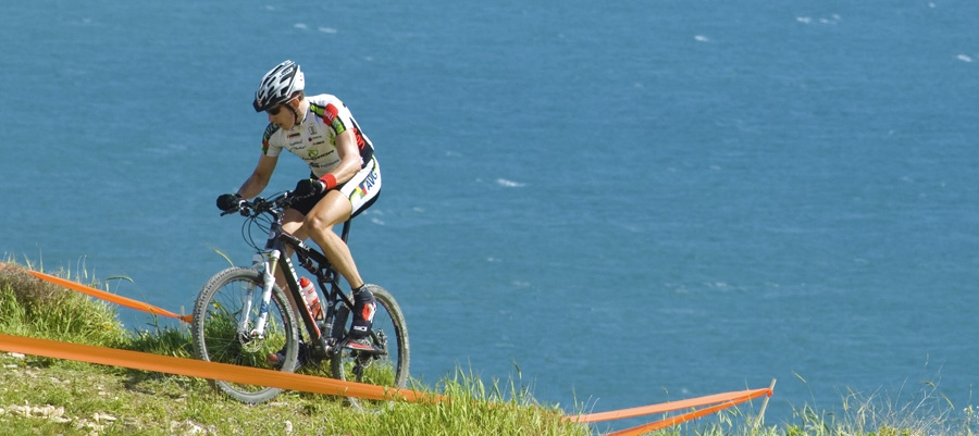
This 23km route heads southwest from Polis along the Polis – Pafos (Paphos) road until it reaches a turning to the right towards Androlikou. Climbing steadily at Xeropotamos, it passes through the villages of Androlikou and Fasli. Continuing in the same direction, it reaches another turning to the right at a dirt road; this leads downhill to the west of the Akamas mountain ridge, as far as the end of the peninsula. After about 4km of dirt road, there is another turning to the right, which leads to the Smigies picnic site, and then to Neo Chorio ­ where it takes the paved road back to Polis.

Start Point: Polis
End Point: Polis
Total Distance: 23km
Difficulty Rating: A difficult route with steep uphills and downhills. Requires a mountain bike with front fork suspension.
Road Conditions: A variety of surfaces.
 

Polis – Pyrgos Cycling Route

This 48km route, along with the routes from Pafos (Paphos), links Pyrgos with Polis and Pafos.

Beginning from Polis, the route travels along the coast in a north­easterly direction to Pachyammos. It then takes a little detour, climbing up into the mountains in a southerly direction in order to by­pass the Turkish enclave of Kokkines, after which it goes downhill to rejoin the coastal road to Pyrgos.

Start Point: Polis
End Point: Pyrgos
Total Distance: 48km
Height Gain: 130km
Difficulty Rating: An easy route of almost flat roads. There are often strong onshore winds in the area, particularly in the afternoon. Requires a street bike with at least 14 speeds.
Road Conditions: Good quality, paved road throughout.


Polis – Argaka Cycling Route

This 28km route travels northeast along the Polis – Pyrgos road, along the coast until a turning to the right that leads to the village of Argaka. The road passes the village school, and continues straight and south along a dirt road. It then turns southeast to the picnic site at Agios Merkourios. From there it follows a descending forest road to Argaka and back to Polis.

Start Point: Polis
End Point: Polis
Total Distance: 28km
Difficulty Rating: An easy route, despite dirt roads. Requires a mountain bike with front fork suspension.
Road Conditions: A variety of surfaces.
 

Polis – Akamas Lighthouse Cycling Route

The greatest advantage of cycling in the Polis area is its proximity to the Akamas Peninsula.

This 22km route begins in Polis and heads west towards Lakki (Latsi), the small harbour / marina of Polis and the Baths of Aphrodite. Shortly after Lakki (Latsi) ­ and just before the Baths it turns south ­ climbing towards Neo Chorio. The route travels through the village and then heads west with the road becoming a dirt road just outside the village. It then passes Smigies picnic site, which is the last stop for water. From Smigies, the route climbs rather steeply and turns right, heading southwest along the slopes of a hill offering alternating views of the east and west sides of the peninsula. A turning to the right, 3km from Smigies, leads to ruins known as Pyrgos tis Rigainas.

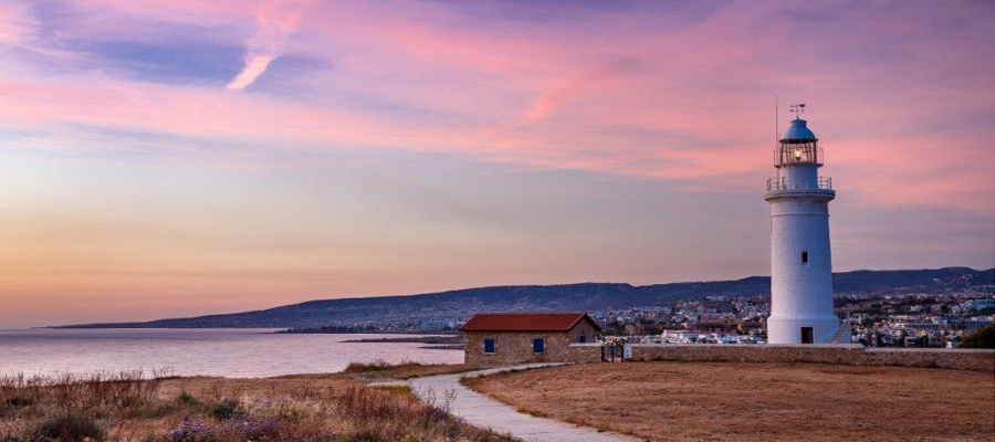
Alternatively, continuing straight for another 2km leads on to the road to Lara, Fontana Amorosa and the Baths of Aphrodite. Further along this road is Akamas lighthouse. Alternative route: You can return to Polis from the lighthouse by going along the Fontana Amorosa road to the Baths of Aphrodite.

Start Point: Polis
End Point: Akamas Lighthouse
Total Distance: 22km
Difficulty Rating: A difficult route. Requires a mountain bike with at least 21 speeds. Front fork suspension is recommended.
Road Conditions: A variety of surfaces.
 

Pafos (Paphos) – Polis Cycling Route

This 37km route goes from Pafos (Paphos) to Polis ­ the main town of Chrysochou Bay.

It begins in Kato Pafos following the coastal road in a north­westerly direction, until the crossroad at Coral Bay, where it turns right. It then climbs to the village of Pegia, known for its fountain. The route continues to climb through the village, offering a spectacular view of the west coast. It then enters the forest, travelling northeast to the village of Kathikas, from where it heads north to Prodromi, and finally to Polis.

Start Point: Pafos
End Point: Polis
Total Distance: 37km
Height Gain: 615m
Difficulty Rating: A difficult route that requires some effort and a good street or mountain bike with speeds.
Road Conditions: Good quality, paved road throughout.
 

Pafos (Paphos) – Baths of Aphrodite Cycling Route

This 37km route rides along the Akamas Peninsula and the Avakas Gorge.

Beginning at Kato Pafos (Paphos), the route heads northwest along the coastal road. At the crossroads between Coral Bay and Pegeia, it continues straight to the fishing refuge of Agios Georgios. A little before the chapel of Agios Georgios ­ on the right and south ­ is a turning along a dirt road for the Akamas area. After about 2km, the route goes over a small bridge at the Avga or Avakas riverbed. Signposts from there lead along a path to the right towards Avakas Gorge.

Heading straight leads to Lara; straight past Lara is a turning to the right to the chapel of Agios Kononas, where there is drinking water. From Agios Kononas, the route heads south to meet the road going over the Akamas ridge ­ crosses the road from Smigies to the Akamas lighthouse ­ and continues downhill to Fontana Amorosa. This road follows the coast in a south­easterly direction to the Baths of Aphrodite and the beach with a CTO Tourist Pavilion.

Start Point: Pafos
End Point: Baths of Aphrodite
Total Distance: 37km
Difficulty Rating: A medium – difficult route due to some challenging uphills with uneven surfaces. Requires a high­quality mountain bike with front fork suspension.
Road Conditions: A variety of surfaces.
 

Kato Pafos (Paphos) – Timi Forest Cycling Route

This 12km route tours the Pafos (Paphos) region, along the coastal front of Kato Pafos, past Geroskipou Tourist Beach, and ending up at Timi Beach near Pafos Airport and the nearby eucalyptus grove.

The route starts off at Pafos Harbour, heading in a south­easterly direction. After the Pafos Beach Hotel, it continues along a bicycle path on the right­hand side of the road, parallel to the coast, as far as Geroskipou Tourist Beach. From there it goes along a dirt road to the Pafos Airport perimeter and crosses the Ezousa Riverbed (on foot). The route then follows the airport perimeter fence, heading first north and then east to join the paved road to the airport. At that point, the route turns right towards the sea. Continuing a little further down, it reaches the small bay and beach of Timi and the nearby eucalyptus grove with its picnic site.

Start Point: Pafos Port
End Point: Timi coast
Total Distance: 12km
Difficulty Rating: An easy – average route. Requires a mountain bike.
Road Conditions: A variety of surfaces.
 

Geroskipou – Pafos (Paphos) Cycling Route

This 24km route goes from Geroskipou to the Monastery of Stavros tis Minthas and the golf course, and then on to the village of Tsada, before ending in Pafos (Paphos).

The route starts from the centre of Geroskipou and heads towards Lemesos (Limassol), travelling along the old Lemesos – Pafos road. Between Geroskipou and Koloni, a turning to the left leads to Agia Marinouda in the north. The route passes through the village and climbs north to reach the village of Marathounta. From there, it turns right, climbing up towards the village of Episkopi in the Pafos district. Just before the top of the hill, the route takes the dirt road to the left, leading to the golf course and the Monastery of Stavros tis Minthas. From here, a paved road covers the 3km to the village of Tsada. From Tsada, it is downhill to Pafos along the Pafos – Polis road.

Start Point: Geroskipou
End Point: Pafos
Total Distance: 24km
Difficulty Rating: A medium – difficult route. Requires a mountain bike of 21 speeds.
Road Conditions: A variety of surfaces.
 

Pitsylia – Troodos Cycling Route

This 28,3km route connects the areas of Pitsylia and Troodos and is an interesting route for visiting the surrounding villages.

From Alona, the route heads southwest, passing through Polystypos, and climbs to the northwest, passing underneath Madari peak to reach Chandria village. At Chandria, it turns right and heads west through Kyperounta to reach the crossroads at Karvounas.

From Karvounas it heads south, climbing steeply towards Pano Amiantos, and then heads west, climbing even more steeply to Troodos Square. Before reaching the square, the route travels past the picnic sites of Almyrolivado and Livadi tou Pashia, as well as a camping and picnic site just before the square.

Start Point: Alona village
End Point: Troodos Square
Total Distance: 28,3km
Height Gain: 695m
Difficulty Rating: A route of medium difficulty, with steep uphills. Requires a good­quality street bicycle with at least 14 speeds, or a mountain bike with 21 speeds.
Road Conditions: Paved roads throughout.
 

Ancient Amathous – Governor’s Beach Cycling Route

This 15km route is best suited to mountain bike enthusiasts who will appreciate the technical difficulties involved. Although there are few changes in gradient, a large part of the route is on rocky ground, and requires a good sense of balance and technical skill.

The route starts where the Lemesos (Limassol) – Ancient Amathous route ends, continuing in the same direction along the old Lemesos – Lefkosia (Nicosia) road for 5km as far as the Moni flyover. There, it turns off onto a dirt road to the right and heads south towards the coast. The route travels past a number of industrial units, as well as the Moni quarry, where it turns left heading east. This part of the route is full of cycling thrills and ends up at Governor’s Beach. Halfway along the route (about 4km) is a biological waste-processing unit. Just before the uphill leading to the unit, there is a narrow path carved out of the cliff on the right that descends to the dry riverbed of Agios Georgios Alamanos. The road at the riverbed is smoother and heads north for about 600m, before turning right in order to cross to the other side. It is not far from there to the coast, with Governor’s Beach 5km away.

Start Point: Ancient Amathous
End Point: Governor’s Beach
Total Distance: 15km
Difficulty Rating: A difficult route of uneven surfaces. Requires a good­ quality mountain bike with 24-speeds and a front fork suspension.
Road Conditions: A variety of surfaces.