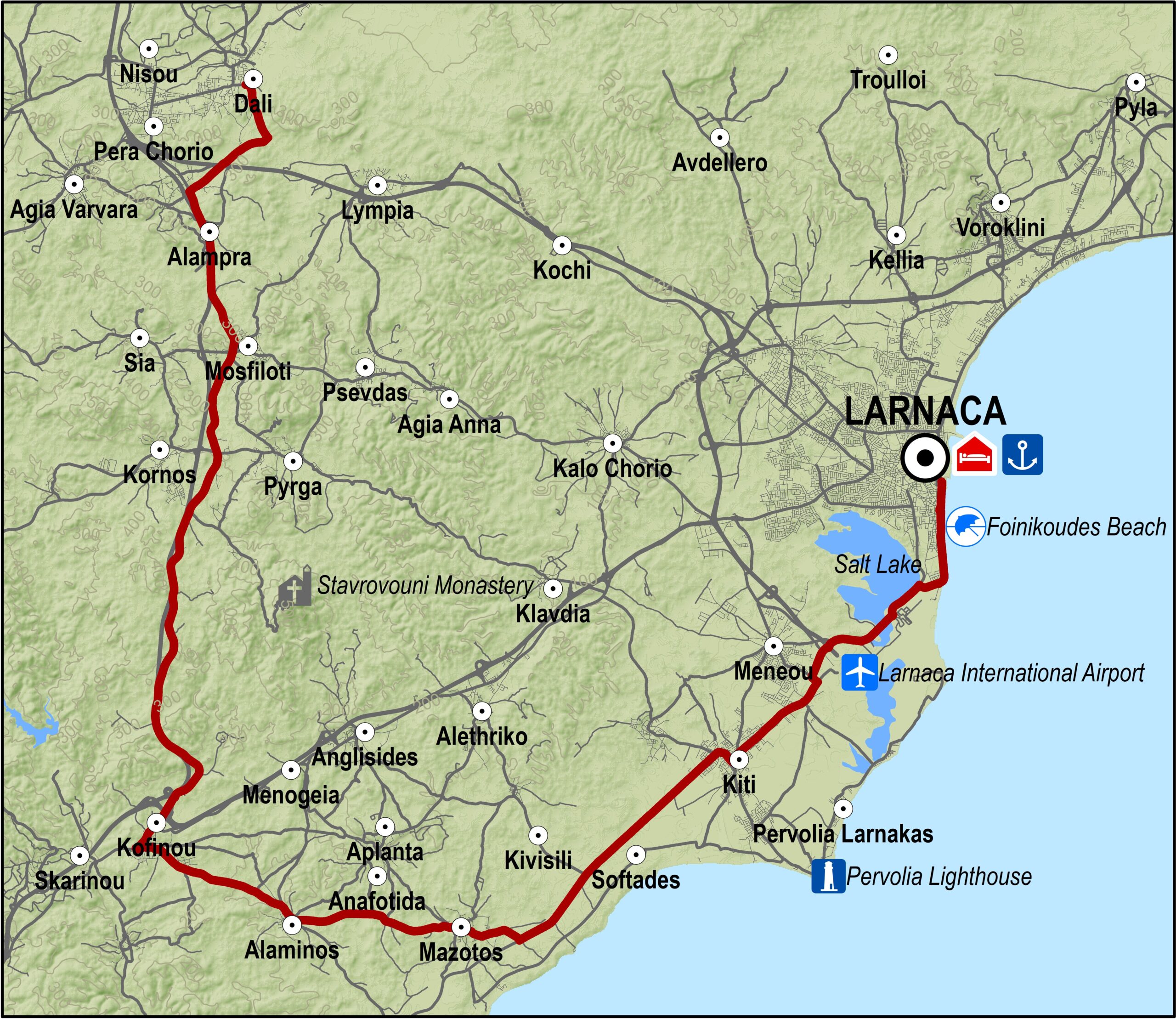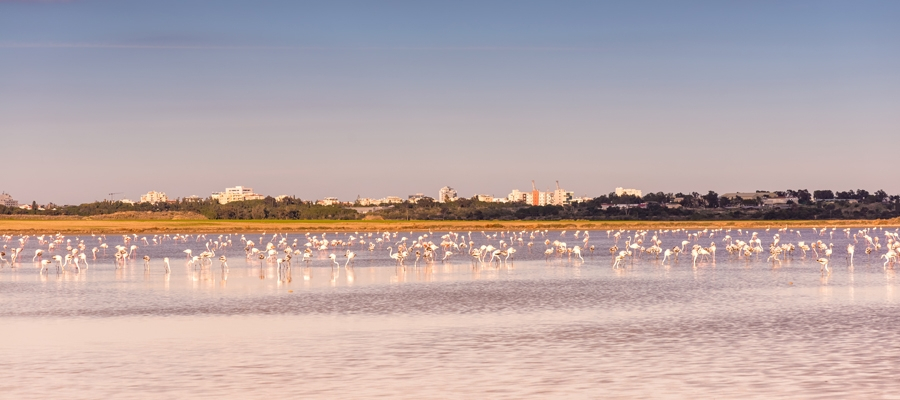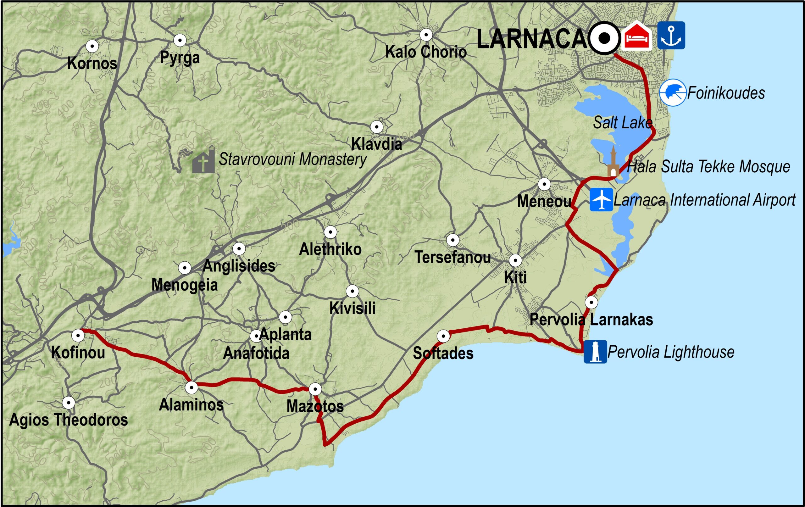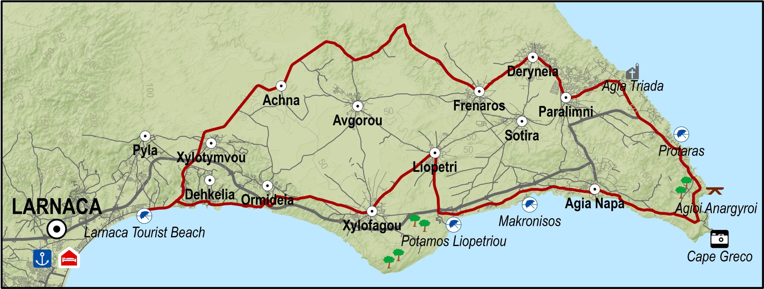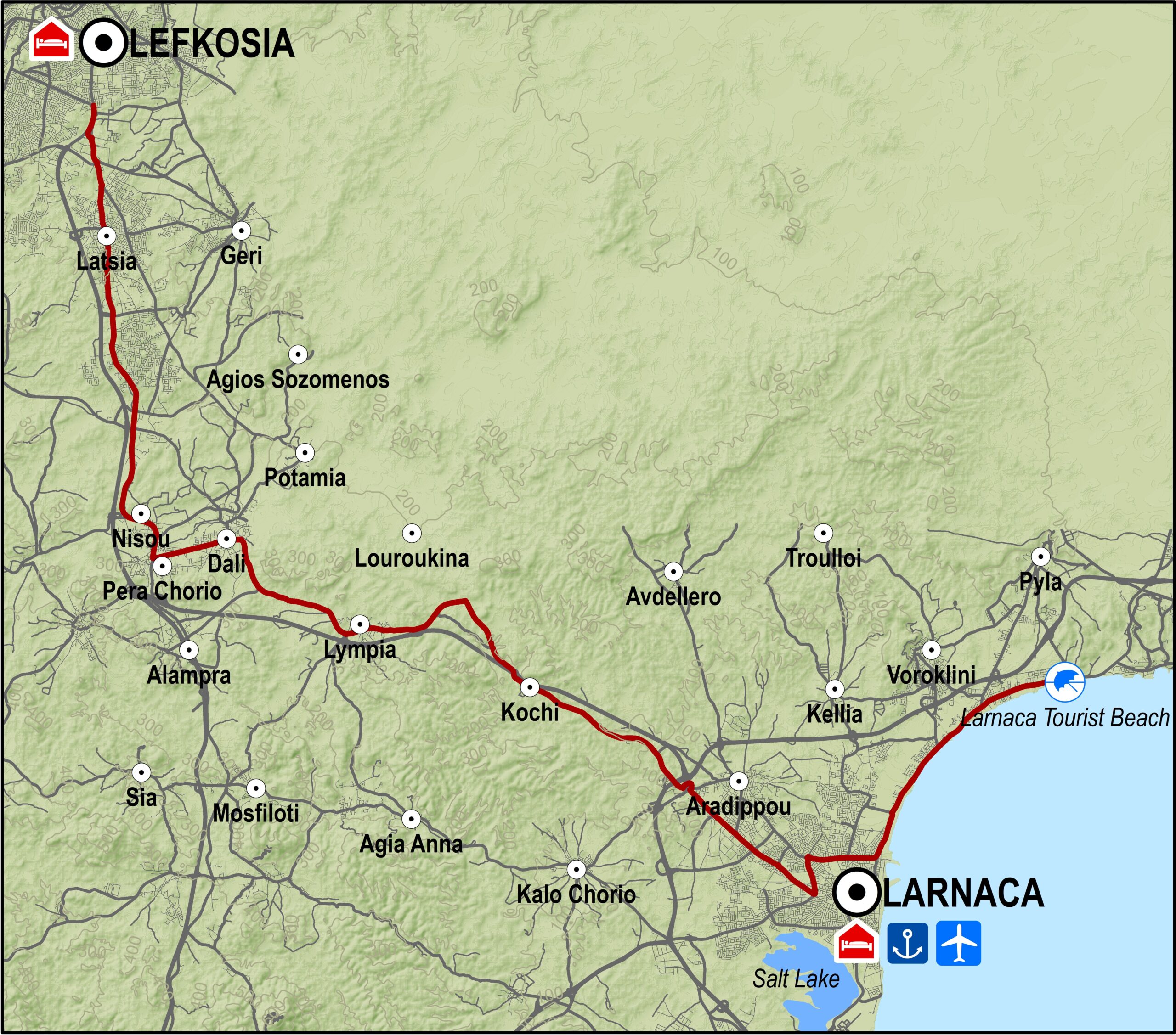
Starting at the Larnaka port roundabout, the route travels along the Stratigos Timagia avenue, crosses the traffic lights at the Fire Department, and continues straight to the next traffic lights where it turns left to reach the traffic lights by the Phaneromeni church on the Larnaka Airport – Meneou road. From there it turns right and goes south, past the airport roundabout and heads southwest to Meneou.
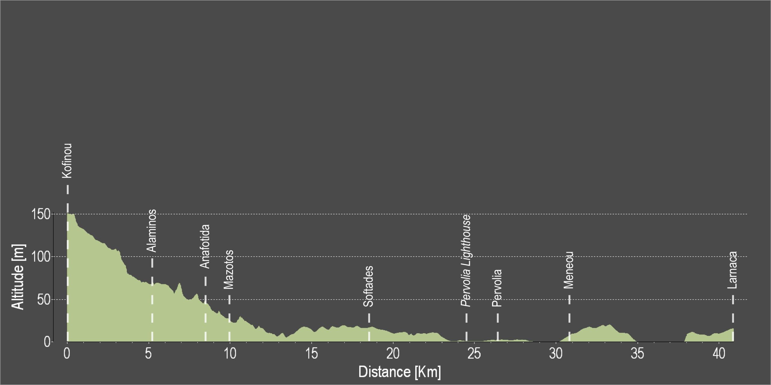
Just before Kiti village, it turns right towards Mazotos, which is about 10km further down after the fuel station. The fuel station also happens to be the starting point for the Mazotos – Vavatsinia – Kofinou route. From Mazotos the route continues west towards Alaminos and reaches Kofinou where it meets the old Lefkosia – Lemesos road. It turns right and to the north towards Lefkosia, and from this point on becomes more difficult, owing to a 220m high vertical climb, which lasts for 6km. After that it is downhill all the way through the villages of Pyrga, Mosfiloti, Alampra and Nisou.
Road condition: Paved roads throughout.
Route Description: This excursion goes from Larnaka to Nisou through the hills of the Kakoradjia region, and are a hard ride. The route also links up nicely with a number of alternative routes.
To download the route in gpx format click here
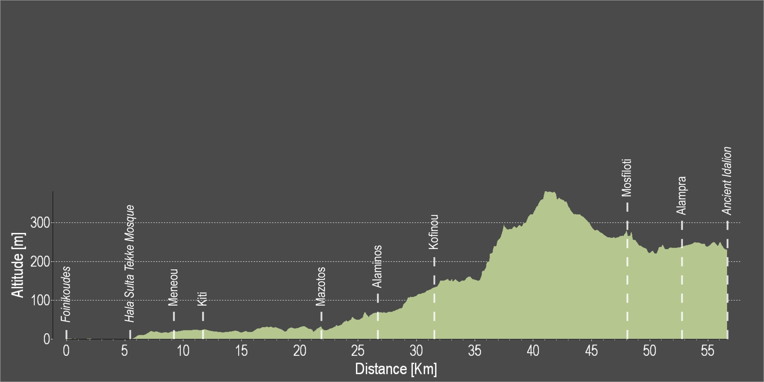
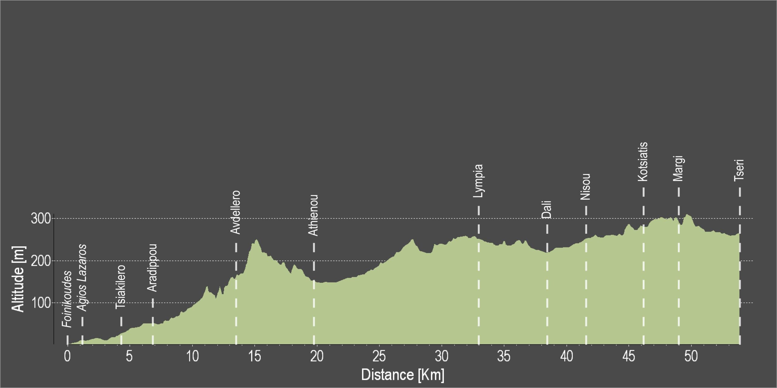
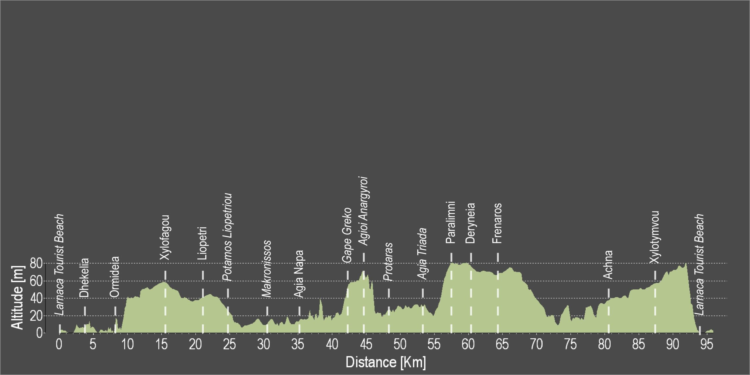
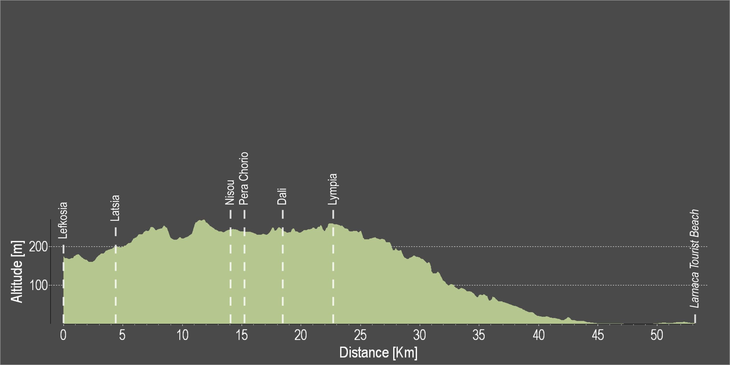
| Distance: | 57.4km |
| Elevation Gain: | 462m |
| Highest point: | 378m |
| Lowest point: | 2m |
| Loop: | NO |
| Terrain: | Mixed |
| Road surface: | Paved |
| Section Distance (km) | Total Distance (km) | |
| Foinikoudes | 0,0 | 0,0 |
| Airport Roundabout | 5,5 | 5,5 |
| Meneou | 1,6 | 7,1 |
| Kiti | 2,2 | 9,3 |
| Mazotos fuel station | 2,4 | 11,7 |
| Mazotos | 8,3 | 20,0 |
| Alaminos | 1,9 | 21,9 |
| Kofinou | 4,9 | 26,8 |
| Pyrga | 4,8 | 31,6 |
| Mosfiloti | 16,4 | 48,0 |
| Alampra | 4,8 | 52,8 |
| Ancient Idalion | 4,6 | 57,4 |