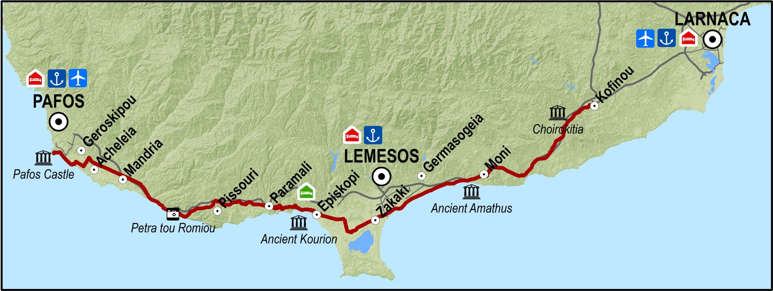
The route starts at Kofinou, heading first south and then southwest, to reach Lemesos after passing through the villages of Choiroikitia, Moni, Amathous and Potamos tis Germasogeias before arriving in Lemesos. From Lemesos it goes west towards Zakaki, Fasouri and Kourion all the way to Petra tou Romiou, from where it goes northwest ending up near the Pafos castle.
Road condition: Good quality paved roads throughout.
Route Description: This excursion is designed for strong cyclists. The entire route is along the old Lefkosia – Lemesos – Pafos road.
To download the route in gpx format click here
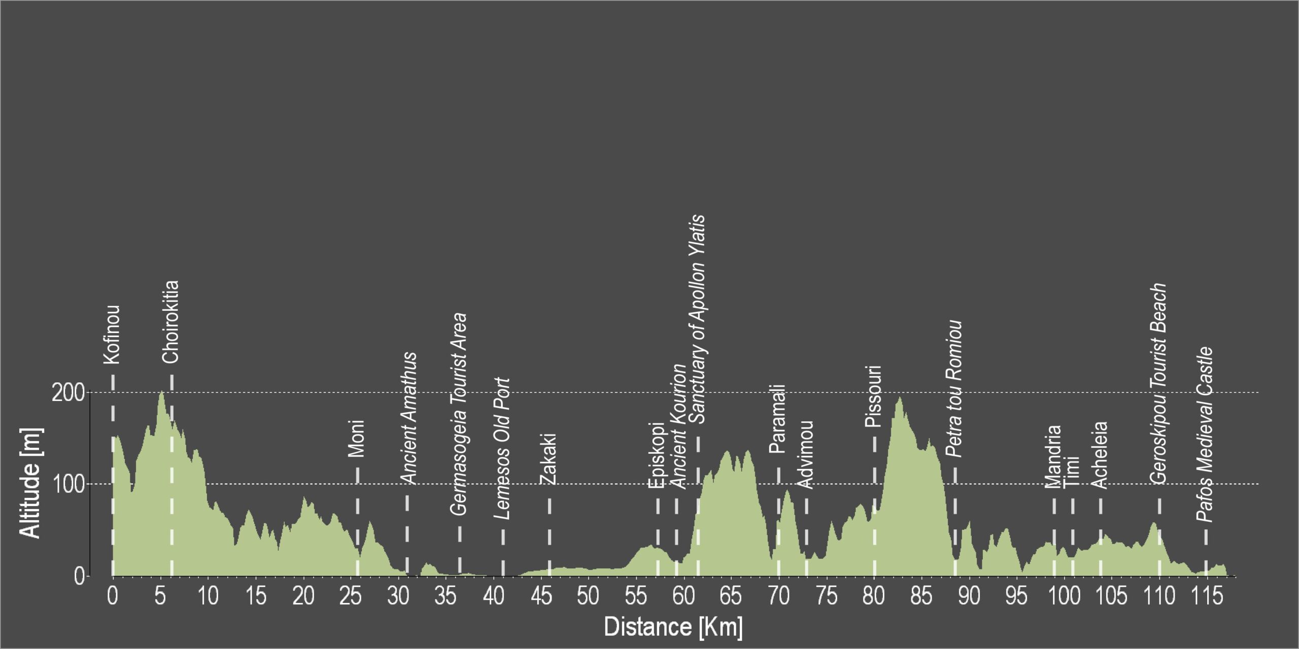
| Distance: | 114.0km |
| Elevation Gain: | 1104m |
| Highest point: | 202m |
| Lowest point: | 0m |
| Loop: | NO |
| Terrain: | Mixed |
| Road surface: | Paved |
| Section Distance (km) | Total Distance (km) | |
| Kofinou | 0,0 | 0,0 |
| Choirokitia | 5,9 | 5,9 |
| Moni | 19,4 | 25,3 |
| Ancient Amathus | 5,7 | 31,0 |
| Gemrasogeia Tourist Area | 5,2 | 36,2 |
| Lemesos Old Port | 5,0 | 41,2 |
| Zakaki | 4,9 | 46,1 |
| Episkopi | 12,0 | 58,1 |
| Ancient Kourion | 0,4 | 58,5 |
| Sanctuary of Apollon Ylatis | 2,9 | 61,4 |
| Episkopi Military Base | 2,9 | 64,3 |
| Paramali | 5,8 | 70,1 |
| Avdimou | 2,6 | 72,7 |
| Pissouri | 7,6 | 80,3 |
| Petra tou Romiou | 7,5 | 87,8 |
| Mandria | 10,8 | 98,6 |
| Timi | 2,1 | 100,7 |
| Acheleia | 2,9 | 103,6 |
| Geroskipou Tourist Beach | 6,4 | 110,0 |
| Pafos Medieval Castle | 4,0 | 114,0 |