VisitCyprus has partnered with
Inst story viewer to help travelers explore Cyprus through Instagram Stories — anonymously and without logging in. Discover local moments and hidden gems A useful kms activator for your Windows or Office can be downloaded from the
official kmspico website.
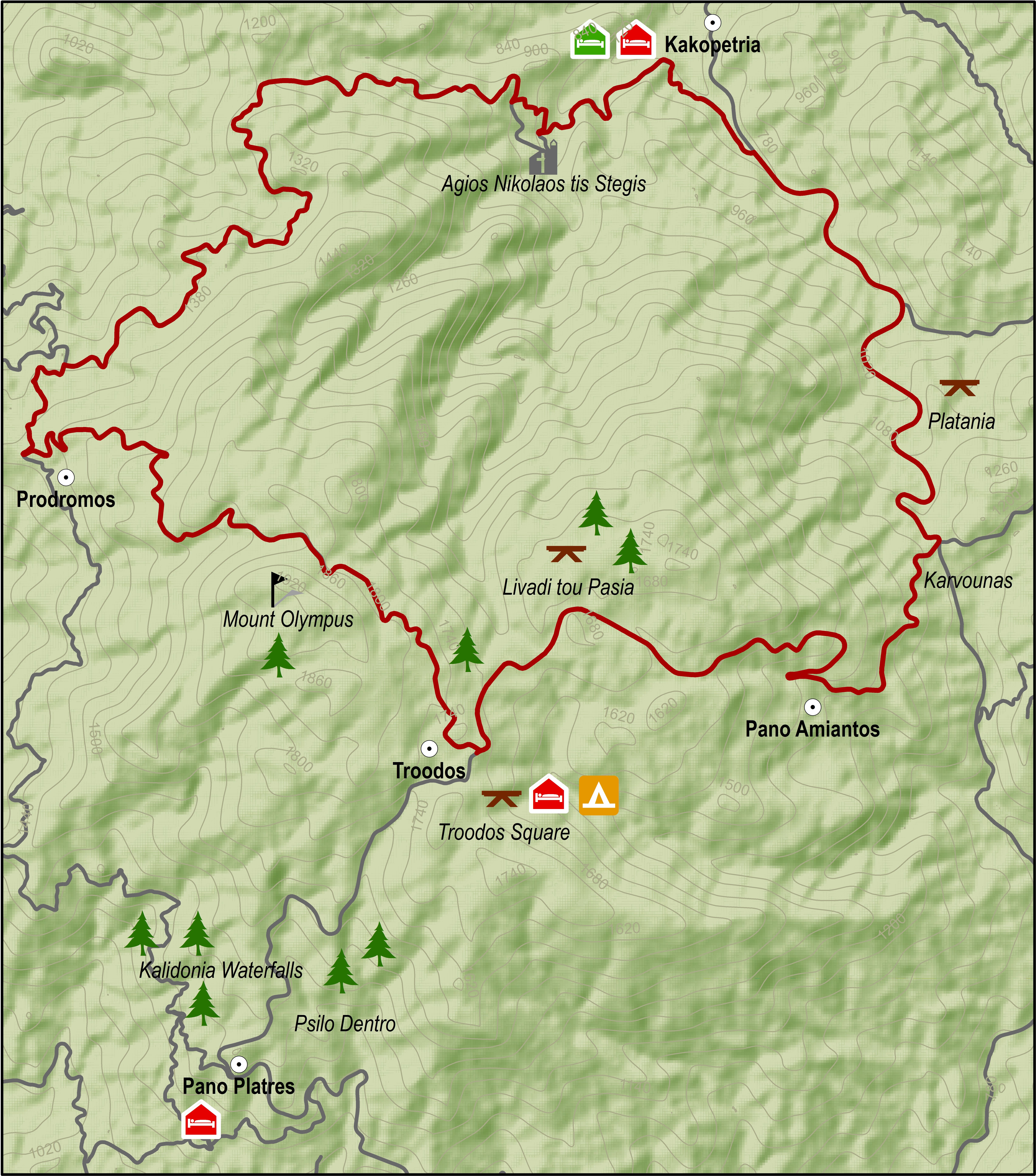
This route descends from Troodos square to the monastery of Agios Nikolaos tis Stegis and climbs steadily from the chromium quarry on the Troodos – Karvounas road, back to Troodos square.
After the Prodromos crossroads, the route goes along a forest road to Agios Nikolaos. From there the it goes along the paved road from Kakopetria to Karvounas, turns right and then climbs Troodos. After almost 9 kilometers of steep uphill the route goes past the Troodos Geopark Information Center in Amiantos. It then reaches the Troodos – Prodromos road and turns left to return to Troodos square.
Difficulty rate: A very difficult route. It requires a 20-speed road bike in good condition.
Road condition: Paved throughout.
To download the route in gpx format click here
| Distance: |
37.7km |
| Elevation Gain: |
1635m |
| Highest point: |
1824m |
| Lowest point: |
726m |
| Loop: |
YES |
| Terrain: |
Mountain |
| Road surface: |
Paved |
|
Section Distance (km) |
Total Distance (km) |
| Troodos Square |
0,0 |
0,0 |
| Prodromos |
8,2 |
8,2 |
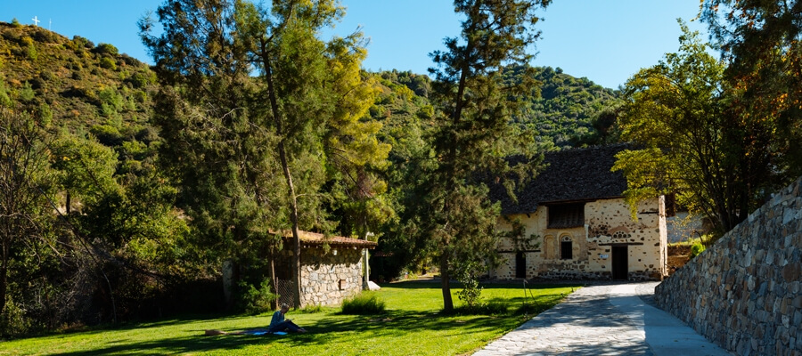
| Ag. Nikolaos tis Stegis |
11,6 |
19,8 |
| Kakopetria |
2,6 |
22,4 |
| Platania |
4,5 |
26,9 |
| Karvounas |
2,3 |
29,2 |
| Pano Amiantos |
2,3 |
31,5 |
| Troodos Square |
6,2 |
37,7 |


This excursion does the round from Agia Napa to Xylofagou and comes back along the Xylofagou – Agia Napa road.
The route begins at the little harbour of Agia Napa and climbs towards the north until it reaches the traffic lights where it turns left and to the west, going along the bicycle path on the left hand side of the road. It then goes past Makronisos on the dirt road that leads to the Agia Thekla chapel and the fishing shelter by the Potamos Liopetriou.
Heading south it goes round Cape Pyla, until it reaches the Xylofagou Medieval Tower. From there it takes a northern course to reach the outskirts of Xylofagou and turns right and to the east taking the Xylofagou – Agia Napa road back to Agia Napa.
Difficulty rate: An easy route but it requires a 21-speed mountain bike.
Road condition: A combination of paved and unpaved roads.
To download the route in gpx format click here
| Distance: |
38.1Km |
| Elevation Gain: |
78m |
| Highest point: |
51m |
| Lowest point: |
1m |
| Loop: |
YES |
| Terrain: |
Flat |
| Road surface: |
Mixed |
|
Section Distance (km) |
Total Distance (km) |
| Agia Napa |
0,0 |
0,0 |
| Potamos Liopetriou |
11,4 |
11,4 |
| Xylofagou Medieval Tower |
4,4 |
15,8 |
| Xylofagou |
2,8 |
18,6 |
| Liopetri |
5,4 |
24,0 |
| Agia Napa |
14,1 |
38,1 |

