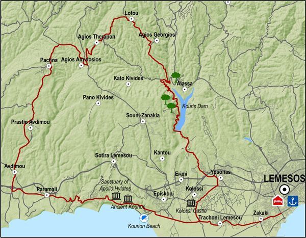
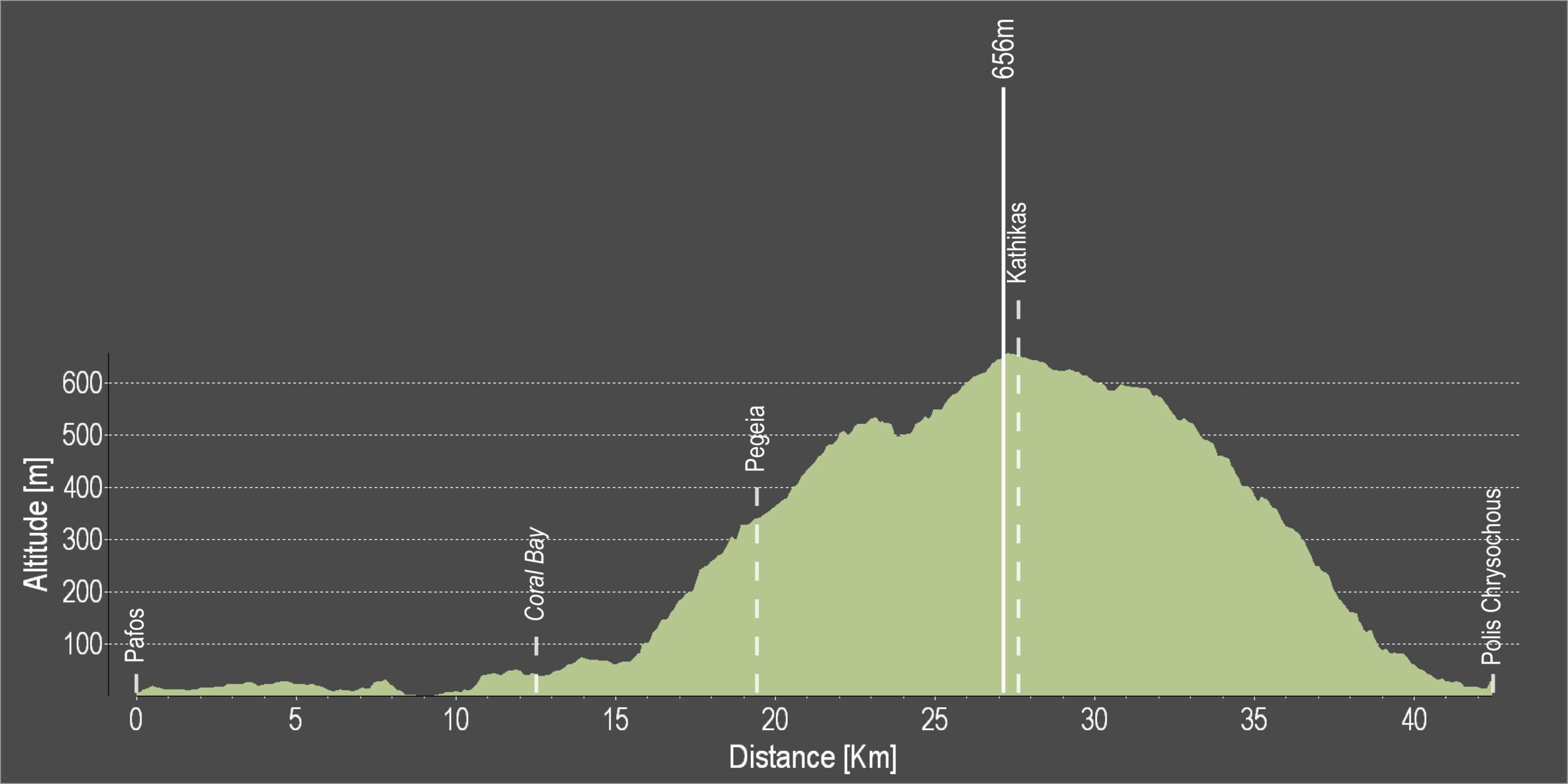
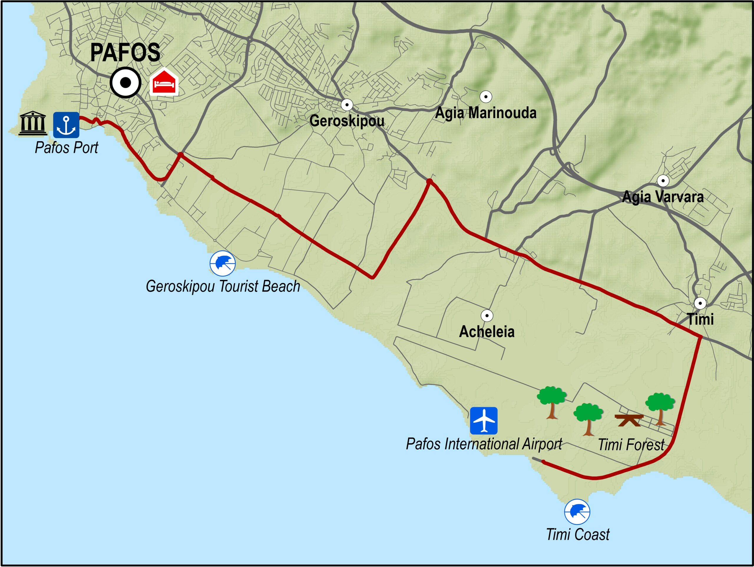
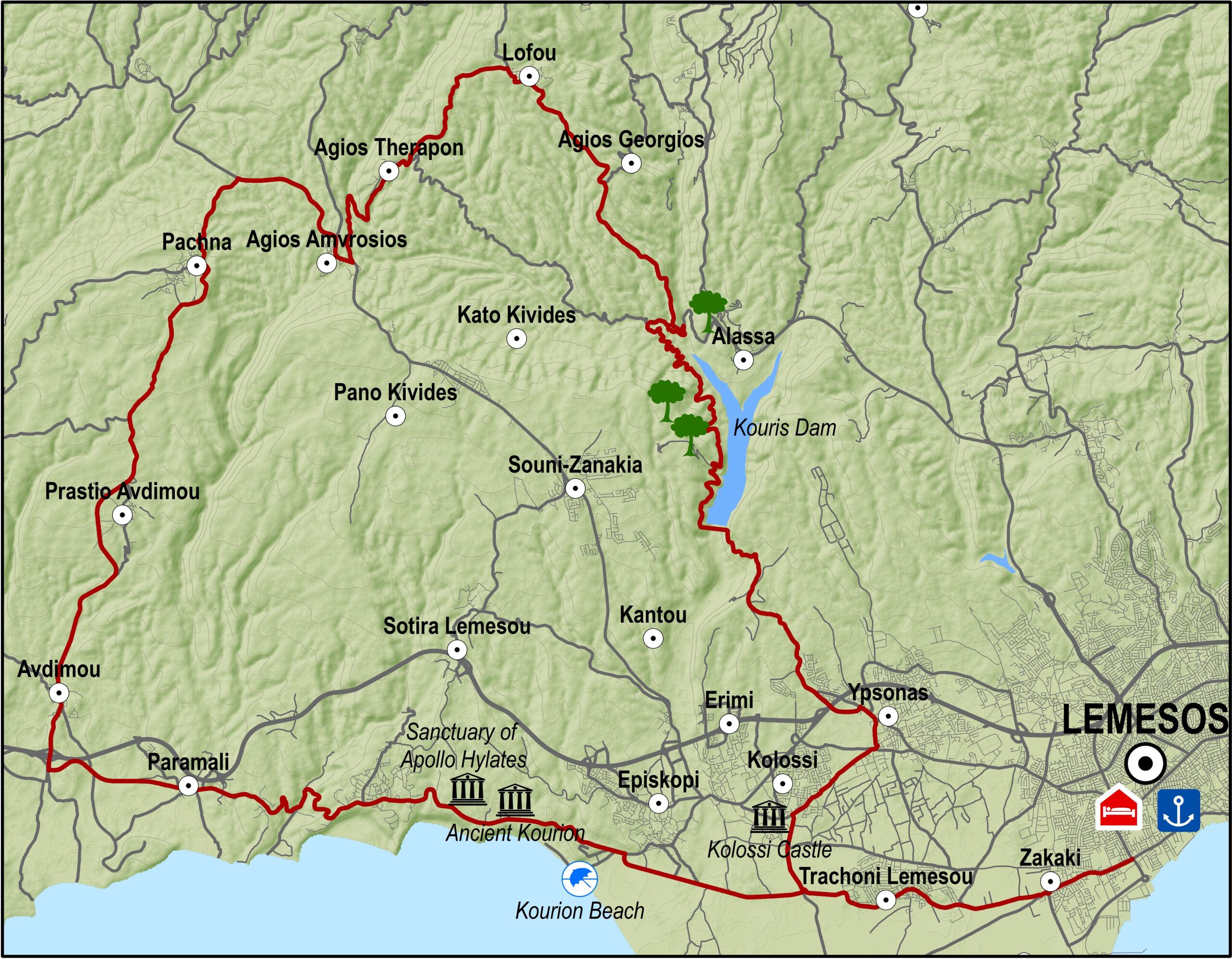
The excursion goes through the western villages of the Lemesos district. It travels past traditional wine-producing villages, goes along the picturesque Fasouri road where the cypress trees growing on either side form a canopy of leaves overhead, and drives past important archaeological sites like that of Kourion.
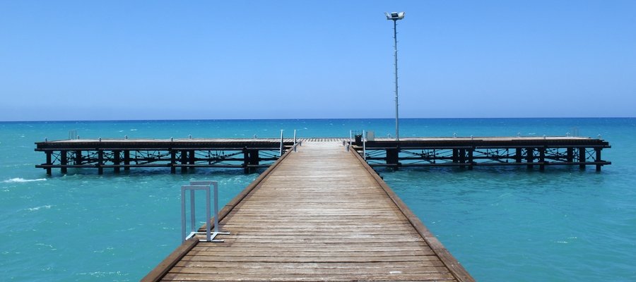
From the Lemesos port traffic lights, the route heads west towards Zakaki. For about 15km the landscape consists of citrus orchards. Asomatos village and Fasouri settlement are the main orange- producing areas of Lemesos. Along the old Lemesos-Pafos road, the route goes past the chapel of Agios Ermogenis, the entrance to the archaeological site of Kourion and the popular Kourion beach.It then climbs steeply for about 1km and arrives at the Ancient Stadium of Kourion and the Sanctuary of Apollo Ylatis.
Next, the route goes past the military base of Episkopi and the village of Paramali, where it starts to climb to the north towards Avdimou and Prastio until it reaches Pachna, the main wine-producing village of the region.The village is full of vineyards, as are the following villages of Agios Amvrosios and Kivides, which are smaller in size and population.
After Kivides the route is downhill and offers a spectacular view to the east of the town and bay of Lemesos spread out below in all its glory as well as the Akrotiri peninsula and the bay of Episkopi. The straight road that leads to Souni and Kantou is relaxing and enables one to enjoy the countryside. Shortly after Kantou is Erimi, a village located on the old Lemesos – Pafos road.From there the route turns left in an easterly direction, and then right to Kolossi and its medieval castle. The return journey to Lemesos is via Fasouri.
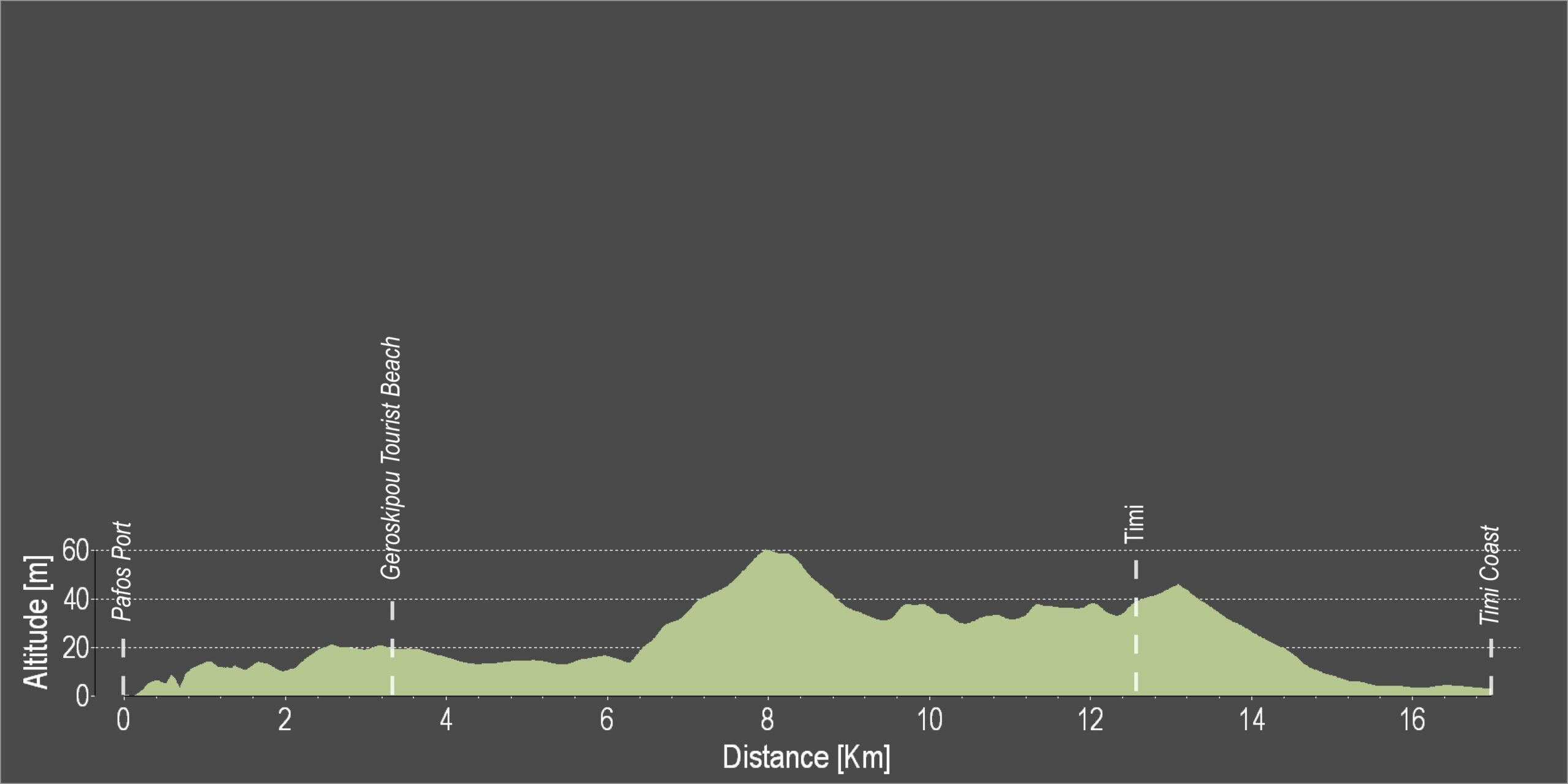
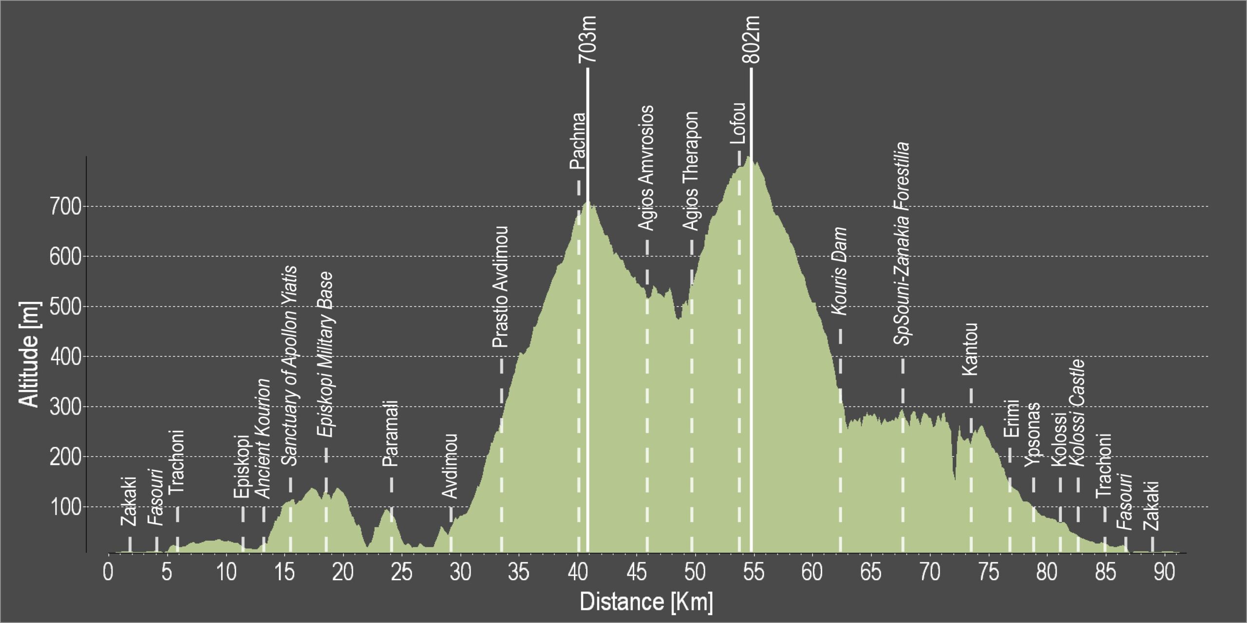
Difficulty rate: It is a relatively long route but it does not present any particular difficulty except for a few steep uphills, which require a bicycle with speeds.
Road condition: Good quality, paved roads throughout.
To download the route in gpx format click here
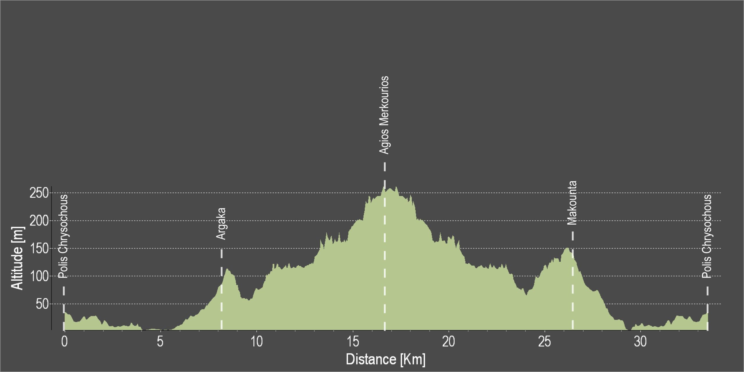
| Distance: |
90.8km |
| Elevation Gain: |
1878m |
| Highest point: |
802m |
| Lowest point: |
3m |
| Loop: |
YES |
| Terrain: |
Mountain |
| Road surface: |
Paved |
|
Section Distance (km) |
Total Distance (km) |
| Port traffic lights |
0,0 |
0,0 |
| Zakaki |
1,8 |
1,8 |
| Fasouri |
2,2 |
4,0 |
| Trachoni |
1,7 |
5,7 |
| Episkopi |
6,3 |
12,0 |
| Ancient Kourion |
0,3 |
12,3 |
| Sanctuary of Apollon Ylatis |
3 |
15,3 |
| Episkopi Military Base |
3,2 |
18,5 |
| Paramali |
5,5 |
24,0 |
| Avdimou |
5 |
29,0 |
| Prastio Avdimou |
4,6 |
33,6 |
| Pachna |
6,6 |
40,2 |
| Agios Amvrosios |
5,7 |
45,9 |
| Agios Therapon |
3,8 |
49,7 |
| Lofou |
4,8 |
54,5 |
| Kouris Dam |
7,8 |
62,3 |
| Souni-Zanakia Forest |
5,4 |
67,7 |
| Kantou |
5,8 |
73,5 |
| Erimi |
3,5 |
77,0 |
| Ypsonas |
1,6 |
78,6 |
| Kolossi |
2,7 |
81,3 |
| Kolossi Castle |
0,8 |
82,1 |
| Trachoni |
3 |
85,1 |
| Fasouti |
1,7 |
86,8 |
| Zakaki |
2,2 |
89,0 |
| Port traffic lights |
1,8 |
90,8 |