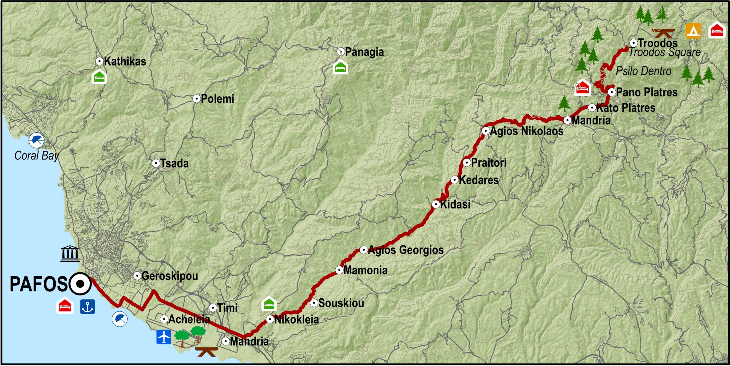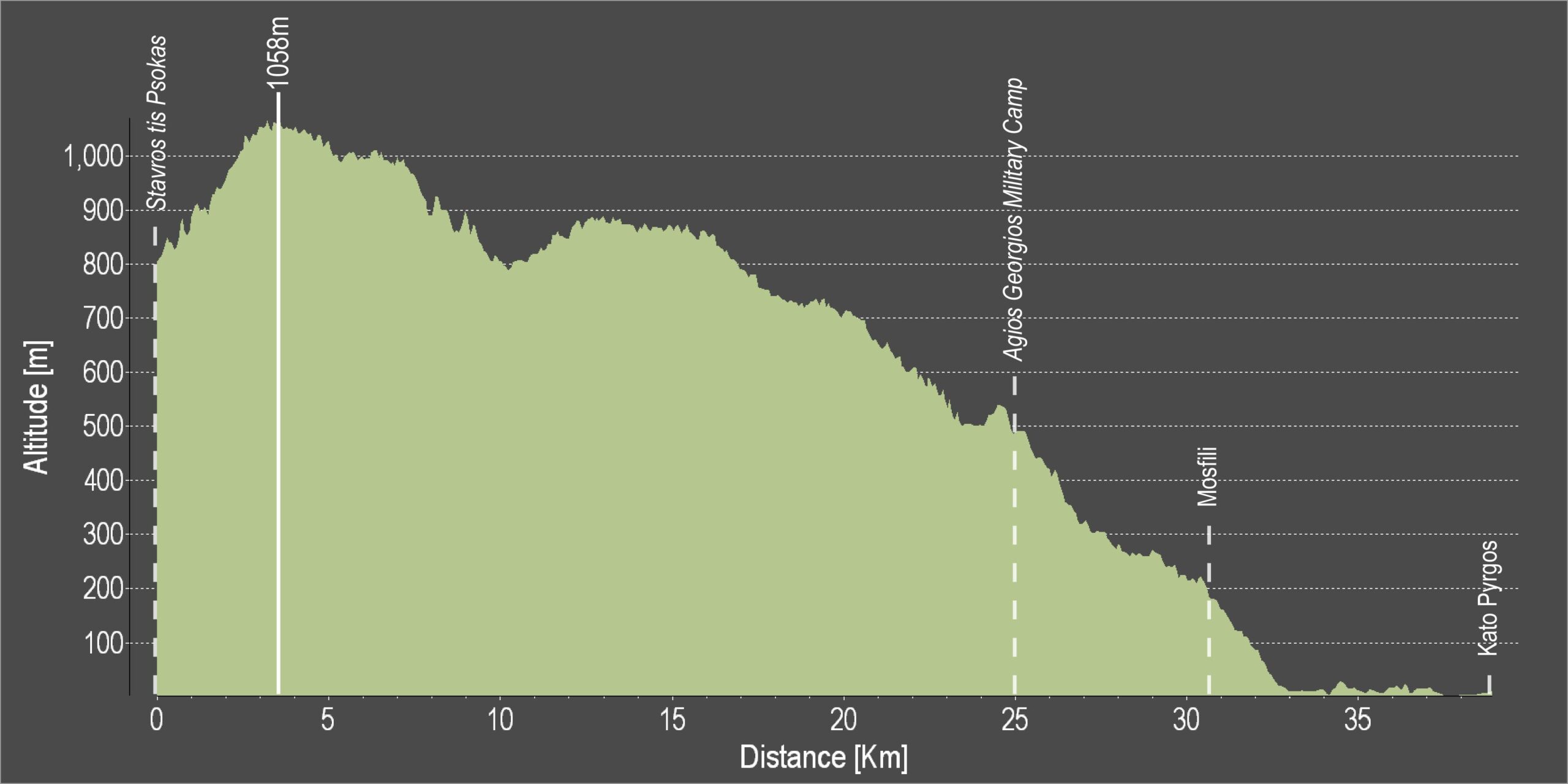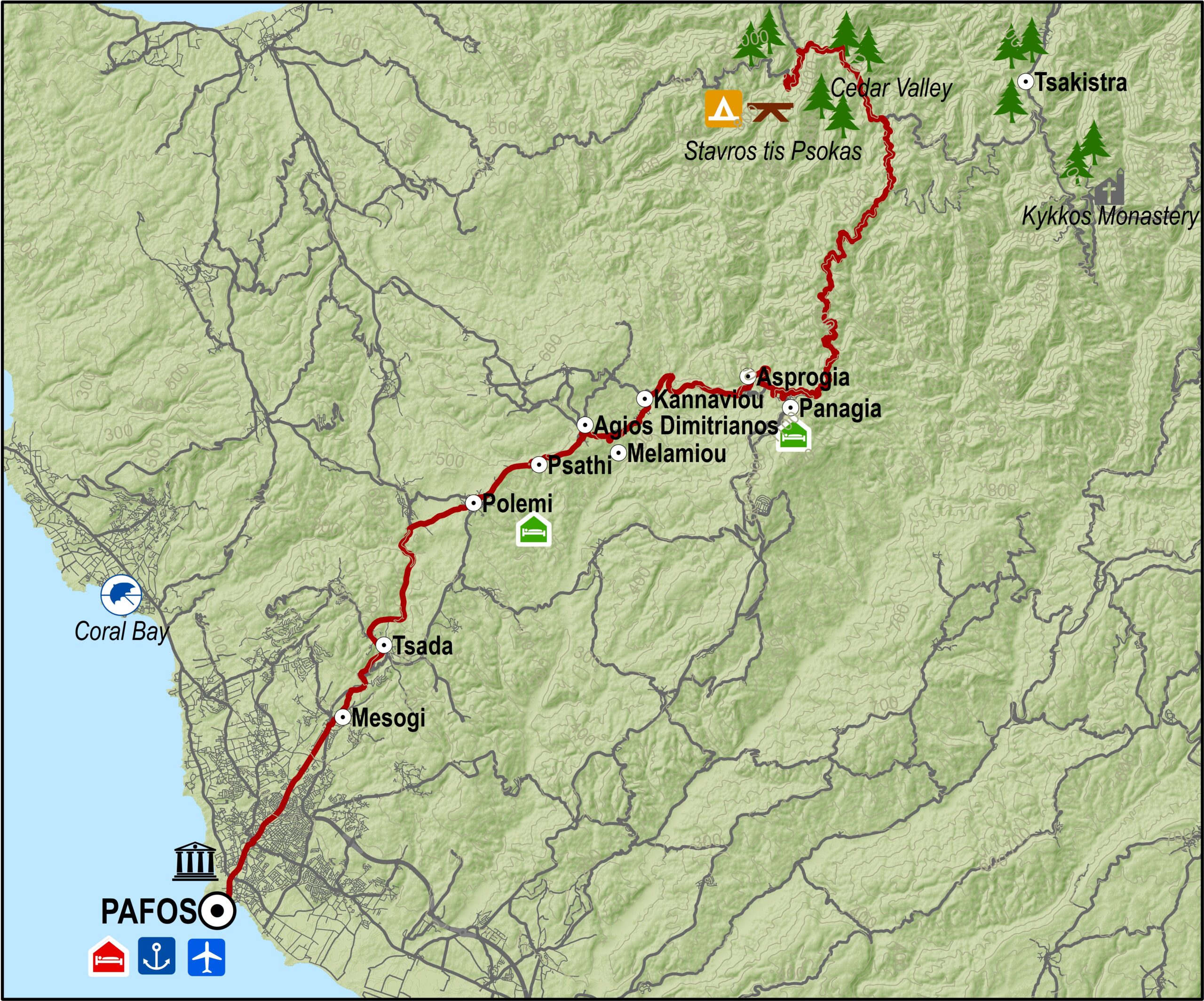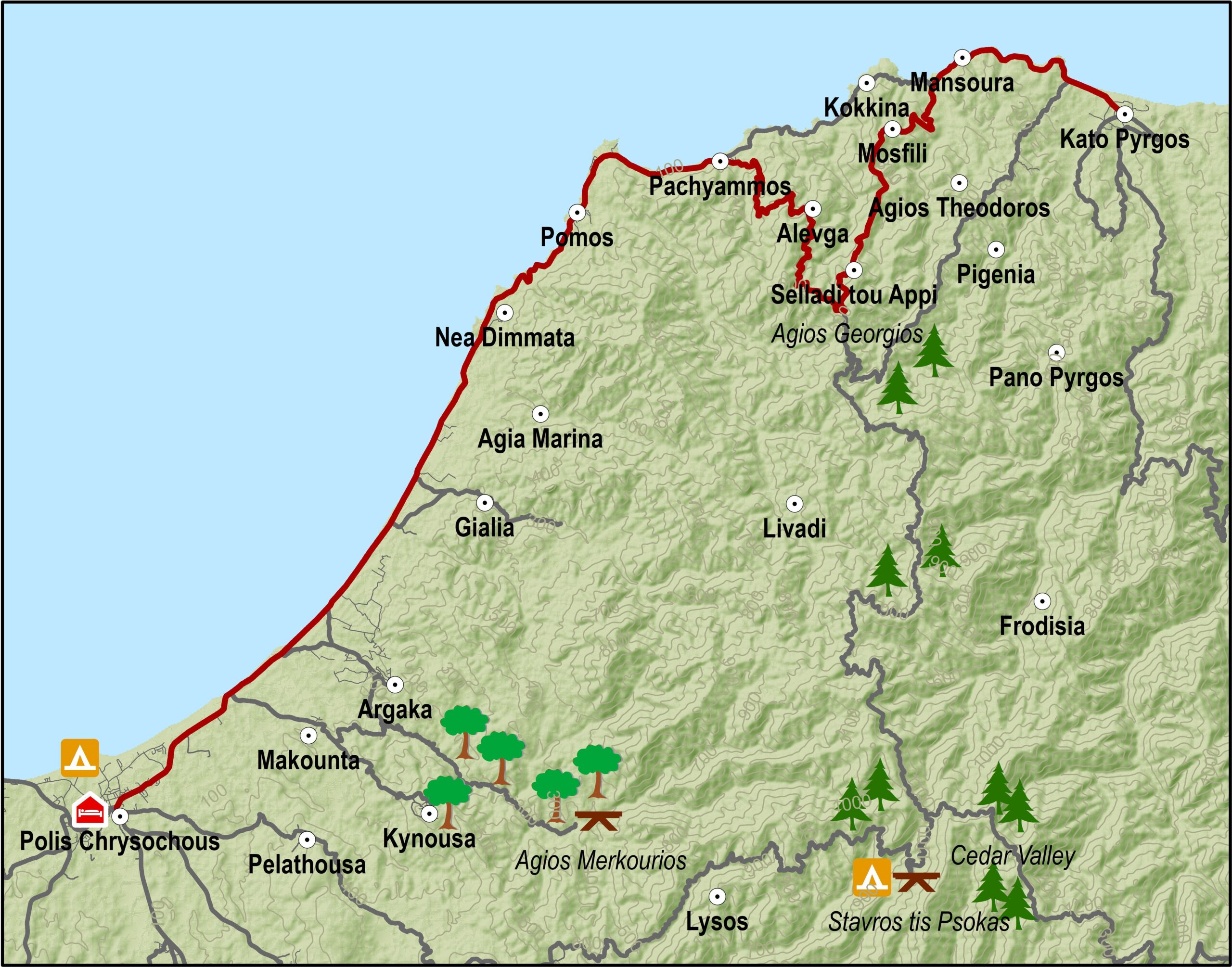
From Troodos square the route heads south along the main Lemesos – Troodos road. At Psilo Dendro it turns right for Pano Platres and then goes on to Kato Platres. Just outside the village it turns right for Mandria and Pafos.
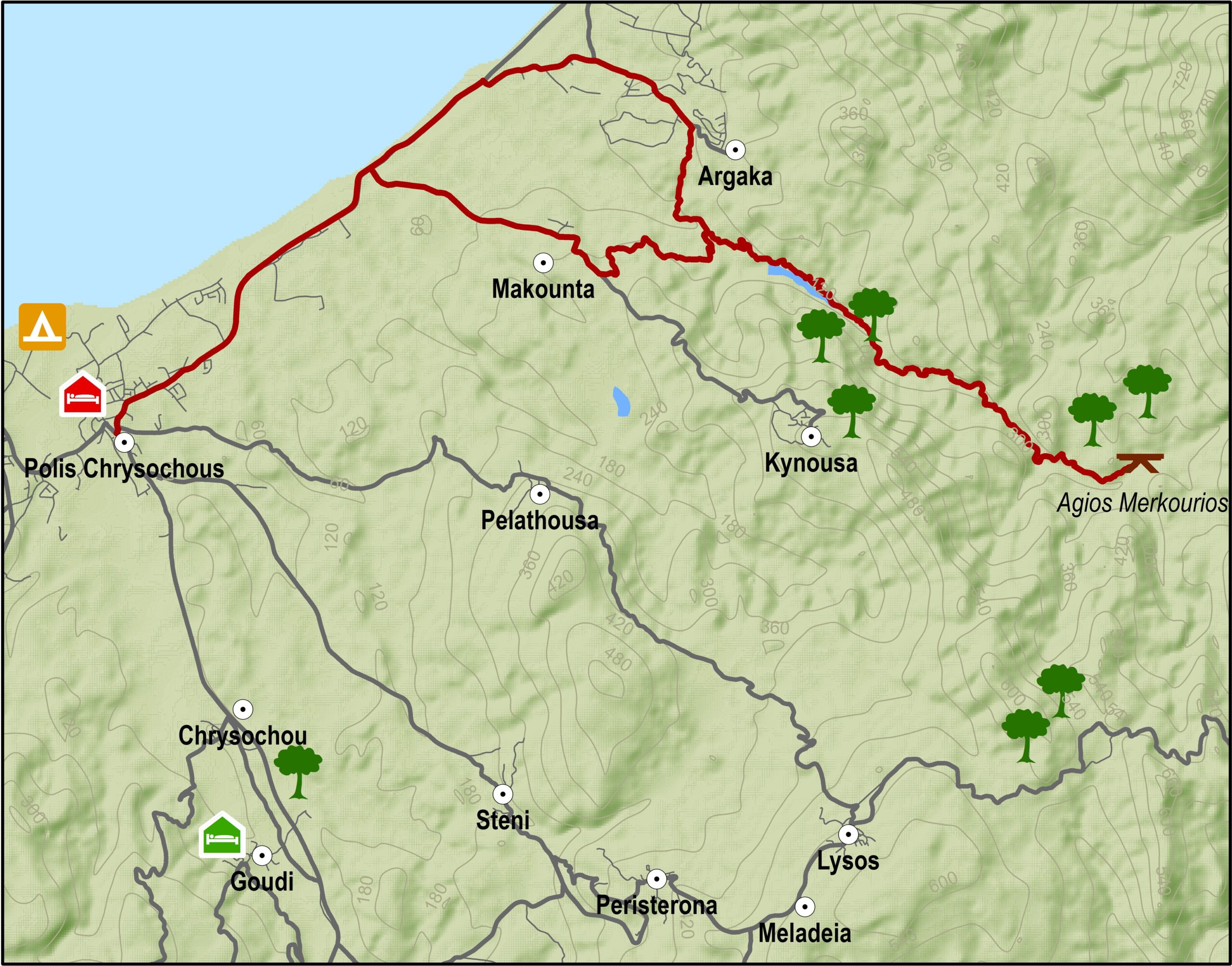
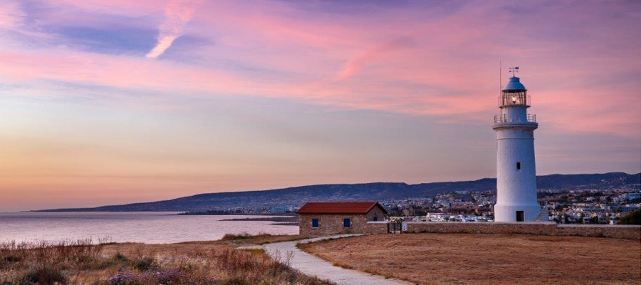
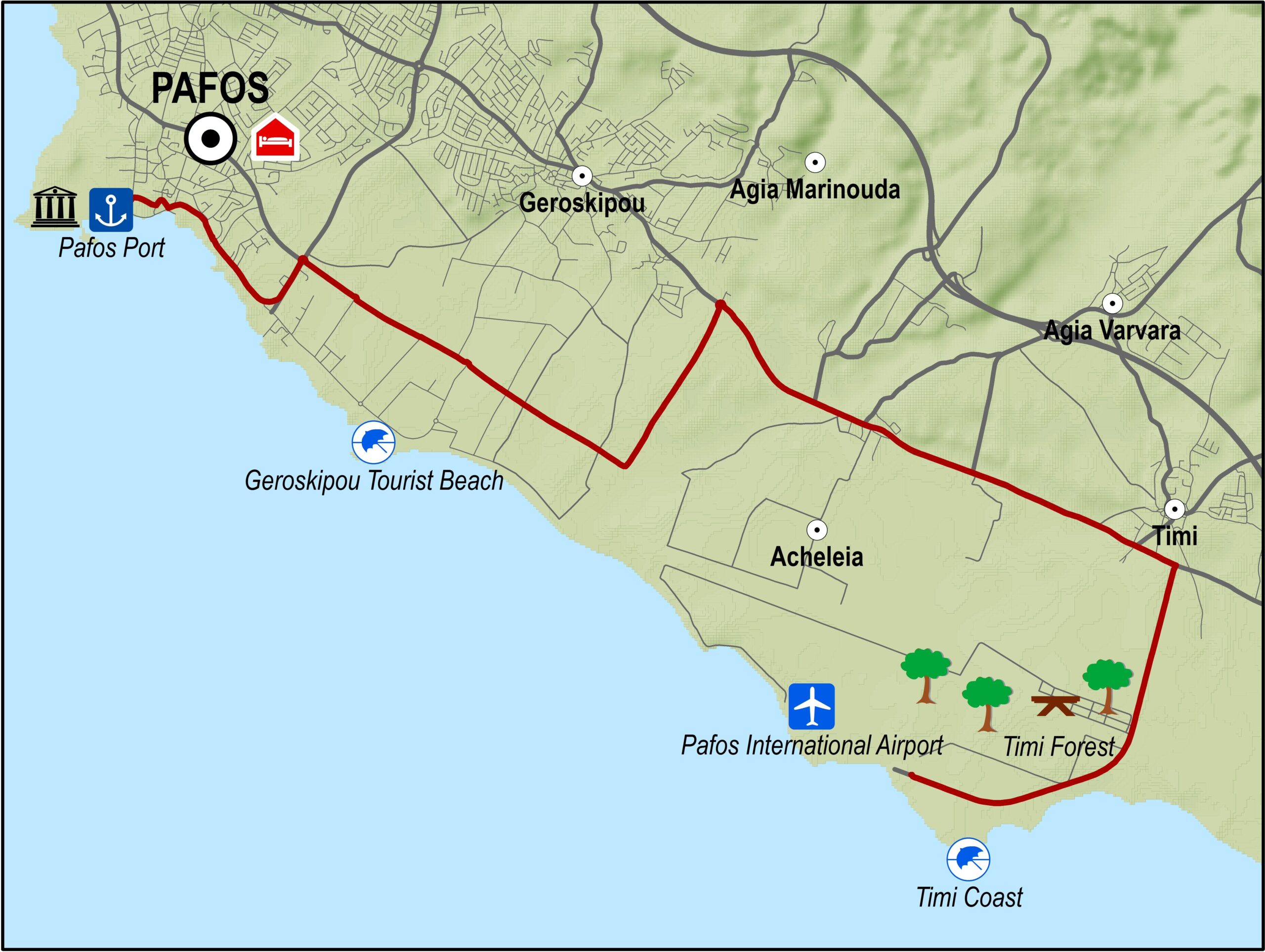
Heading southwest the route goes through Mandria and then enters the Diarizos valley going through the villages of Agios Nikolaos, Praitori, Kedares, Kidasi, Agios Georgios, Mamonia, Fasoula, Nikokleia, finally coming out at the old Lemesos-Pafos road. From there it turns west to reach Pafos via the villages of Mandria, Timi, Acheleia and Geroskipou and then finishes in Pafos Castle.
Road condition: Paved road throughout.
Route Description: This excursion links the Troodos area to Pafos via the picturesque villages in the valley of the Diarizos river.
To download the route in gpx format click here
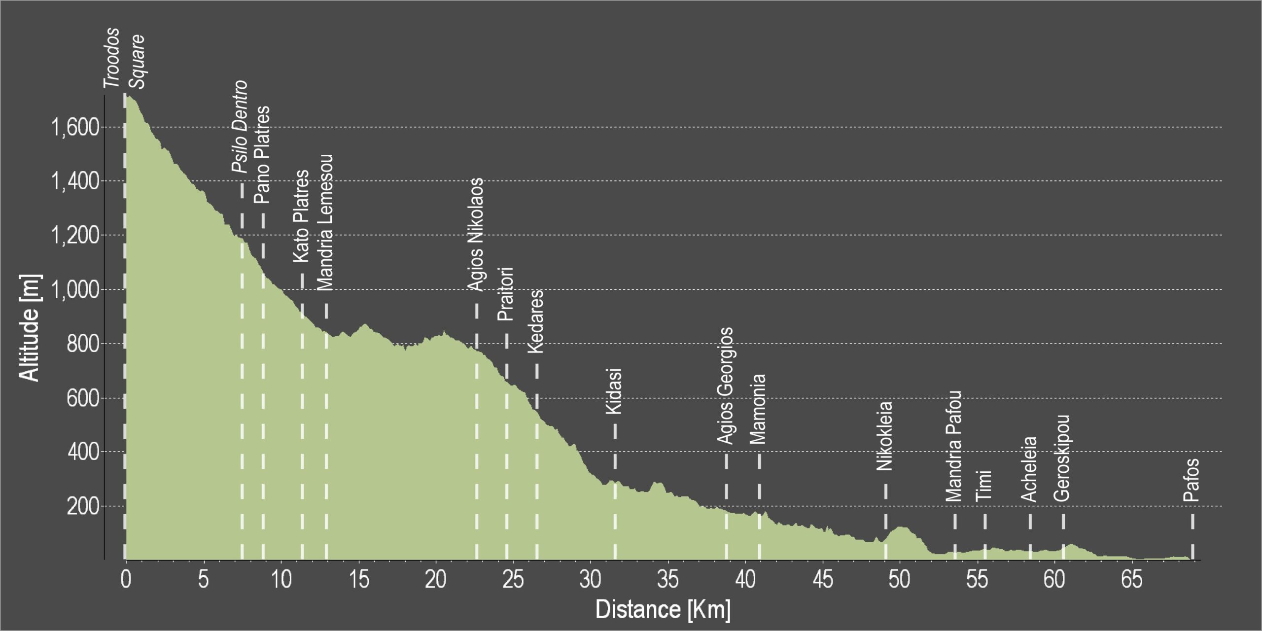
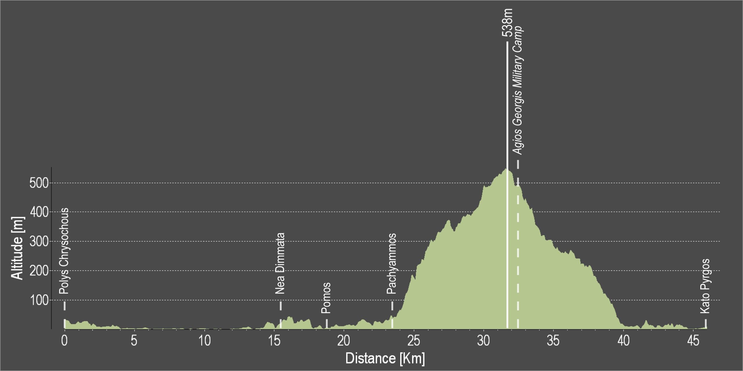
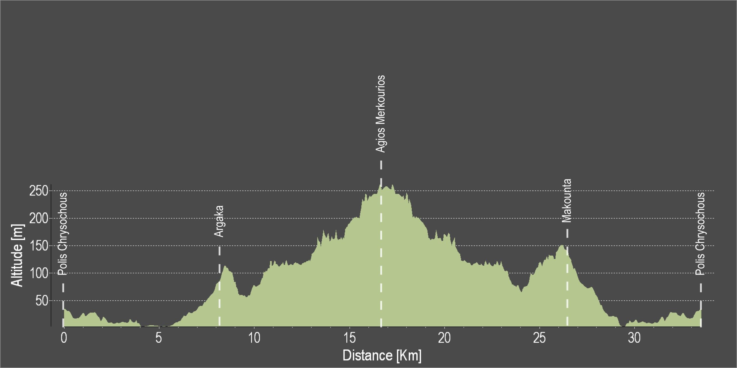
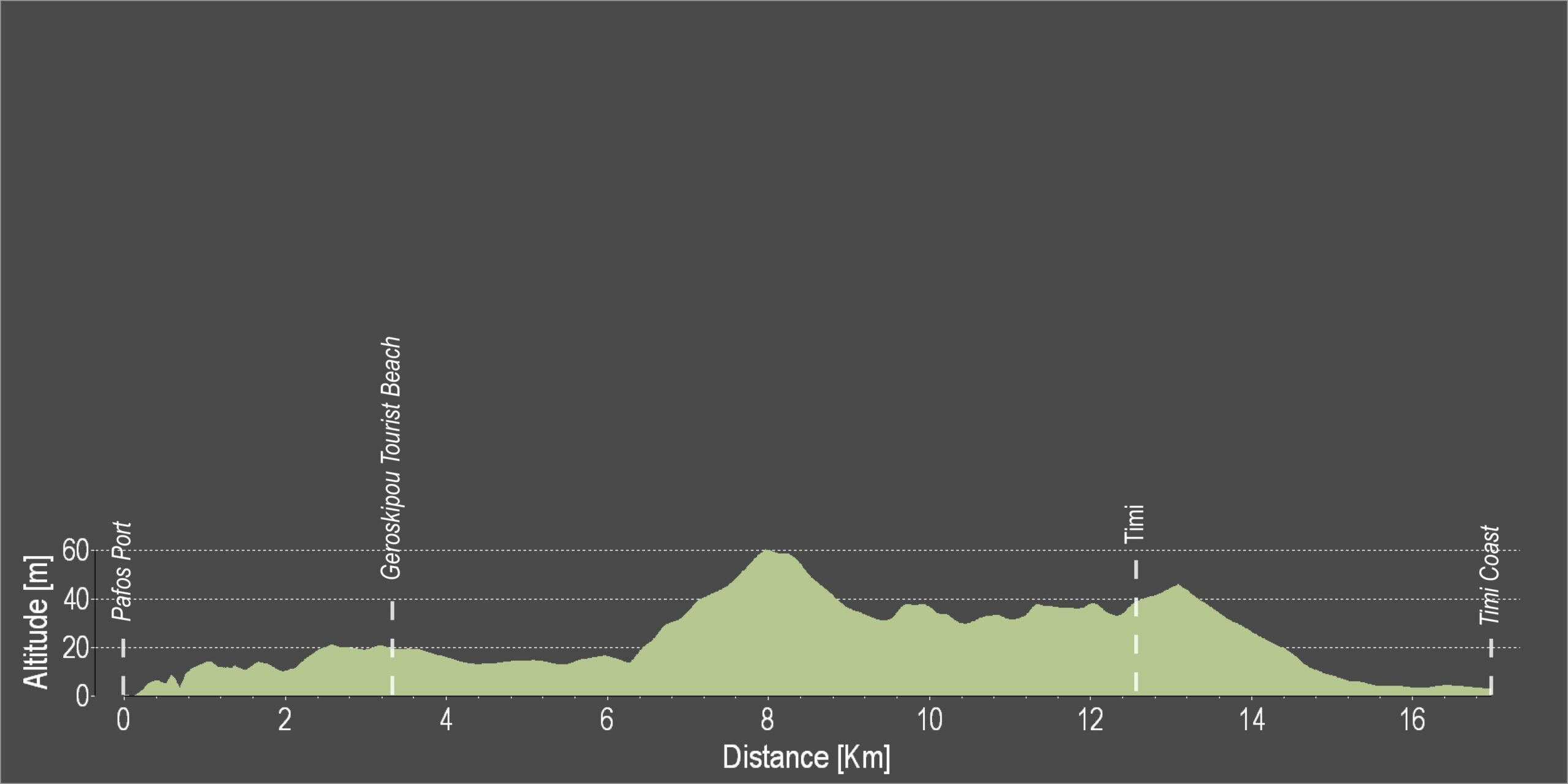
| Distance: | 68.6km |
| Elevation Gain: | 614m |
| Highest point: | 1735m |
| Lowest point: | 1m |
| Loop: | NO |
| Terrain: | Mountain |
| Road surface: | Paved |
| Section Distance (km) | Total Distance (km) | |
| Troodos square | 0,0 | 0,0 |
| Psilo Dendro | 7,6 | 7,6 |
| Pano Platres | 1,3 | 8,9 |
| Kato Platres | 2,6 | 11,5 |
| Mandria | 1,5 | 13,0 |
| Agios Nikolaos | 9,7 | 22,7 |
| Praitori | 1,9 | 24,6 |
| Kedares | 1,7 | 26,3 |
| Kidasi | 5,3 | 31,6 |
| Agios Georgios | 7,2 | 38,8 |
| Mamonia | 2,0 | 40,8 |
| Nikokleia | 8,2 | 49,0 |
| Mandria | 4,6 | 53,6 |
| Timi | 2,1 | 55,7 |
| Acheleia | 2,9 | 58,6 |
| Geroskipou | 1,8 | 60,4 |
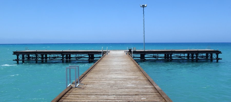
| Pafos | 8,2 | 68,6 |