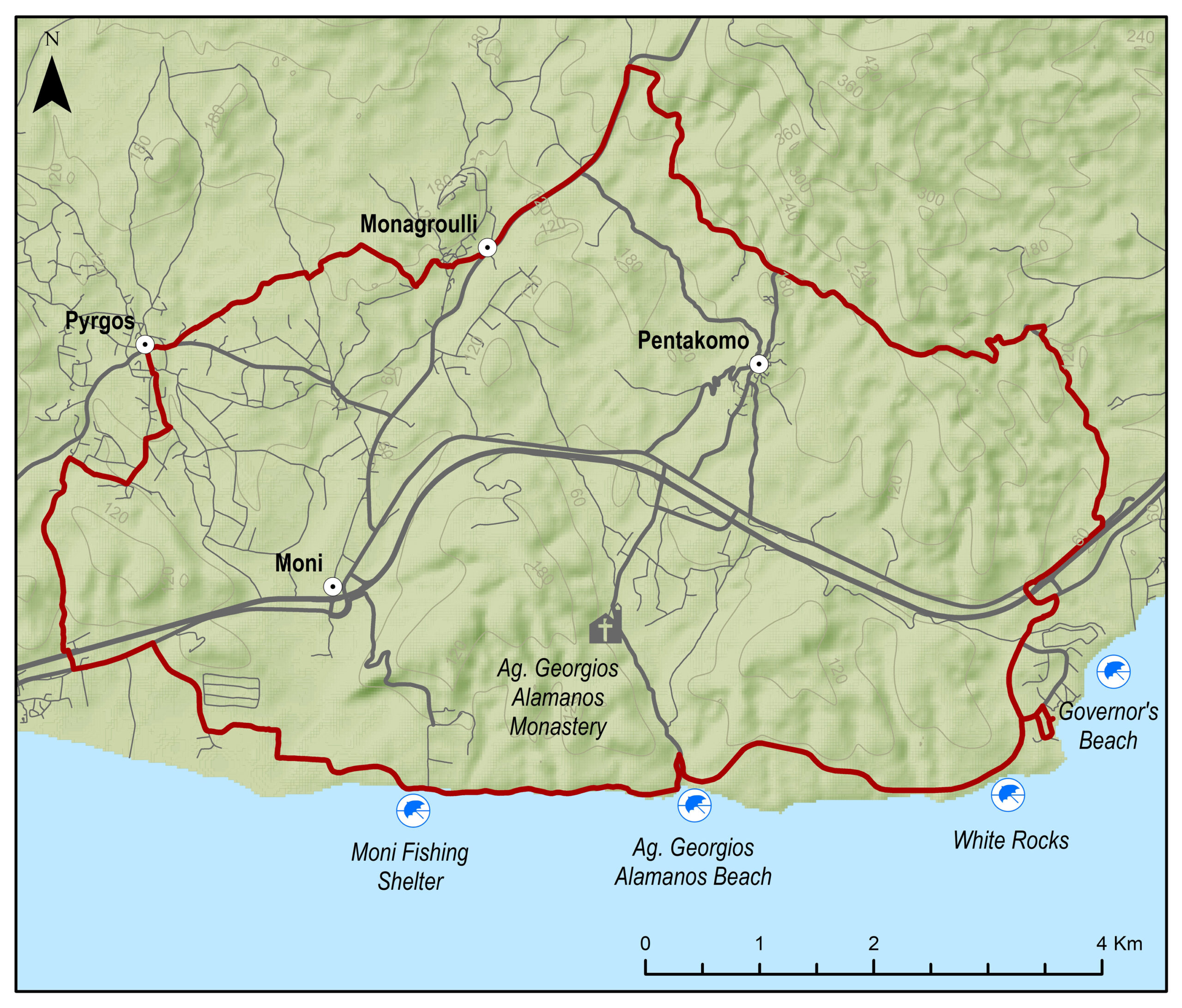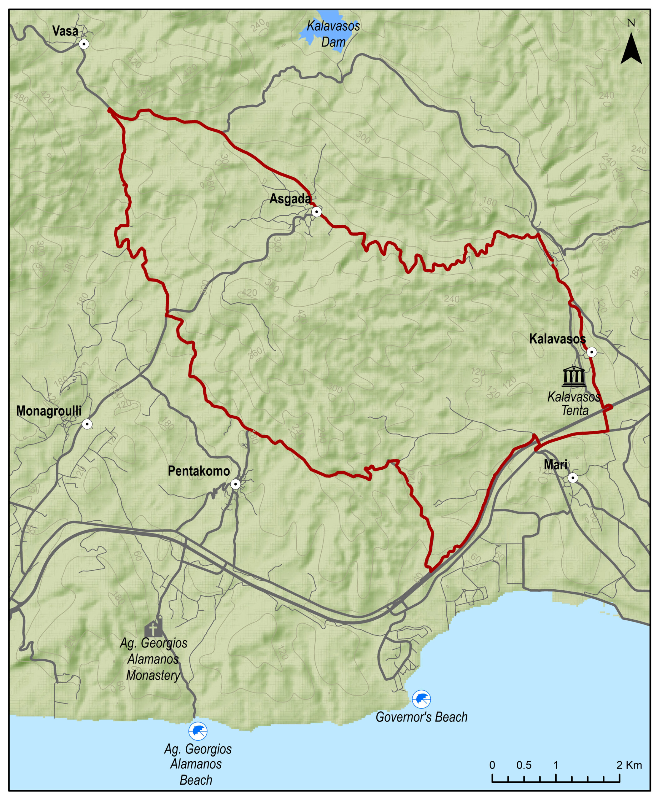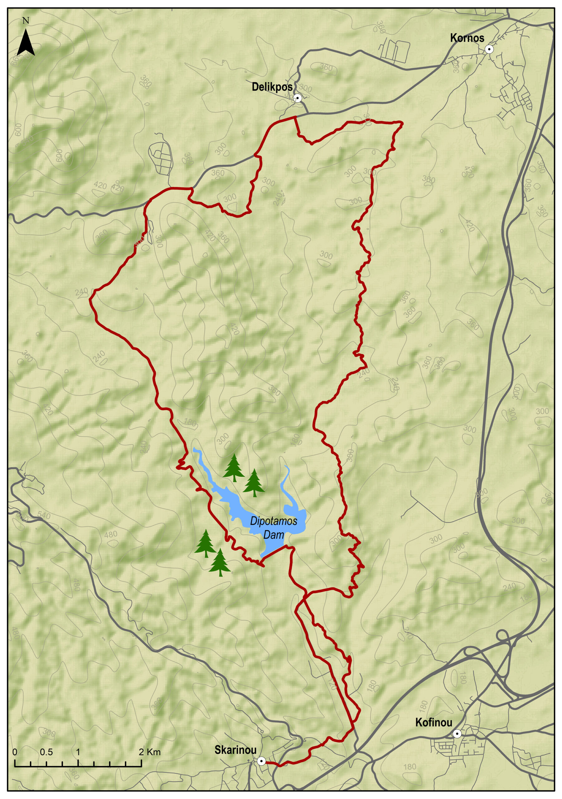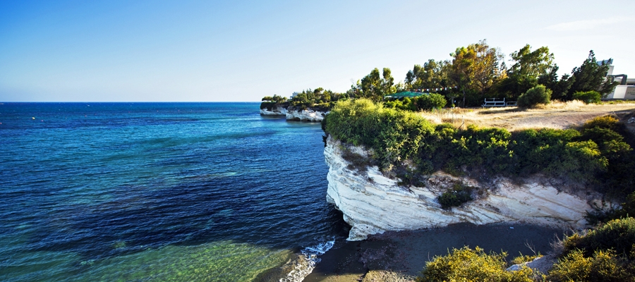
The route starts from the Governor’s Beach, heads towards the coast and reaches the Parklane Resort. From there turn right and head towards Pyrgos village. Then pass through the village of Monagroulli and climb towards Asgata on a challenging 2km ascent. Turn right onto a dirt road and head south to Governor’s Beach.
To download the route in gpx format click here
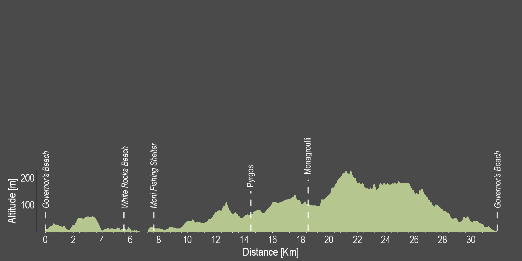
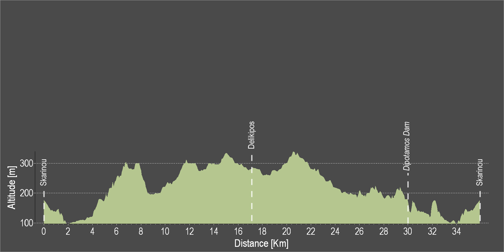
| Distance: | 31.3km |
| Elevation Gain: | 431m |
| Highest point: | 227m |
| Lowest point: | 3m |
| Loop: | YES |
| Terrain: | Flat |
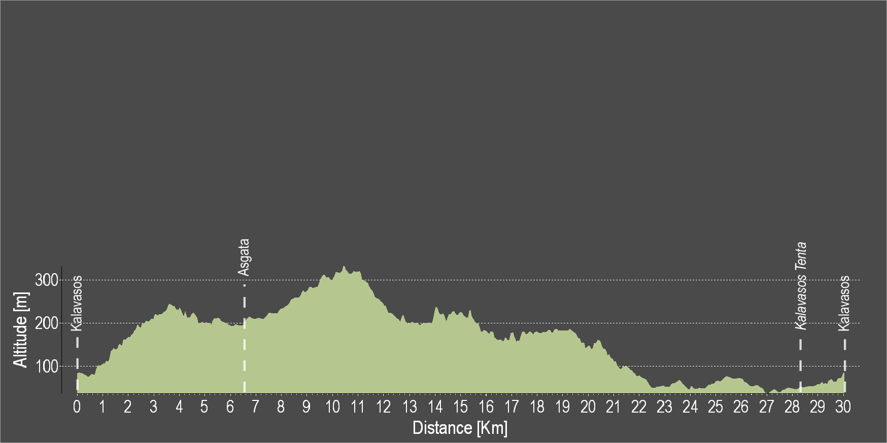
| Section Distance (km) | Total Distance (km) | |
| Governor’s Beach | 0.0 | 0.0 |
| White Rocks Beach | 5.6 | 5.6 |
| Moni Fishing Shelter | 1.9 | 7.5 |
| Pyrgos | 7.2 | 14.7 |
| Monagrouli | 6.5 | 21.2 |
| Governor’s Beach | 10.1 | 31.3 |