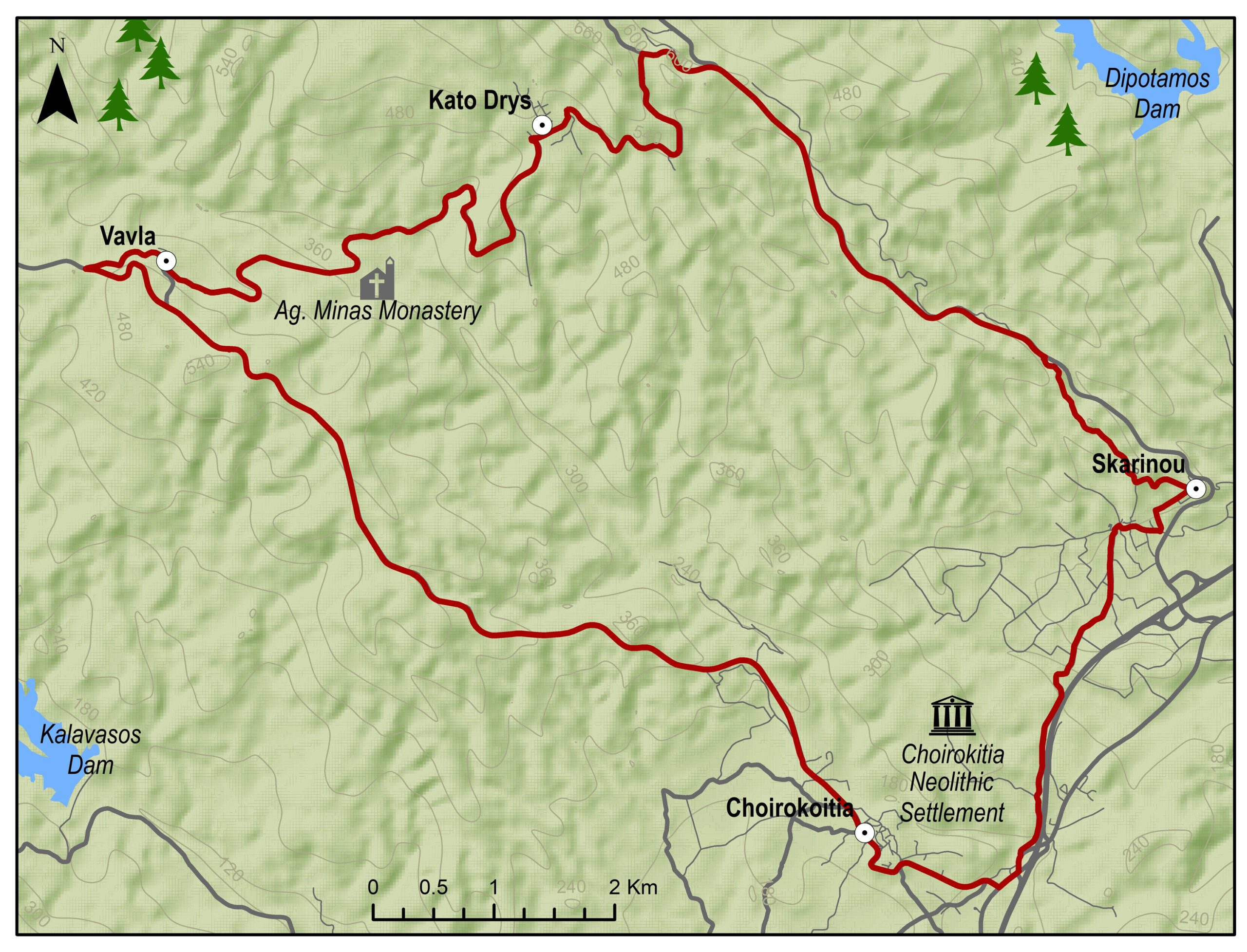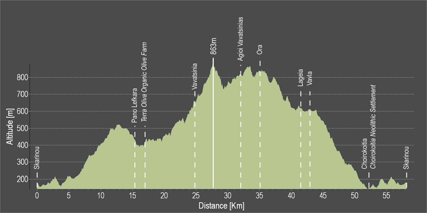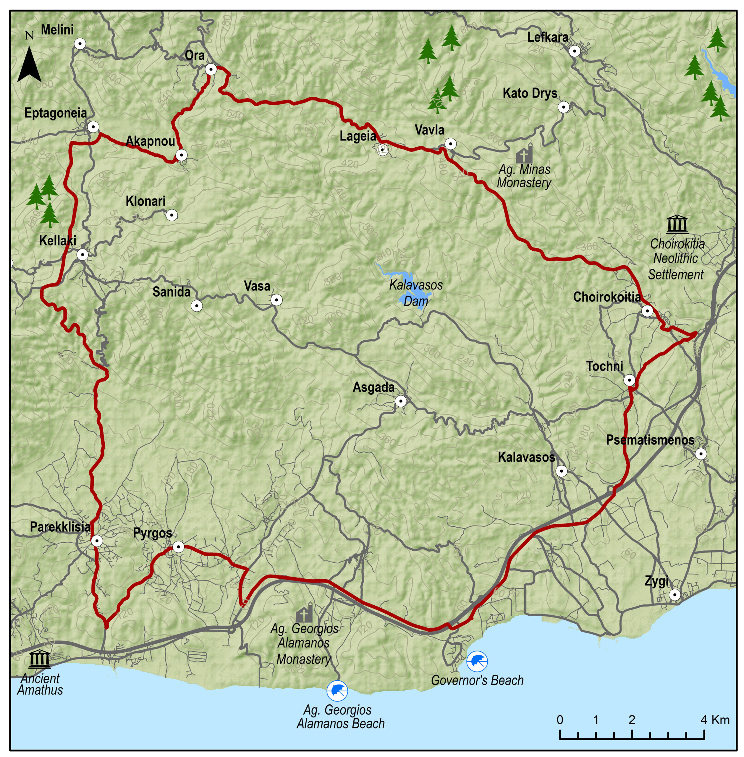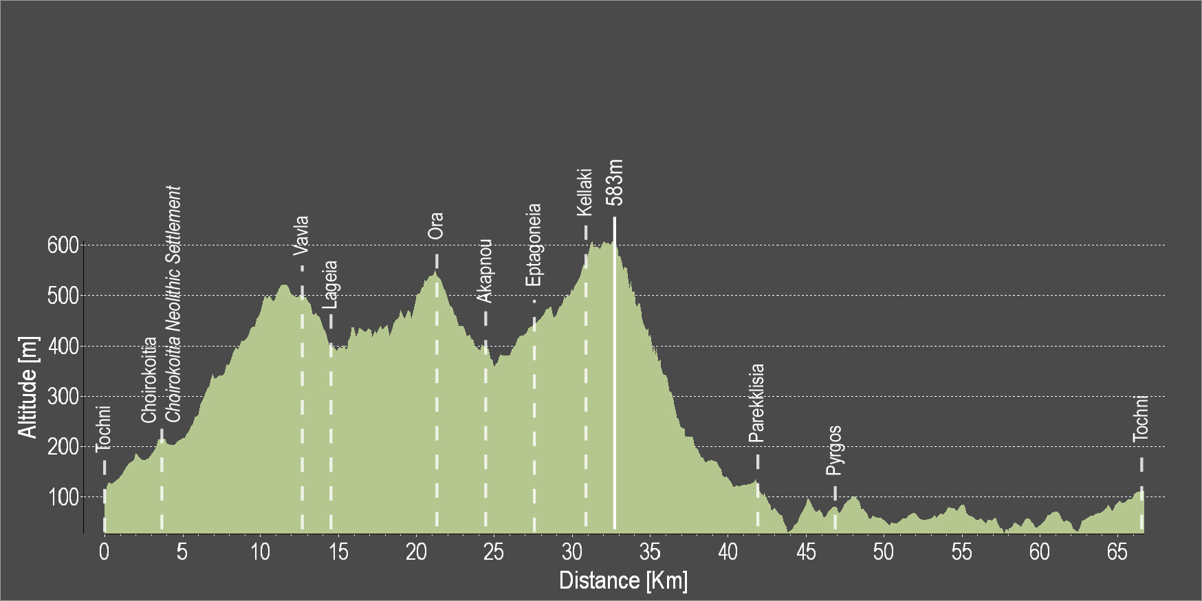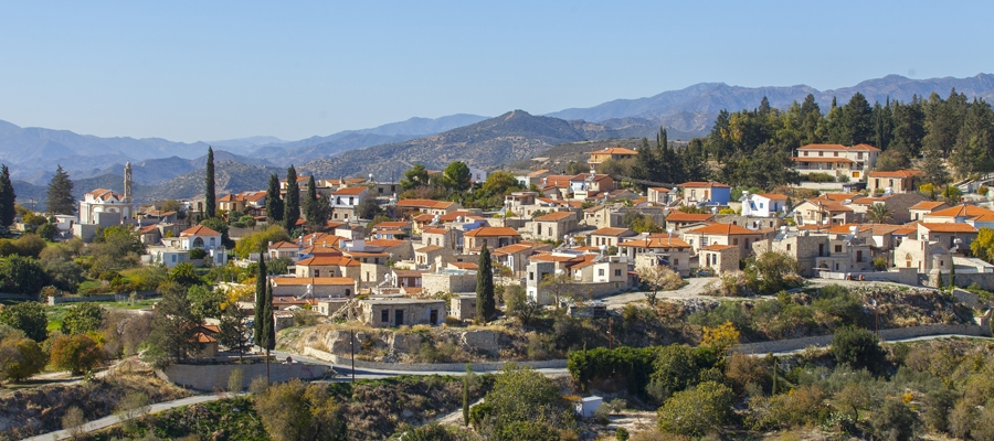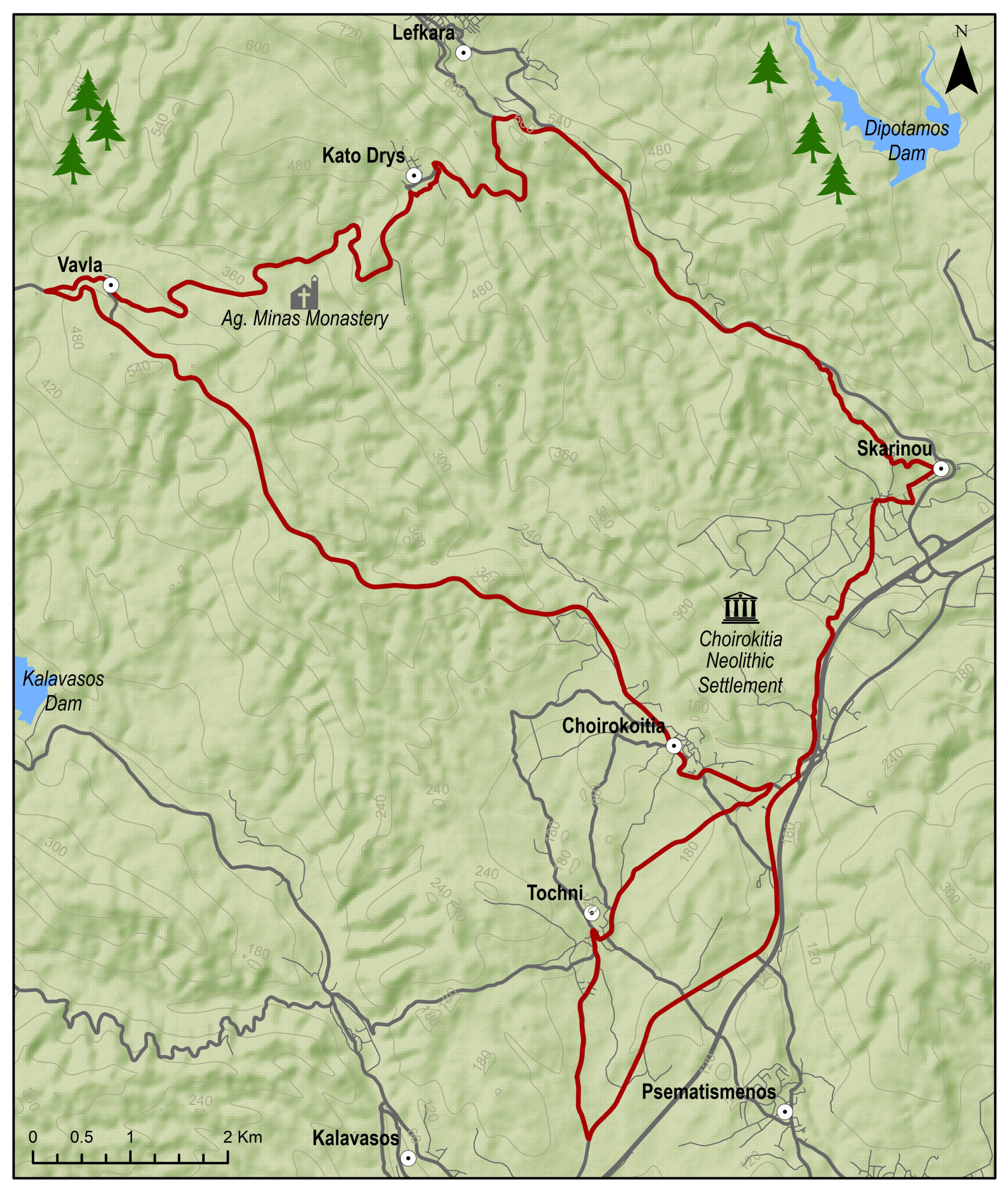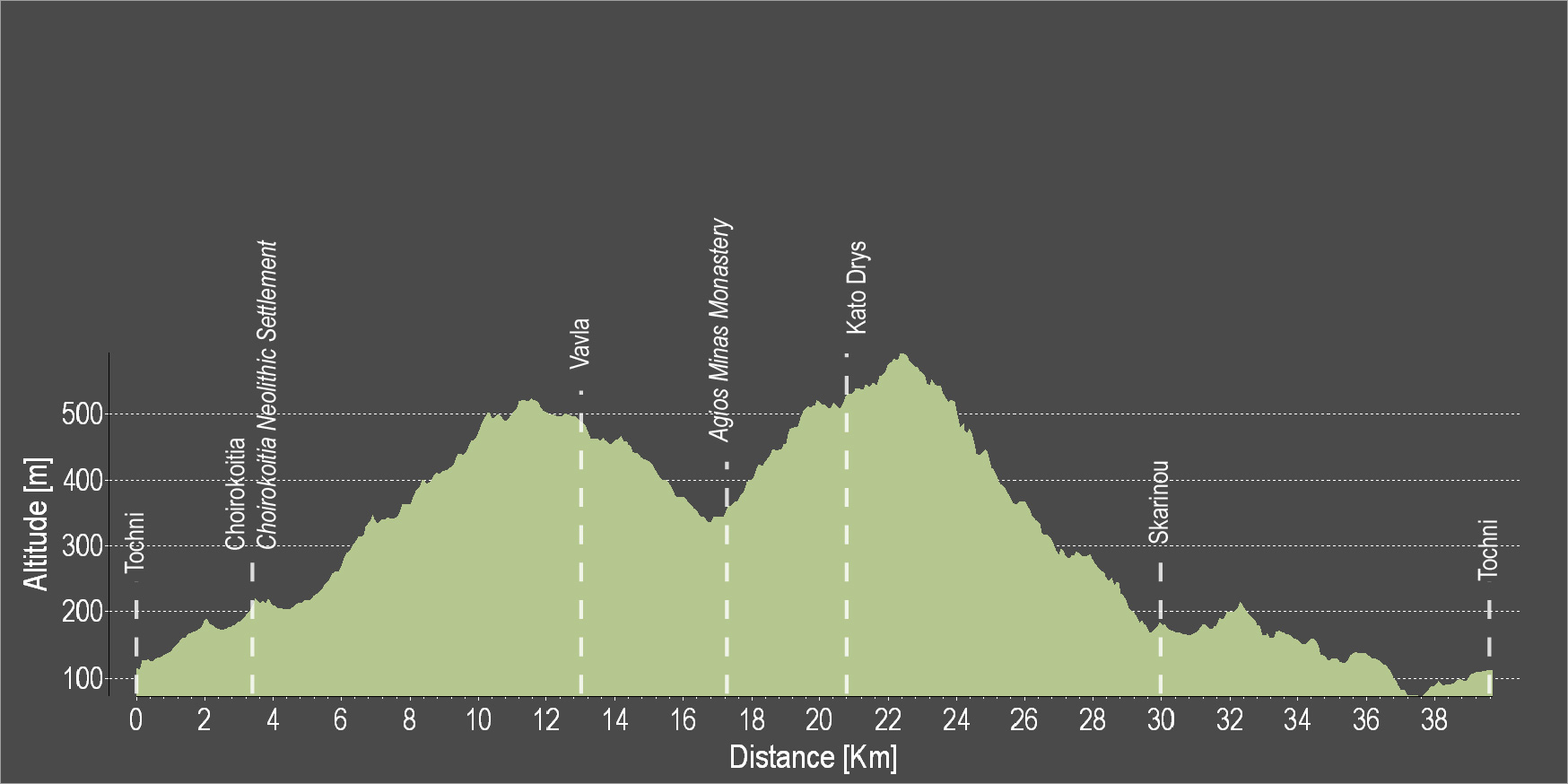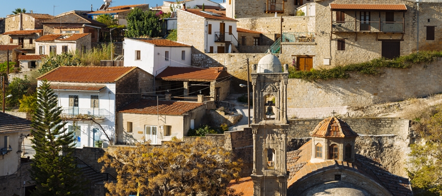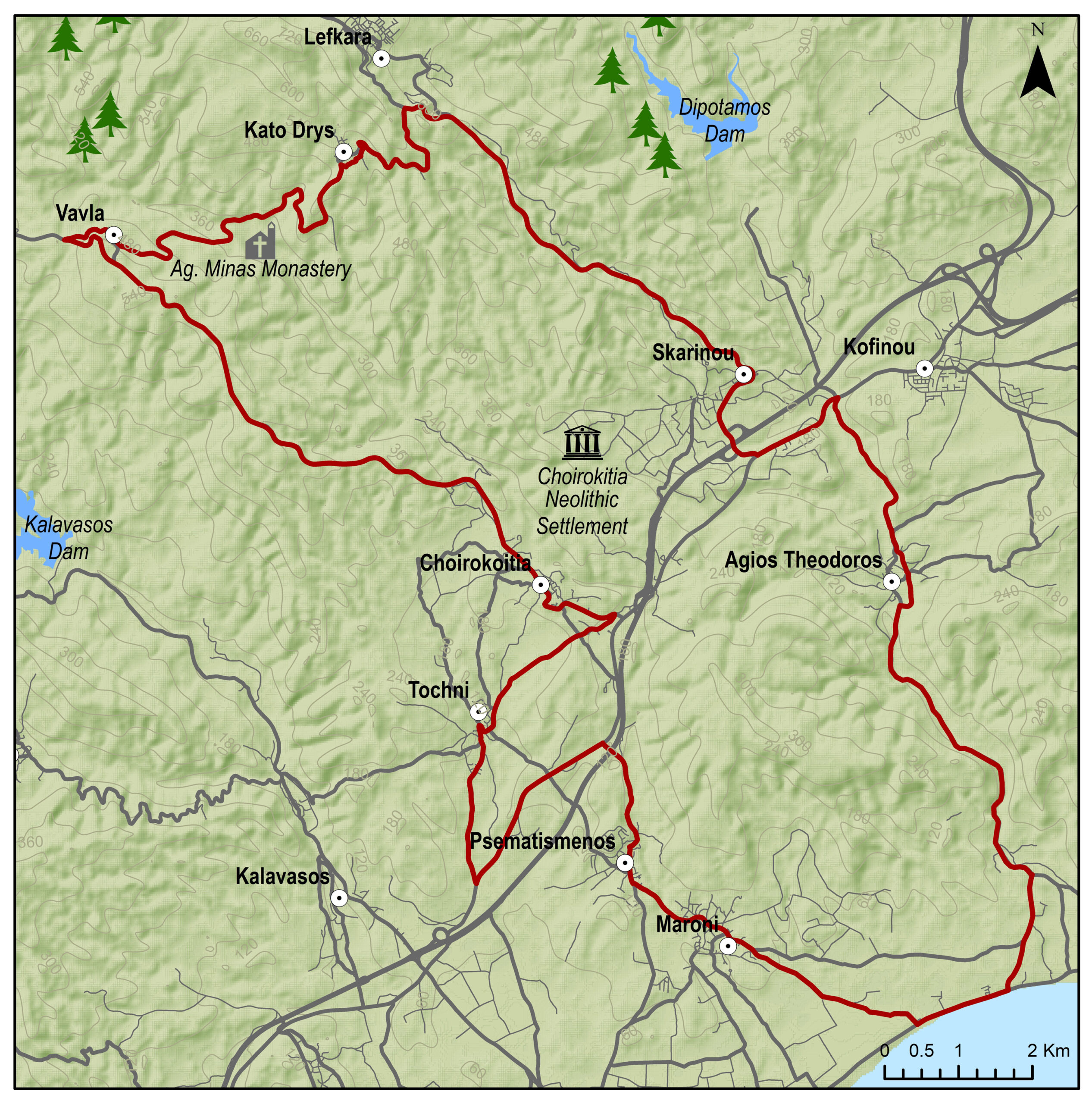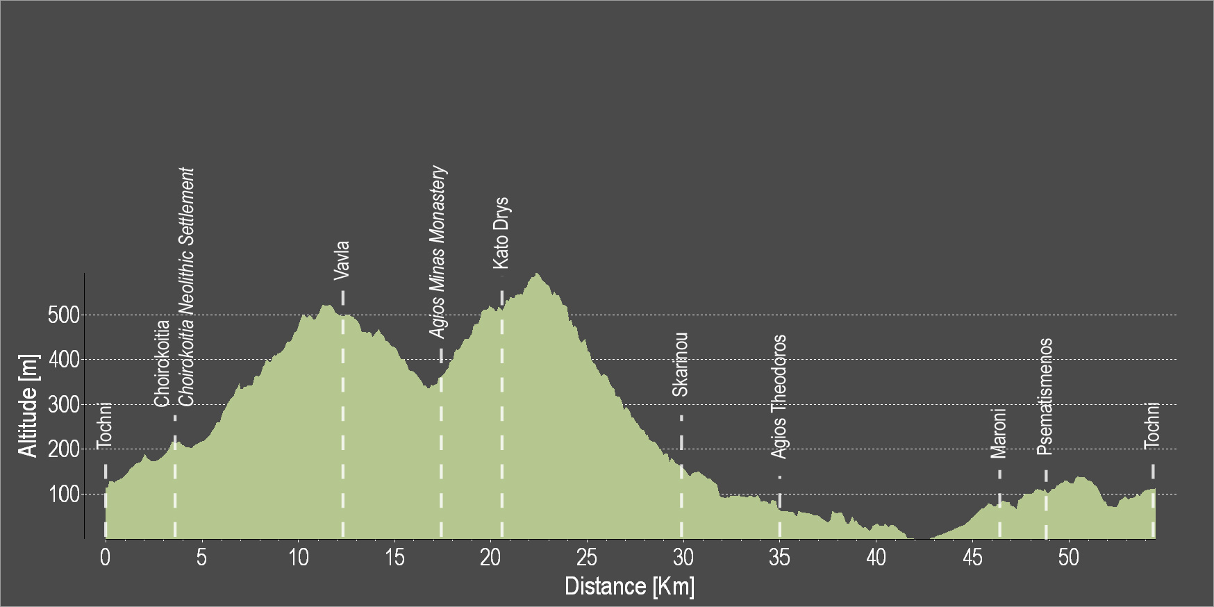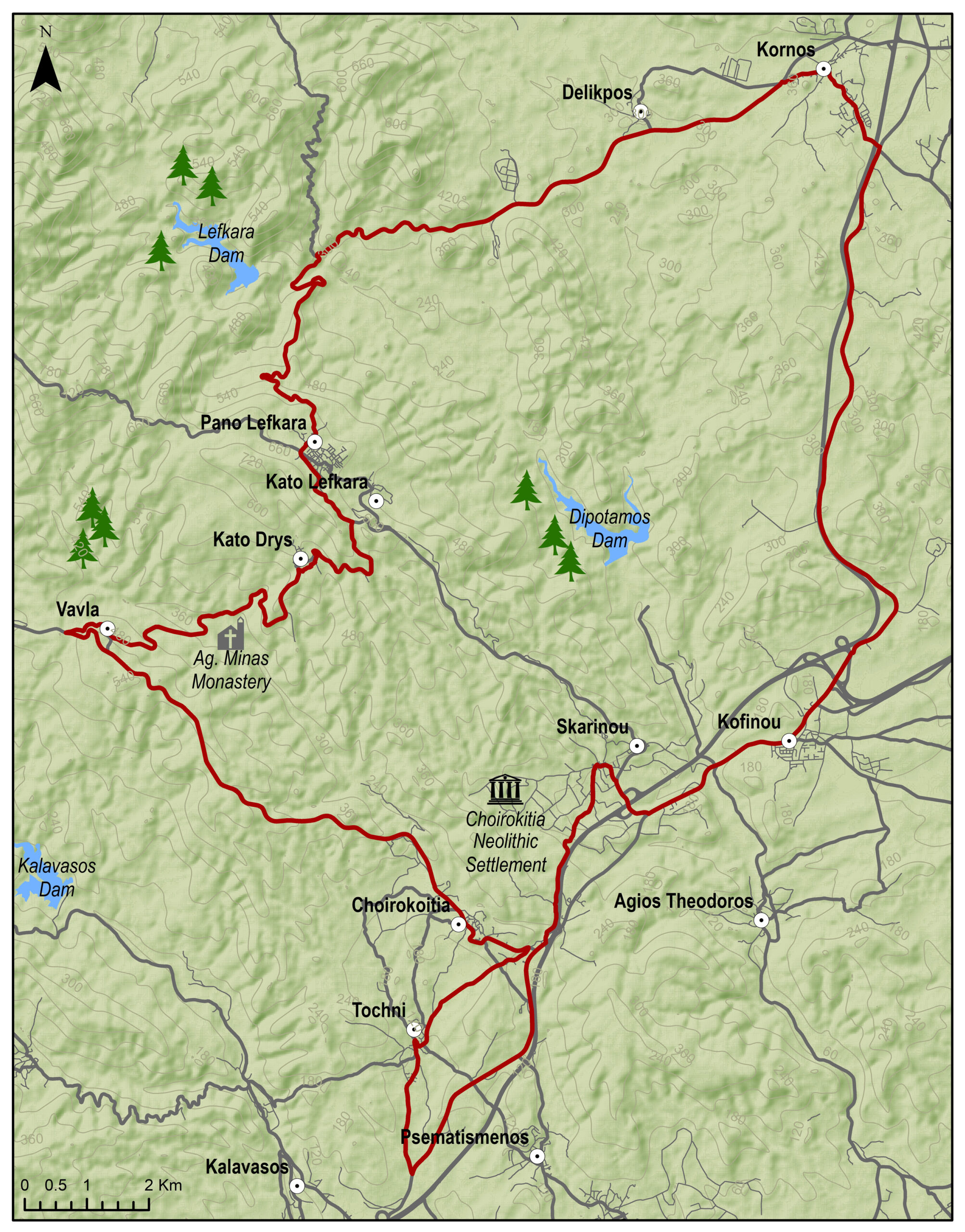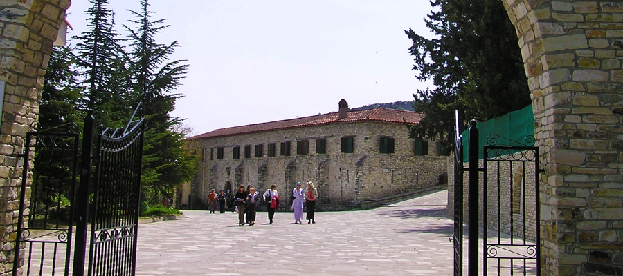
The route starts from the village of Skarinou, and continues upward to Kato Drys. Pass through a pine woodland to reach the Monastery of Agios Minas and climb towards the Vavla village. Then, a big downhill ride with beautiful views will lead to Choirokoitia and then to the starting point in Skarinou.
To download the route in gpx format click here
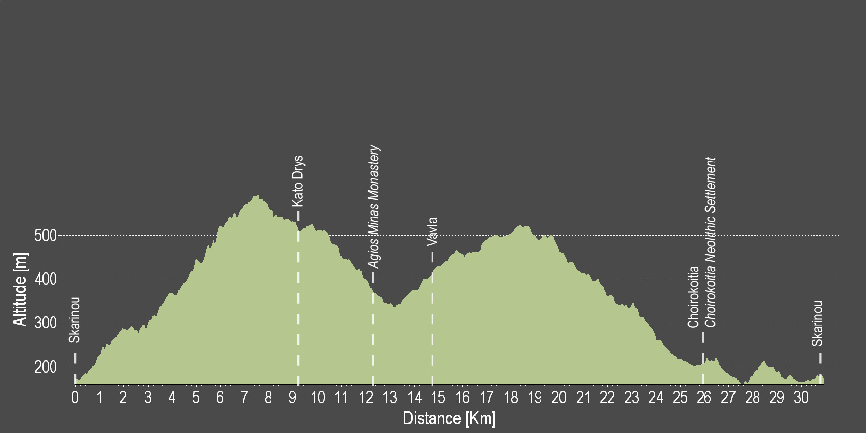
| Distance: | 30.1km |
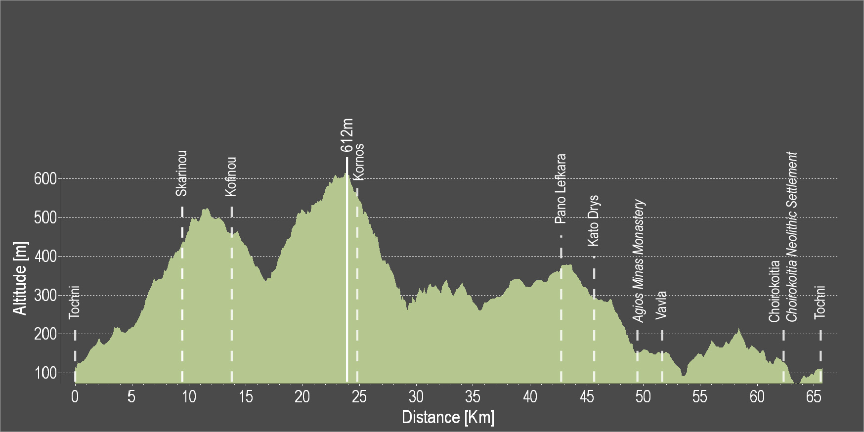
| Elevation Gain: | 743m |
| Highest point: | 593m |
| Lowest point: | 156m |
| Loop: | YES |
| Terrain: | Mixed |
| Road surface: | Paved |
| Section Distance (km) | Total Distance (km) | |
| Skarinou | 0.0 | 0.0 |
| Kato Drys | 9.1 | 9.1 |
| Agios Minas Monastery | 3.1 | 12.2 |
| Vavla | 2.5 | 14.7 |
| Choirokoitia | 11.2 | 25.9 |
| Choirokoitia Neolithic Settlement | 0.0 | 25.9 |
| Skarinou | 4.2 | 30.1 |