Takis Pattichis Museum of Industrial Pharmacy

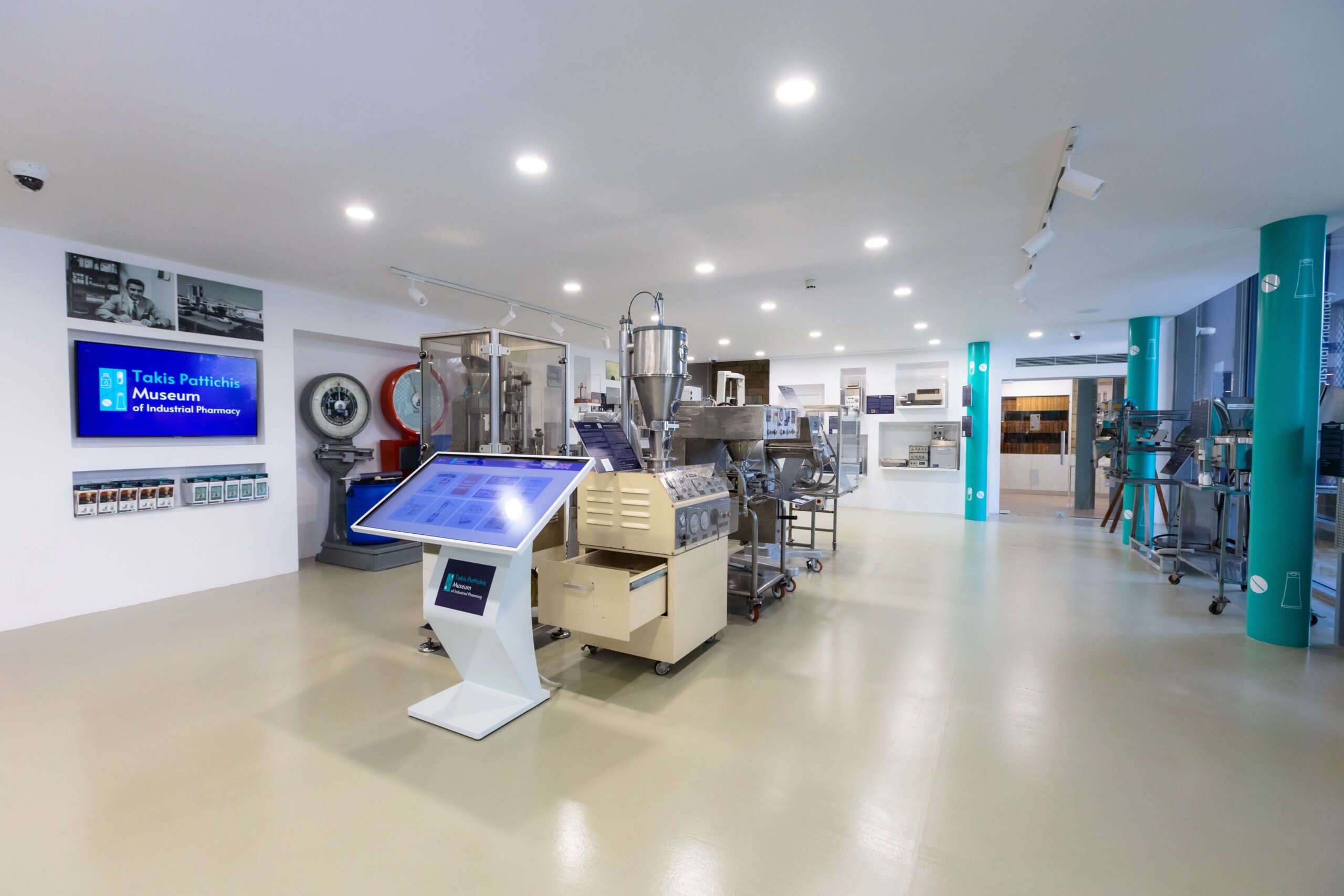
Established in 2022 by the Charalambos & Elena Pattihis Foundation, the Takis Pattichis Museum of Industrial Pharmacy is the only museum of its kind in Cyprus and probably in the whole world.
The Museum features an eclectic selection of scientific exhibits dedicated to the industrial manufacturing and analysis of medicines and it stands as a tribute to the history of the Cyprus Pharmaceutical Industry and to its founder – Mr. Takis Pattichis.
Starting out in the 1960’s, Takis Pattichis’ vision was to establish the manufacturing and exporting of pharmaceuticals right here in Cyprus, something which he achieved – making Cyprus known as a country manufacturing high-tech products in over 100 other countries.

Visitors of the Museum have the unique opportunity to:
 Learn about the machinery and processes used to manufacture pharmaceutical dosage forms like capsules, tablets, gels / creams / ointments, and syrups.
 Discover some of the relevant analytical instruments and other testing apparatuses used in monitoring and controlling the quality of medicines.
 Explore the development of weighing instruments and see how they have evolved over a period of more than 120 years.
 See original versions of historic books, manuals, guides, and reference books related to Chemistry and to Industrial Pharmacy, some of which date back to the 19th century.
 Understand the complicated manufacturing methods that pharmaceutical companies use to produce the medicines we consume.

All of the Museum’s exhibits have descriptions in both Greek and English as well as QR codes that open up web pages with information and pictures of each individual exhibit.

The Museum also includes an interactive touch screen with many interesting topics including a simple yet extensive Guide to Industrial Pharmacy, as well as posters explaining the process steps of manufacturing various pharmaceutical dosage forms.

The Museum’s main TV screen shows visitors an interesting video on the biography of Takis Pattichis and on the history of the Cyprus Pharmaceutical Industry.

Access: By public transport, by car (parking available near-by), on foot. There are no stairs in the display area of the Museum, so it is suitable for pushchairs / prams and wheelchair users.

Children: The Museum is ideally suitable for children of school age, and children below the age of 12 should be accompanied by an adult. 

Amenities: The Museum is located in the heart of the historic Limassol Old Town at the Carob Mill premises. As such, there are many cafes and restaurants in the adjacent buildings, as well as public toilets nearby in the Carob Mill main building itself.

Website:www.pattichismuseum.cy
 

Region: Lemesos (Limassol)
Address: Vasilissis Street, Limassol 3042 (on the pedestrian street behind the Limassol Castle) 
GPS coordinates: Lat: 34.66782 Lon: 33.03096
Contact No: For any questions, private event inquiries or additional information required, please contact the Museum directly at [email protected]
Operating Hours: Tuesday – Saturday: 09:30 – 18:00
Sunday: 9:30 – 17:30
Operating Period: All year round.
Closed on Monday and on public holidays
Entrance Fee: Free


Kavos (Circular) – Ammochostos (Famagusta) District, Cape Gkreko National Forest Park Nature Trail

GPS coordinates of the starting point: Lat: 34.963785 Lon: 34.067116
GPS coordinates of the ending point: Lat: 34.963785 Lon: 34.067116
Altitude of the starting point: 64m
Altitude of the highest peak: 70m
Altitude of the end peak: 64m
Starting point: Old quarry.
Length: 1.2km
Estimated duration: 45 minutes
Difficulty rate: 1


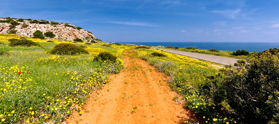
Points of interest: The trail is located at Cape Gkreko within the boundaries of the National Forest Park, which is a Natura 2000 area. The trail first passes through a pine tree landscape and then through low, shrubby vegetation. All along the trail, there are many points of exceptional view, the most impressive of which is at the hilltop, from where you can enjoy an unobstructed nature view on all the points of the horizon: to the east you can see the tip of the cape (Pidalion) where the lighthouse and the facilities of a French radio station (SOMERA) are located: to the west there is the tourist resort of Agia Napa; to the north the main part of the National Forest Park, and to the south the pristine waters and rugged coastline. The impressive cliffs on the south side of the hill are ideal for rock climbing enthusiasts. The Kavos Trail connects to the Sea Caves – Agioi Anargyroi Trail.

Flora: While hiking you can study the indigenous plants: Phoenician juniper (Juniperus phoenicea), lentisk (Pistacia lentiscus), wild thyme (Thymus capitatus), prickly burnet (Sarcopoterium spinosum), and the endemic Cyprus bosea (Bosea cypria).


Trooditissa – Foini (Linear) – Lemesos (Limassol) District, Troodos Forest Nature Trail

GPS coordinates of the starting point: Lat: 34.912177 Lon: 32.837174
GPS coordinates of the ending point: Lat: 34.896838 Lon: 32.837357
Altitude of the starting point: 1,330m
Altitude of the highest peak: 1,330m
Altitude of the end peak: 944m
Starting point: The Platres – Prodromos main road.
Length: 4.5km
Estimated duration: 2 hours
Difficulty rate: 1


Points of interest: The route follows a forest road that connects Trooditissa Monastery with the beautiful village of Foini, with exceptional views towards the village along the way. The trail crosses the Trooditissa River and leads you to the route’s main attraction, the Chantara waterfall (eight metres high), then passes by vertical cliffs before the journey ends on the Foini – Agios Dimitrios road, right outside Foini. The entire trail is located within Troodos National Forest Park, which is a Natura 2000 area.

Flora: While hiking you can study (amongst other plants) the indigenous plants: Calabrian pine (Pinus brutia), strawberry tree (Arbutus adrachnae), and the endemic golden oak (Quercus alnifolia).


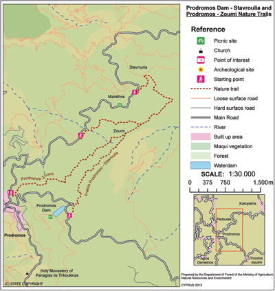
Prodromos – Zoumi (Linear) ­- Lemesos (Limassol) / Lefkosia (Nicosia) Districts, Troodos Forest Nature Trail

GPS coordinates of the starting point: Lat: 34.952183 Lon: 32.833700
GPS coordinates of the ending point: Lat: 34.963214 Lon: 32.849812
Altitude of the starting point: 1,499m
Altitude of the highest peak: 1,475m
Altitude of the end peak: 1,314m
Starting point: The children’s play area in Prodromos.
Length: 3km
Estimated duration: 1 – 1.5 hour
Difficulty rate: 2


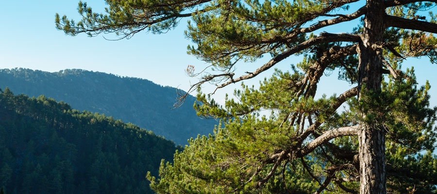
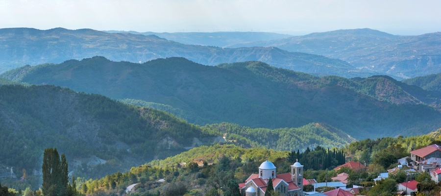
Points of interest: The trail passes through rows of Black Pine trees (Pinus nigra subsp. pallasiana). At various points along the trail there are panoramic views of the Marathasa valley, Morfou Bay, Kykkos Monastery, Tripylos and Vouni Panagias. At Zoumi, the path joins with the Fragma Prodromou­ – Stavroulia nature trail. The path can also be circular if the walker chooses the Prodromos – Troodos road, with an extra distance of 2.7 kilometres. The trail is located within the Troodos National Forest Park.

Flora: While hiking you can study the endemic plants: Manouthkia (Pterocephalus multiflorus subsp. multiflorus – an evergreen small shrub with pale pink flowers), Troodos sage (Salvia willeana), Cyprus Germander (Teucrium cyprium subsp. cyprium).

Fauna: The main species of fauna found in the area are:

Mammals: Fox, hare, hedgehog.

Birds: Bonelli’s eagle, Eurasian jay, Wood pigeon, partridge, Cyprus warbler (endemic), Cyprus wheatear (endemic).

Reptiles: Cyprus viper, Montpellier snake.

Fragma (Dam) Prodromou – Stavroulia (Linear) – Lemesos (Limassol) / Lefkosia (Nicosia) Districts, Troodos Forest Nature Trail

GPS coordinates of the starting point: Lat: 34.947845 Lon: 32.847256
GPS coordinates of the ending point: Lat: 34.971462 Lon: 32.862341
Altitude of the starting point: 1,592m
Altitude of the highest peak: 1,592m
Altitude of the end peak: 1,262m
Starting point: Troodos Square ­ Prodromos main road, a little bit above the Prodromos dam, at an 8km distance from Troodos Square and a 3km distance from Prodromos. There are two options for the finishing point, both on the Prodromos – Agios Nikolaos road.
Length: (a) 4.5km / (b) 5.5km
Estimated duration: 1.5 – 2 hours
Difficulty rate: 3 (very sudden downhill)


Points of interest: The trail offers a wonderful view of Morfou Bay and the Troodos mountain range, and a panoramic view of the abandoned chrome mining tunnels. The trail passes through an incredibly dense black pine forest and is located within the Troodos National Forest Park. On the west side of the dam there is a picnic site ‘Fragma Prodromou’ and the ‘Marathos’ picnic site is found on the Agios Nikolaos ­ – Prodromos road.

Flora: While hiking you can study the endemic plants: Troodos catmint (Nepeta troodi), Cyprus germander (Teucrium cyprium subsp. cyprium), Troodos Alison (Alyssum troodi).

Fauna: The main species of fauna found in the area are:

Mammals: Fox, hare, hedgehog.

Birds: Bonelli’s eagle, Eurasian jay, Wood pigeon, partridge, Cyprus warbler  (Εndemic), Cyprus wheatear (Εndemic).

Reptiles: Cyprus viper, Cyprus snake (endemic).

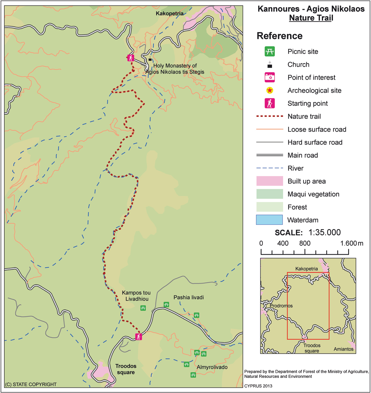
Kannoures – Agios Nikolaos tis Stegis (Linear) – Lemesos (Limassol) / Lefkosia (Nicosia) Districts, Troodos Forest Nature Trail


GPS coordinates of the starting point: Lat: 34.931739 Lon: 32.887044
GPS coordinates of the ending point: Lat: 34.977789 Lon: 32.885425
Altitude of the starting point: 1,654m
Altitude of the highest peak: 1,654m
Altitude of the end peak: 872m
Starting point: The main road of Karvounas ­ Troodos Square, 1km before Troodos, 9.5km from Karvounas. The trail can either end at the Agios Nikolaos tis Stegis Church or continue until Kakopetria Village.
Length: 9km (12km until Kakopetria)
Estimated duration: 3 hours (4 hours until Kakopetria)
Difficulty rate: 3 (quite a difficult downhill route)


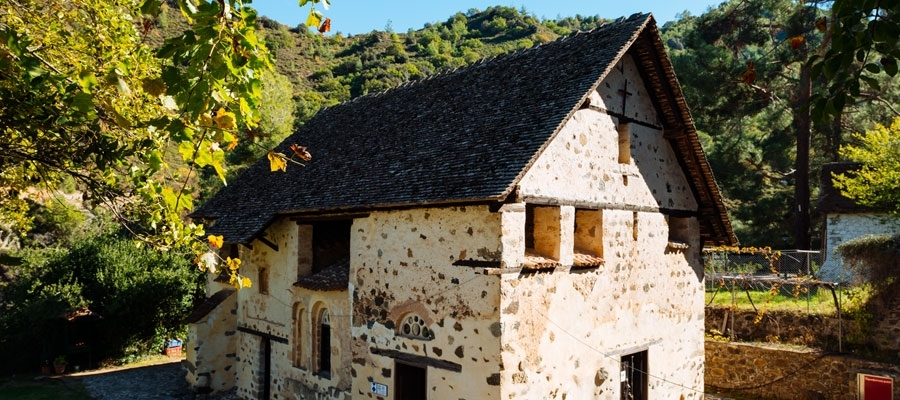
Points of interest: The trail begins at the source of the Karkotis River and crosses through the river’s beautiful valley, passing near the closed chrome mine and ending in Kakopetria. On the way, you can visit the Agios Nikolaos tis Stegis church (12th century) that boasts exquisite frescoes; it is also a UNESCO World Heritage site. From the church, if you follow the Pedoulas – Kakopetria road for about three kilometres, you will end up in Kakopetria. The trail is located within the Troodos National Forest Park.

Flora: While hiking you can study the endemic plants: Shrubby knapweed (Ptilostemon chamaepeuce var. cyprius), Golden oak (Quercus alnifolia), Purple Rock Cress (Arabis purpurea), ‘Manouthkia’  (Pterocephalus multiflorus subsp. multiflorus – an evergreen small shrub with pale pink flowers), Thyme (Thymus integer).

Fauna: The main species of fauna found in the area are:

Mammals: Fox, hare, hedgehog.

Birds: Bonelli’s eagle, Eurasian jay, Wood pigeon, partridge, Cyprus warbler  (endemic), Cyprus wheatear (endemic).

Reptiles: Cyprus viper, Cyprus lizard, Black whip snake, Montpellier snake.

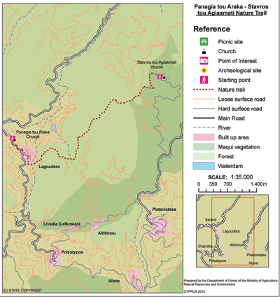
Panagia tou Araka – Stavros tou Agiasmati (Linear) – Lefkosia (Nicosia) District, Adelfoi Forest Nature Trail

GPS coordinates of the starting point: Lat: 34.965616 Lon: 33.006824
GPS coordinates of the ending point: Lat: 34.978989 Lon: 33.045905
Altitude of the starting point: 1,035m
Altitude of the highest peak: 1,164m
Altitude of the end peak: 854m
Starting point: (a) Panagia tou Araka, Lagoudera
(b) Stavros tou Agiasmati (8km from Platanistasa).
Length: 7km
Estimated duration: 3 hours
Difficulty rate: 3


Points of interest:  Of particular interest on this route are the churches of Panagia tou Araka (1192 AD) and Stavros tou Agiasmati (1494 AD) which boast outstanding frescoes and are UNESCO World Heritage Sites. The trail passes through a pine forest, vineyards, almond trees and old stone structures. To the east of the trail you will see Kionia peak. To the north you will see the Morfou plain and Pentadaktylos mountain range. To the west, you will see Troodos, and to the south you will see Madari. The trail connects with the Lagoudera or Agros – Madari trail. At the entrance of the Panagia tou Araka church you will find a 700 year ­old oak tree.

Flora: While hiking you can study the endemic plants: Thyme (Thymus integer), Shrubby knapweed (Ptilostemon chamaepeuce var. cyprius), ‘Manouthkia’ (Pterocephalus multiflorus subsp. multiflorus – an evergreen small shrub with pale pink flowers), Cyprus skullcap (Scutellaria cypria subsp. cypria).

Fauna: The main species of fauna found in the area are:

Mammals: Fox, hare, hedgehog.

Birds: Bonelli’s eagle, Wood pigeon, partridge, Cyprus warbler (endemic), Cyprus wheatear (endemic).

Reptiles: Cyprus viper, Cyprus lizard, Cyprus chameleon, Black whip snake

Pissouromoutti (Circular) – Pafos (Paphos) District, Akamas Forest Nature Trail

GPS coordinates of the starting point: Lat: 35.023417 Lon: 32.333405
GPS coordinates of the ending point: Lat: 35.023417 Lon: 32.333405
Altitude of the starting point: 285m
Altitude of the highest peak: 400m
Altitude of the end peak: 285m
Starting point: Smigies picnic site.
Length: 3km
Estimated duration: 2 hours
Difficulty rate: 2 (upward and downward gradients around the hill)


Points of interest: There are many points of exceptional view along the trail, but the most impressive view is from the top of the hill. Here, you can seamlessly enjoy nature all around you (toward the south coast: Tzioni, Geranissos, Lara, Agios Georgios Pegeias, and toward the north coast: Chrysochou Bay). Part of the trail passes through a pine forest that offers shade on warm summer days, making the walk particularly unique and enjoyable. Smigies picnic site has drinking water flowing directly to the area from a spring.

Flora: While hiking you can study the indigenous plants: Phoenician juniper (Juniperus phoenicea), lentisk (Pistacia lentiscus), terebinths (Pistacia terebinthus), rockroses (Cistus creticus, Cistus monspeliensis etc), wild thyme (Thymus capitatus).