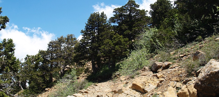
Artemis (Circular) – Lemesos (Limassol) District, Troodos Forest Nature Trail

GPS coordinates of the starting point: Lat: 34.933166 Lon: 32.871986
GPS coordinates of the ending point: Lat: 34.933221 Lon: 32.871964
Altitude of the starting point: 1,835m
Altitude of the highest peak: 1,850m
Altitude of the end peak: 1,835m
Starting point: 300m from where the Chionistra road meets the Troodos – Prodromos road.
Length: 7km
Estimated duration: 2.5 – 3 hours
Difficulty rate: 1


Points of interest: The trail passes through the black pine forest where you will also encounter rare species of flora and rock formations of the area. You can find two perennial black pine trees (Pinus nigra subsp. pallasiana) that are around 500 years old. Of historic interest are ‘The teishia tis palaias choras’ ruins of makeshift fortifications built in the last years of the Venetian occupation of Cyprus (1571 AD) by a group of Venetian generals attempting to defend themselves against the Ottomans. The route circles around the top of Mount Olympos (Chionistra) at an altitude of 1,850 metres, offering an excellent view in all directions. The trail is located within the Troodos National Forest Park and you will find the Environmental Information Centre for the Troodos National Forest Park at a distance of 2.2km from the trail.

Flora: While hiking you can study the endemic plants: Cyprus Skullcap (Scutellaria cypria subsp. cypria), Spurge (Euphorbia cassia subsp. rigoi), Cyprus germander (Teucrium cyprium subsp. cyprium), Troodos sage (Salvia willeana), Pondikangathos (common subshrub) (Astragalus echinus subsp. chionistrae).

Fauna: The main species of fauna found in the area are:

Mammals: Fox, hare, hedgehog.

Birds: Bonelli’s eagle, Eurasian jay, Wood pigeon, partridge, Cyprus warbler (endemic), Cyprus wheatear (endemic).

Reptiles: Cyprus viper, Cyprus snake (endemic).
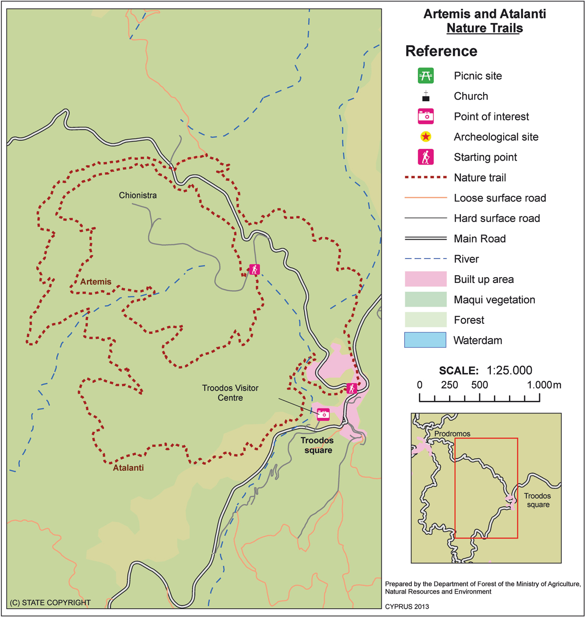
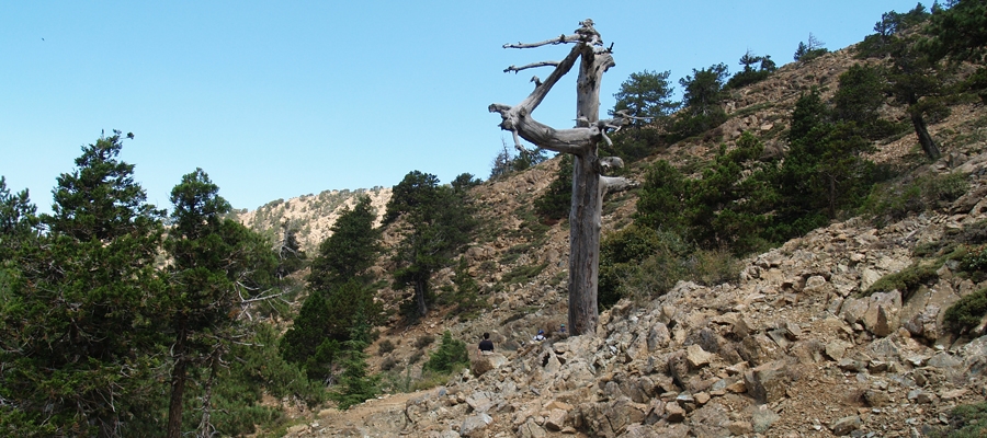
Atalanti (Circular) – Lemesos (Limassol) / Lefkosia (Nicosia) Districts, Troodos Forest Nature Trail

GPS coordinates of the starting point: Lat: 34.924239 Lon: 32.880879
GPS coordinates of the ending point: Lat: 34.924275 Lon: 32.880956
Altitude of the starting point: 1,725m
Altitude of the highest peak: 1,830m
Altitude of the end peak: 1,748m
Starting point: Troodos Square.
Length: 14km
Estimated duration: 4 – 5 hours
Difficulty rate: 2


Points of interest: The trail goes around Chionistra mountain at an altitude of 1,700­-1,750 metres, passing through dense areas of black pine trees (Pinus nigra subsp.pallasiana) and Foetid Juniper (Juniperus foeditissima). One of the largest trees ­ Foetid Juniper ­ is found on the trail; it is 800 years old. There are wonderful views of all the areas of the island. The entrance tunnel of the chrome mine ­ which has been out of service since 1982 is particularly interesting. The first finishing point of the trail is nine kilometres along the Troodos-Prodromos road. To continue on the trail you must cross the main road and walk on the forest road of Katoikies Chromiou towards Agios Nikolaos tis Stegis church for around 200m, where a wooden sign points your direction;  the trail is approximately parallel to the main road and ends at Troodos Square, where you will find the Environmental Information Centre of Troodos National Forest Park. A fountain with drinking water is located three kilometres from the starting point heading towards Troodos Square.

Flora: While hiking you can study the endemic plants: Golden oak (Quercus alnifolia), Manouthkia (Pterocephalus multiflorus subsp. multiflorus – an evergreen small shrub with pale pink flowers), Urse mint (Mentha longifolia subsp. cyprica), Troodos Alison  (Alyssum troodi).

Fauna: The main species of fauna found in the area are:

Mammals: Mouflon, Fox, hare, hedgehog.

Birds: Bonelli’s eagle, Eurasian jay, Wood pigeon, partridge, Cyprus warbler  (endemic), Cyprus wheatear (endemic).

Reptiles: Cyprus viper, Cyprus snake (endemic).
Teisia tis Madaris (Circular) – Lefkosia (Nicosia) / Lemesos (Limassol) Districts, Adelfoi Forest Nature Trail

GPS coordinates of the starting point: Lat: 34.951404 Lon: 32.999168
GPS coordinates of the ending point: Lat: 34.951404 Lon: 32.999168
Altitude of the starting point: 1,582m
Altitude of the highest peak: 1,582m
Altitude of the end peak: 1,582m
Starting point: Close to the Madari fire lookout tower, near the ending point of the Doxa soi o Theos – Madari trail.
Length: 3km
Estimated duration: 1.5 hour
Difficulty rate: 3


Points of interest: There are tall, impressive cliffs along the trail, as well as areas of geological interest. You will also encounter beautiful views of the Mesaoria Plain and Morfou Bay. The trail connects with the Madari – Doxa soi o Theos trail and the Madari – Selladi tou Karamanli trail. The path is at an altitude of 1,600 metres. At the highest point of Adelfoi mountain (1,613 metres), you will find the Madari fire lookout tower.

Flora: While hiking you can study the endemic plants: Troodos rose (Rosa chionistrae), Troodos cat­mint (Nepeta troodi), Star­ of­ Bethlehem (Ornithogalum chionophilum), Chamomile (Anthemis plutonia), ‘Manouthkia’ (Pterocephalus multiflorus subsp. multiflorus – an evergreen small shrub with pale pink flowers), Golden oak (Quercus alnifolia), Cedar (Cedrus brevifolia), Cyprus crocus (Crocus cyprius), Thyme (Thymus integer).

Fauna: The main species of fauna found in the area are:

Mammals: Fox, hare, hedgehog.

Birds: Bonelli’s eagle, Eurasian jay, Wood pigeon, partridge, Cyprus warbler  (endemic), Cyprus wheatear (endemic).

Reptiles: Cyprus viper, Cyprus lizard, Black whip snake

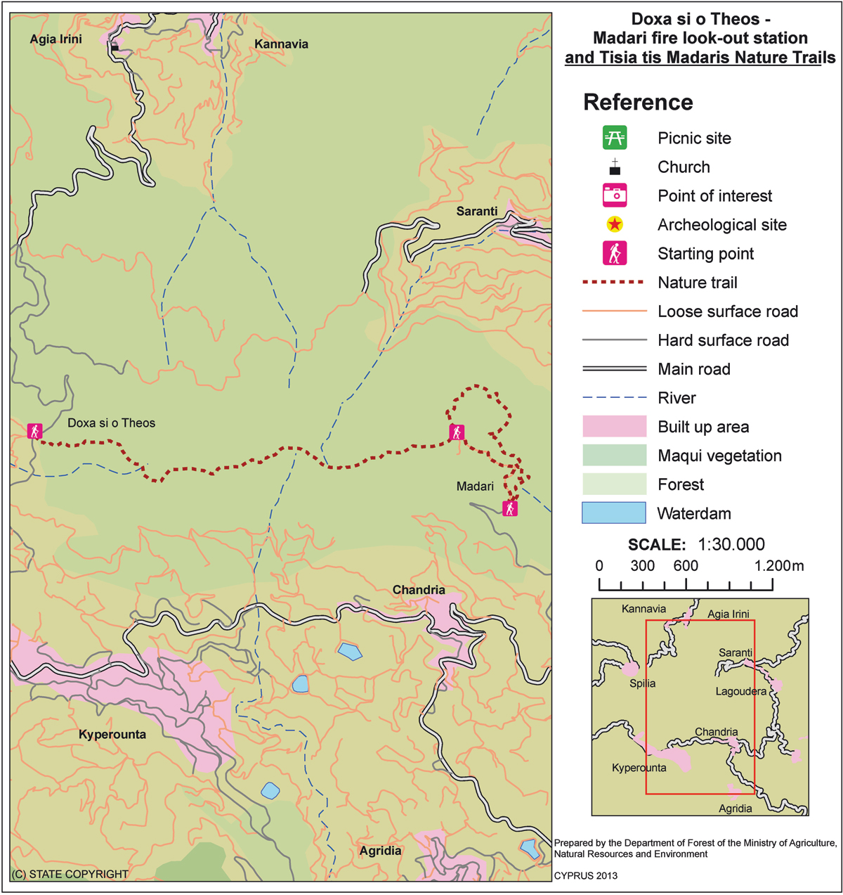
Doxa soi o Theos – Pyrofylakio (Fire Lookout Station) Madaris (Linear) – Lefkosia (Nicosia) District, Adelfoi Forest Nature Trail

GPS coordinates of the starting point: Lat: 34.956223 Lon: 32.963155
GPS coordinates of the ending point: Lat: 34.956147 Lon: 32.995126
Altitude of the starting point: 1,338m
Altitude of the highest peak: 1,609m
Altitude of the end peak: 1,582m
Starting point: (a) At Doxa soi o Theos, 2km from Kyperounta and 5km from Spilia, on the Kyperounta – Spilia road.
(b) At the Madari fire lookout tower.
Length: 3.8km
Estimated duration: 2 hours
Difficulty rate: 3


Points of interest: There are panoramic views in all directions when you reach an altitude of around 1,400­-1,600m along the Madari ridge. The path ends close to the top of Adelfoi mountain (1,613 metres). The walk offers the opportunity to climb up the Madari fire lookout tower, which overlooks the area. The trail connects with other nature trails in the area, such as: the Madari ­ Selladi  tou Karamanli path, Teisia tis Madaris and the Doxa soi o Theos ­ Moutti tis Choras path. There is a fountain with drinking water at starting point (a).

Flora: While hiking you can study the endemic plants: Shrubby knapweed (Ptilostemon chamaepeuce var. cyprius), Golden oak (Quercus alnifolia), Purple Rock Cress (Arabis purpurea), ‘Manouthkia’  (Pterocephalus multiflorus subsp. multiflorus – an evergreen small shrub with pale pink flowers), Cyprus skullcap (Scutellaria cypria subsp. cypria), Thyme (Thymus integer).

Fauna: The main species of fauna found in the area are:

Mammals: Fox, hare, hedgehog.

Birds: Bonelli’s eagle, Eurasian jay, Wood  pigeon, partridge, Cyprus warbler (endemic), Cyprus wheatear (endemic).

Reptiles: Cyprus viper, Cyprus lizard, Black whip snake.

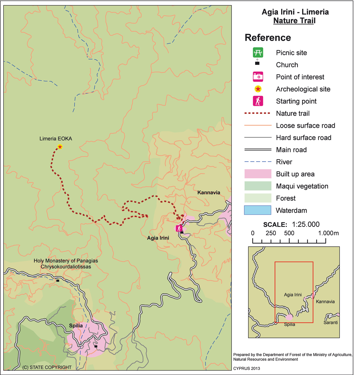
Agia Eirini – Limeria (Linear) – Lefkosia (Nicosia) District, Adelfoi Forest Nature Trail

GPS coordinates of the starting point: Lat: 34.980599 Lon: 32.968808
GPS coordinates of the ending point: Lat: 34.990647 Lon: 32.950746
Altitude of the starting point: 906m
Altitude of the highest peak: 1,217m
Altitude of the end peak: 1,204m
Starting point: Agia Eirini Village.
Length: 5km
Estimated duration: 2.5 hours
Difficulty rate: 3 (steep uphill route)


Points of interest: The trail passes through a Calabrian pine forest with beautiful view spots of the Bay of Morfou (central­ west part of Cyprus). At Selladi tis Straorouthkias, the trail joins with the Kourdali – Limeria trail, and both trails share a common route for the next two kilometres. The trail ends at the location of Limeria with its many hideouts that were used during the anti­colonial National struggle war of 1955-19­59. Some six kilometres north of Agia Eirini Village there is a picnic site: ‘Kapoura’, which is situated next to the Kapoura Forest Station.

Flora: While hiking you can study the endemic plants: Golden oak (Quercus alnifolia), Thyme (Thymus integer), ‘Manouthkia’ (Pterocephalus multiflorus subsp. multiflorus – an evergreen small shrub with pale pink flowers), Cyprus skullcap (Scutellaria cypria subsp. cypria).

Fauna: The main species found in the area are:

Mammals: Fox, hare, hedgehog.

Birds: Bonelli’s eagle, Eurasian jay, Wood pigeon, Partridge, Cyprus warbler (endemic), Cyprus wheatear (endemic).

Reptiles: Cyprus viper, Cyprus lizard, Black whip snake.

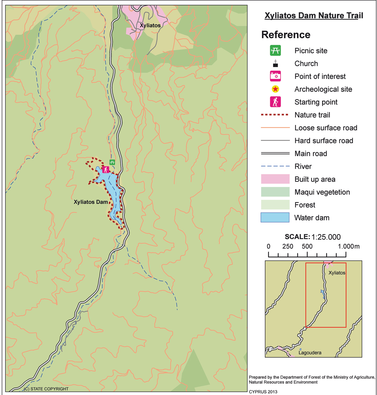
Xyliatos (Circular) – Lefkosia (Nicosia) District, Adelfoi Forest Nature Trail

GPS coordinates of the starting point: Lat: 35.009318 Lon: 33.036420
GPS coordinates of the ending point: Lat: 35.009318 Lon: 33.036420
Altitude of the starting point: 543m
Altitude of the highest peak: 601m
Altitude of the end peak: 543m
Starting point: (a) The overflow of the dam, (b) The dam’s picnic site.
Length: 3.8km
Estimated duration: 1 – 1.5 hour
Difficulty rate: 2


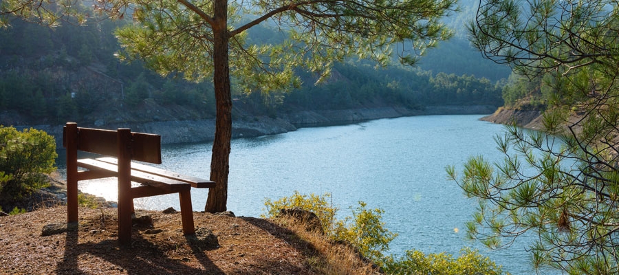
Points of interest: The trail begins at the overflow of the dam and runs alongside the highest water level point of the dam. It then crosses the artificial bridge over the dam. The uphill trail takes you to the Xyliatos – ­Lagoudera road, which leads you to the starting point if you follow through the dam’s embankment. The trail connects with another 200-metre trail, which starts from the picnic site ‘Fraktis tou Xyliatou’ (Xyliatos Dam) then follows a small section of the Xyliatos – ­Lagoudera road, joining with the circular path at the dam’s embankment. The dam itself is also of interest. A section of the path passes through a pine forest where you will encounter varieties of the golden oak tree, strawberry tree, myrtle, oriental alder and rockrose.

Flora: While hiking you can study the endemic plants: Shrubby knapweed (Ptilostemon chamaepeuce var. cyprius), Purple Rock ­ Cress (Arabis purpurea), ‘Manouthkia’ (Pterocephalus multiflorus subsp. multiflorus – an evergreen small shrub with pale pink flowers), Cyprus skullcap (Scutellaria cypria subsp. elatior), Thyme (Thymus integer), Wild garlic (Allium willeanum).

Fauna: The main species of fauna found in the area are:

Mammals: Fox, hare, hedgehog.

Birds: Bonelli’s eagle, Wood pigeon, partridge, Cyprus warbler (endemic), Cyprus wheatear (endemic).

Fish: Trout, carp, bass.

Amphibians: Frogs.


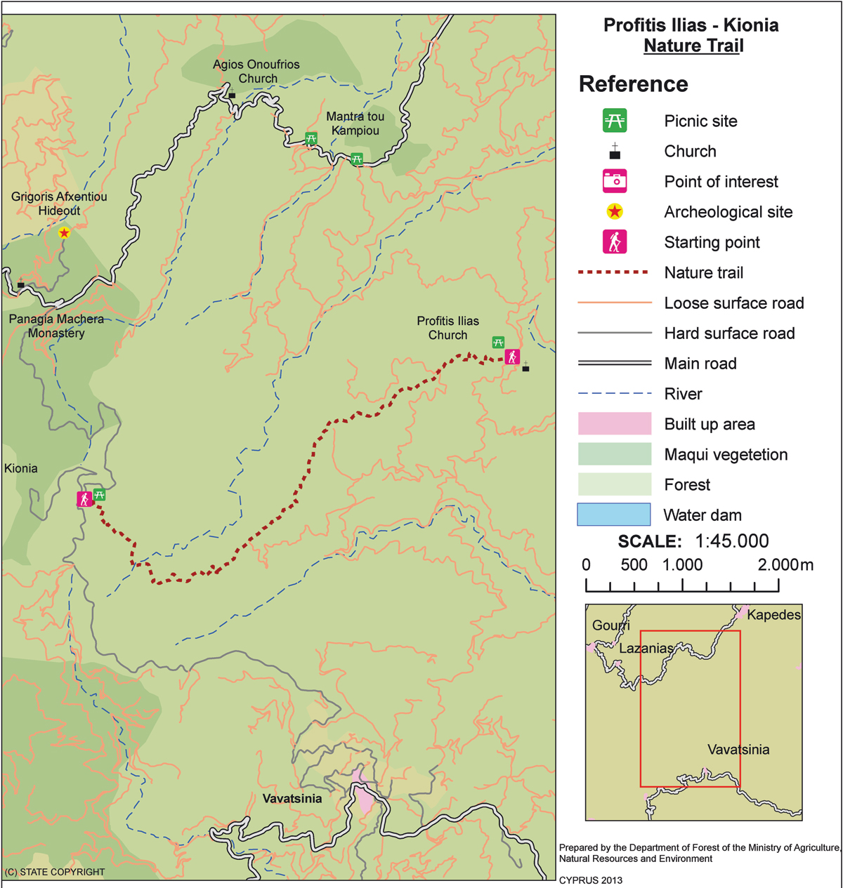
Kionia – Profitis Ilias (Linear) – Lefkosia (Nicosia) District, Machairas Forest Nature Trail

GPS coordinates of the starting point: Lat: 34.920214 Lon: 33.197602
GPS coordinates of the ending point: Lat: 34.933480 Lon: 33.246317
Altitude of the starting point: 1,251m
Altitude of the highest peak: 1,251m
Altitude of the end peak: 677m
Starting point: Kionia picnic site. There are two access points to the trail- one from the Machairas monastery road that leads to Kionia, and the other from the Vavatsinia to Machairas road.
Length: 7km
Estimated duration: 2.5 hours
Difficulty rate: 3 (steep downhill path, especially towards the end)


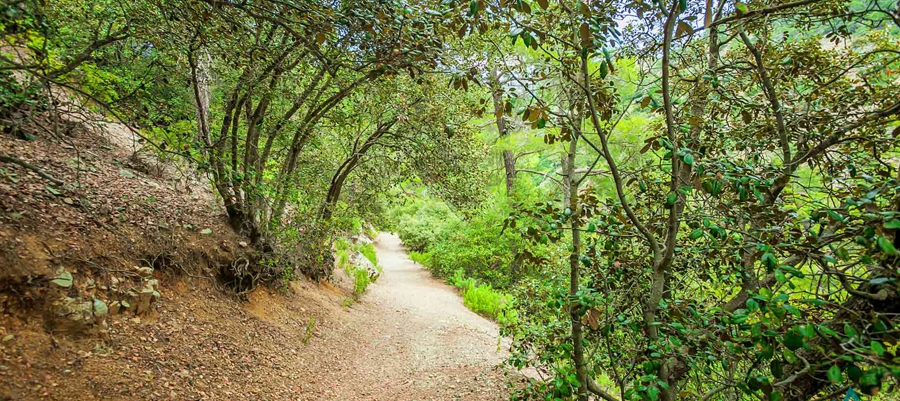
Points of interest: The trail starts at the Kionia picnic site, where you can find a fountain with drinking water, and runs through a forest section where it affords great views of the Mesaoria plain, which belongs to the Machairas National Forest Park a Natura 2000 site. There is a perennial strawberry tree on the trail, whilst the picnic site boasts perennial pine and arar trees. The trail ends at the Profitis Ilias picnic site, approximately eight kilometres from Lythrodontas and six kilometres from Mandra tou Kambiou, via dirt roads.

Flora: While hiking you can study the endemic plants: Shrubby knapweed (Ptilostemon chamaepeuce var. cyprius), Golden oak (Quercus alnifolia), Purple Rock ­ Cress (Arabis purpurea), ‘Manouthkia’ (Pterocephalus multiflorus subsp. multiflorus – an evergreen small shrub with pale pink flowers).

Fauna: The main species of fauna found in the area are:

Mammals: Fox, hare, hedgehog.

Birds: Bonelli’s eagle, Eurasian jay, Wood pigeon, Partridge, Cyprus warbler  (endemic),

Cyprus wheatear (endemic).

Reptiles: Cyprus viper, Black whip Snake, Cyprus lizard.

Avakas Gorge (Linear) – Pafos (Paphos) District, Akamas Forest Nature Trail

GPS coordinates of the starting point: Lat: 34.920499 Lon: 32.337698
Altitude of the starting point: 47m
Altitude of the highest peak: 45m
Altitude of the end peak: 45m
Starting point: Avakas Gorge, following the Agios Georgios Pegeias – Toxeftra road for 2.5km and heading east from where Toxeftra Bay begins.
Length: 1.2km
Estimated duration: 45 minutes
Difficulty rate: 1 – 2


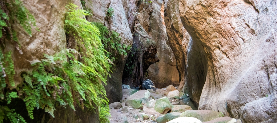
Points of interest: The Avakas Gorge Trail is located in the homonymous gorge, within Pegeia state forest with the end of the trail located inside the gorge. It follows the course of the Avgas River, from where the gorge gets its name and resulted from constant erosive activity on the erodible, sloping limestone rocks composed of loams, chalks, reef and grain limestone and bentonitic clays. The gorge is also a Natura 2000 area. The trail firstly follows a dirt road (closed to private vehicles) through an open valley, then takes you into the gorge. In its last section, the trail is in the stream, in which water usually flows throughout the year. The route through the gorge is characterised by thick vegetation and a particularly attractive, shady and moist environment.

Flora: While hiking you can study the indigenous plants: lentisk (Pistacia lentiscus), Phoenician juniper (Juniperus phoenicea), terebinth (Pistacia terebinthus), thorny broom (Calycotome villosa), common smilax (Smilax aspera), oleander (Nerium oleander), storax (Styrax officinalis), and the endemic endangered Akamas centaury (Centaurea akamantis).

Fauna: The main species of fauna found in the area are:

Mammals: Fox, hare, hedgehog. Birds: Cyprus wheatear (endemic), Cyprus warbler (endemic), scops owl (endemic), partridge, little owl, kestrel, wild pigeon.

Reptiles: Stellion lizard. Amphibians: Marsh frog, iridescent frog, tree frog.

Smigies (Circular) – Pafos (Paphos) District, Akamas Forest Nature Trail

GPS coordinates of the starting point: Lat: 35.024020 Lon: 32.333115
GPS coordinates of the ending point: Lat: 35.024020 Lon: 32.333115
Altitude of the starting point: 273m
Altitude of the highest peak: 388m
Altitude of the end peak: 273m
Starting point: Smigies picnic site, 2.5km from Neo Chorio, within the Akamas region.
Length: a) Short route: 2.5km, (b) Long route: 6km
Estimated duration: (a) Short route: 1 hour, (b) Long route: 2 hours
Difficulty rate: 2


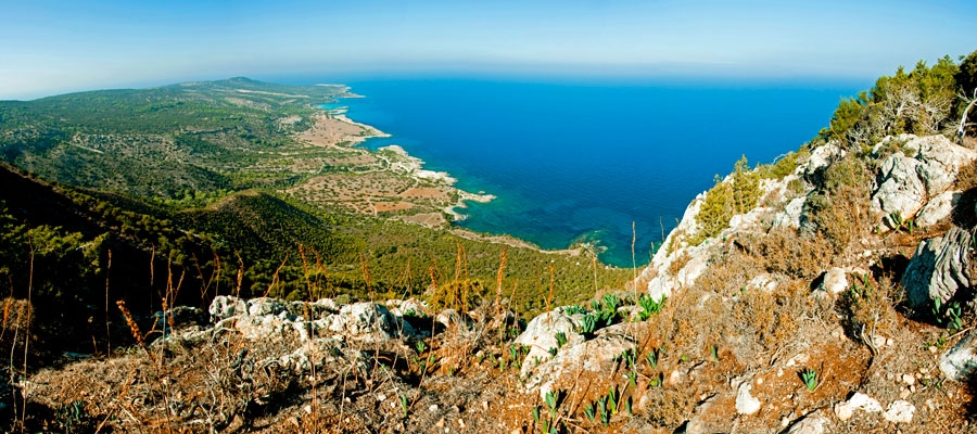
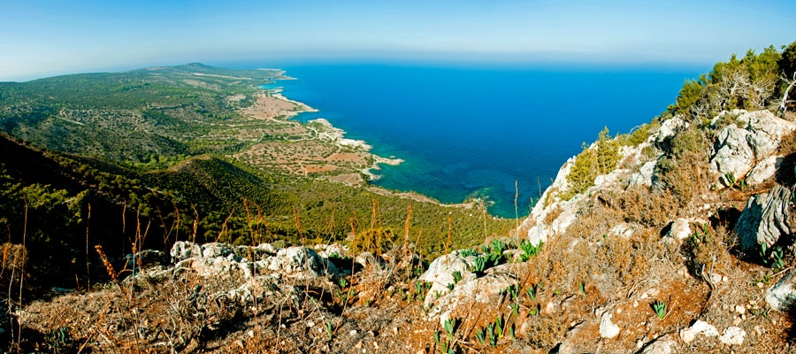
Points of interest: Initially, the trail offers beautiful views of the coastline of the Akamas peninsula to the west ­ including Lara Bay ­ and later on, to the east, with views of Chrysochous bay in the direction of Latsi, Polis, Pachyammos and Pafos (Paphos) forest. The longer route runs past the old mines, magnesium facilities, and abandoned kilns, and through a dense section of the Akamas forest. The trail also connects with the Adonis trail at Kefalovrisia, where you will find a non­ potable water fountain. At the starting point, the two routes are adjacent to the walking trail of Pissouromoutti. Both routes pass by the Piana fire lookout station of the Forestry Department.

Flora: While hiking you can study the endemic plants: Thyme (Thymus integer), Cyprus germander (Teucrium micropodiodes), Cyprus Golden – Drop (Onosma fruticosa), Entire – Leaved Horehound (Acanthoprasium integrifolium), Sweet Marjoram (Origanum majorana var. tenuifolium).

Fauna: The main species of fauna found in the area are:

Mammals: Fox, hare, hedgehog.

Birds: Wood pigeon, partridge, Cyprus warbler (endemic), Cyprus wheatear (endemic).

The Forest of Akamas serves as a resting point for many migratory birds.

Reptiles: Cyprus viper, Cyprus lizard, Black whip snake.


Aphrodite (Circular) – Pafos (Paphos) District, Akamas Forest Nature Trail

GPS coordinates of the starting point: Lat: 35.056063 Lon: 32.345565
GPS coordinates of the ending point: Lat: 35.056063 Lon: 32.345565
Altitude of the starting point: 35m
Altitude of the highest peak: 333m
Altitude of the end peak: 35m
Starting point: The Loutra tis Afroditis (Baths of Aphrodite).
Length: 7.5km
Estimated duration: 3 – 4 hours
Difficulty rate: 3


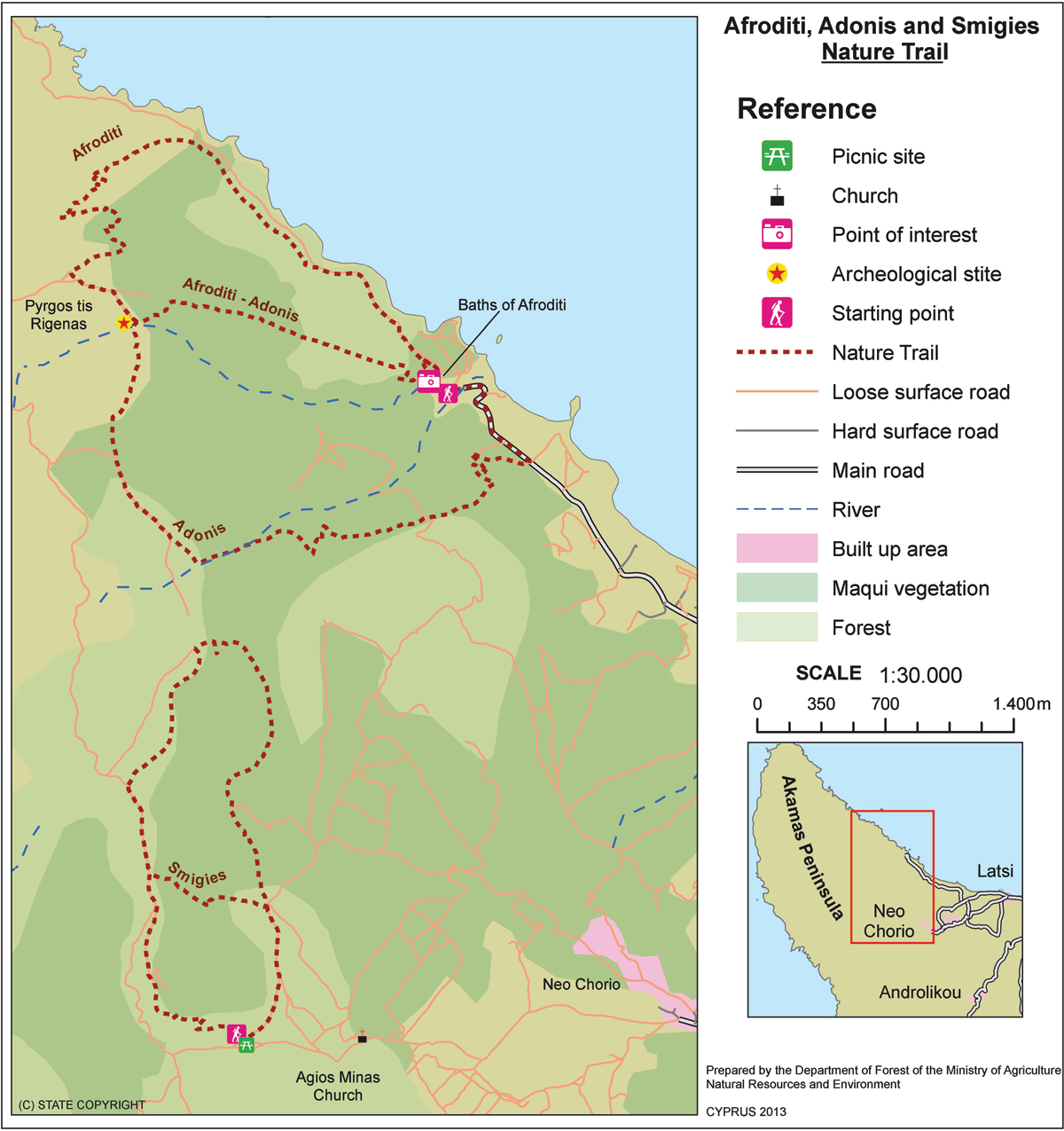
Points of interest: Of special interest on this trail are the Loutra tis Afroditis (Baths of Aphrodite), where, according to legend, the Goddess of Love and Beauty used to take her baths. You will also pass by the ruins of Pyrgos tis Rigainas (Queen’s Tower), which are believed to belong to a Medieval monastery. Also noteworthy is a 500­ year­ old oak tree, which is located near the ruins of the tower. Along the trail you can enjoy excellent views of Cape Arnaoutis, Polis Chrysochous and Pafos (Paphos) Forest. There are two non­ potable water fountains along the trail; one near the ruins of Pyrgos tis Rigainas, and another between the Loutra tis Afroditis (Baths of Aphrodite) and Kakoskali. The trail connects with the Adonis trail, whilst at its starting point you can visit the Botanical Gardens of Akamas. 

Flora: While hiking you can study the endemic plants: Cyprus Golden – Drop (Onosma fruticosa), Cyprus sage (Phlomis cypria var. occidentalis).

Fauna: The main species of fauna found in the area are:

Mammals: Fox, hare, hedgehog.

Birds: Wood pigeon, partridge, Cyprus warbler  (endemic), Cyprus wheatear (endemic).

The forest serves as a resting point for many migratory birds.

Reptiles: Cyprus viper, Cyprus lizard, Black whip Snake.